Computational directional well design
Technology arrived in the oil industry to improve processes, which is why today the planning of directional wells are mostly performed by computers through computer programs which simulate the behavior of what would be the best directional trajectory proposed based on the requirements of reservoir and well conditions.
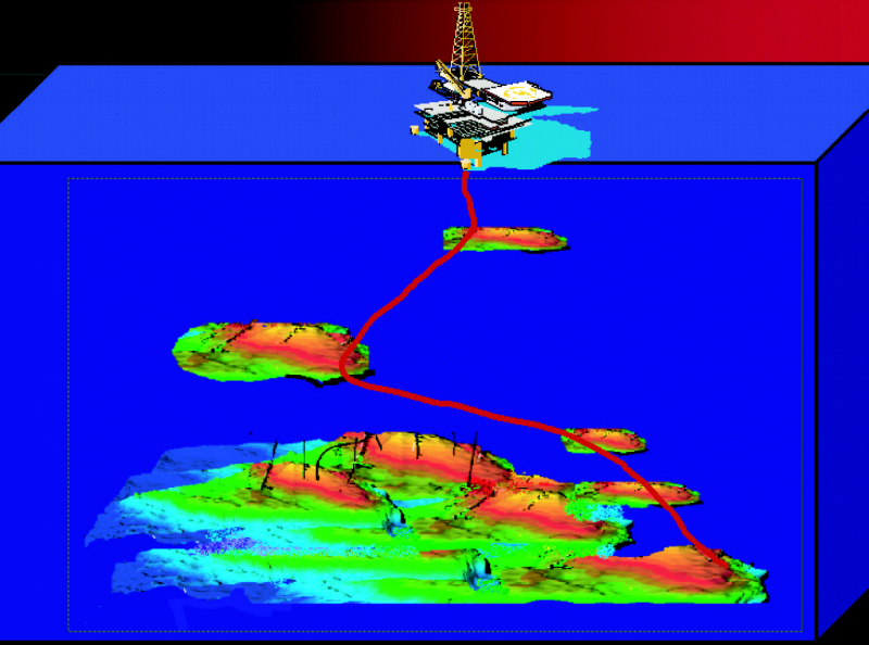
By means of increasingly capable computers due to their upgrades, software programs can be used that are at the forefront and requirements of modern computer technologies. If we look for the origin of this technological evolution we realize that with the resources we had in the past we could not visualize as we can do today how to see a directional trajectory in 3D format.
Advances in the visualization of directional trajectories in 3D format has made it easier for professionals such as geologists and petroleum engineers to use tools that are really in line with the operational needs in the construction of a directional well. All this makes me reflect on the fact that from these technological advances can design a well to be drilled directionally from simple interactions in which you can create, visualize and optimize various parameters whose directional trajectories in oil wells can pursue the correct objectives because of the depths where the oil and natural gas producing reservoirs are located.
The computational design to follow a directional drilling plan is complemented very well with the directional tools that are available today, among which we have for example the geosteering systems that are basically developed to allow directional trajectories to be followed in the drilling of oil wells foreseeing a future production of hydrocarbons since through a directional trajectory it is possible to have a greater reach of the producing sand and to be able to drain a larger part of the reservoir.
Conclusion
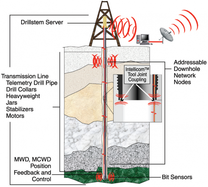
The future of directional drilling will be in the integration that can continue to exist between computational technology tools and equipment that help to follow a directional trajectory but at the same time can measure parameters in real time. Real-time measurement of drilling parameters (LWD), geosteering and 3D visualization resulting from computational models cannot be separated, since the objective of directional design must always be to allow an integrated management, in which new knowledge for the design of directional drilling is obtained and in which decisions can be made in real time.
References
Thanks for your contribution to the STEMsocial community. Feel free to join us on discord to get to know the rest of us!
Please consider delegating to the @stemsocial account (85% of the curation rewards are returned).
You may also include @stemsocial as a beneficiary of the rewards of this post to get a stronger support.