Walk along the gold roman mine route of Las Médulas
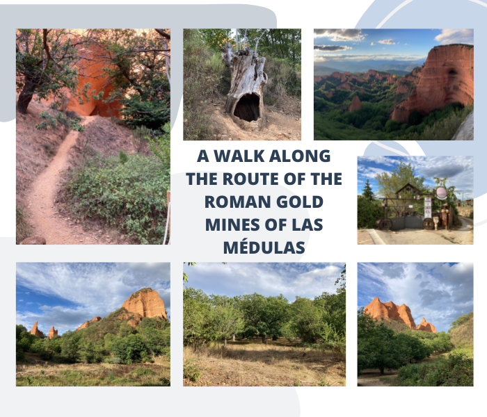

I hope you are having a happy Wednesday. A few weeks ago I was working in the city of Ponferrada (Spain) and one of my clients advised me to visit the village of Las Medulas, where the largest open-pit gold mine of the Roman Empire that is preserved today is located.
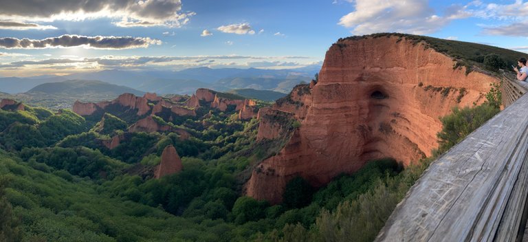
That same day in the afternoon, after work, I went in my vehicle to the viewpoint of Orillan, which allows me to contemplate the magic of this place where history is mixed with nature, resulting in a spectacular place.

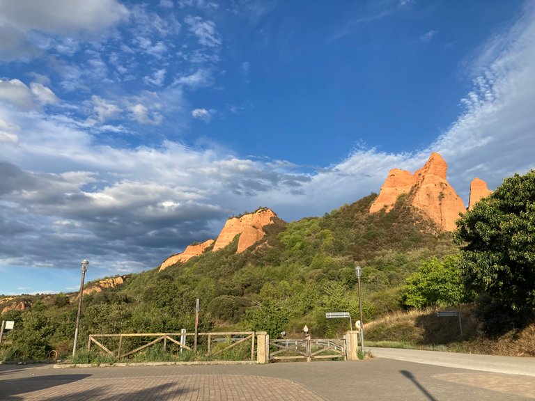
The next day, after leaving work, I went to the hotel to dress in more comfortable clothes and shoes and I went back to this wonderful place. This time, instead of going to the viewpoint of Orellan I went directly to the village of Las Médulas following the directions that my Google Maps application gave me until just the entrance of the village, which is where there is a parking lot enabled for tourists and hikers from which only residents can enter with their vehicles.
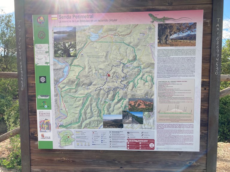
One of the aspects I liked about the parking, is that just at the exit you can find some informative signs about the different routes, duration, difficulty and mileage.
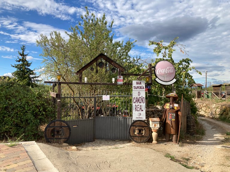
After walking a few meters, one is already inside the village of Las Médulas, where one can find several bars and restaurants to eat or to drink some soft drinks or beers in order to regain strength to return from the different routes that exist in this peculiar place.
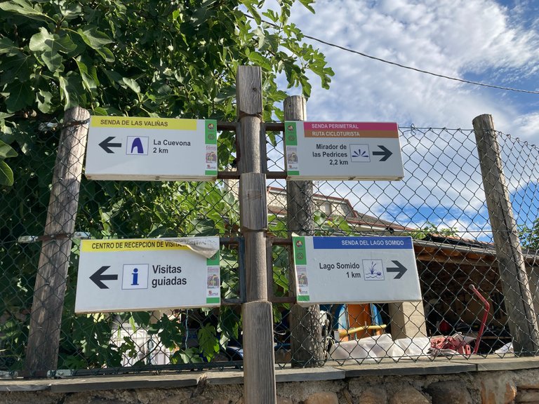
Once well into the village we find different indicators for the various routes to perform. In my case I did the route of great cave "La Cuevona", 2 kilometers long and of medium difficulty. Additionally, other routes include going to Lake Somido or the viewpoint of Las Predices. Additionally, at certain times of the day you can hire a guide at the tourist office, so that as you go along the walk they will explain the history of the formation of these plumes in the time of the Roman Empire through the mechanism used for the extraction of gold from the mountains that existed at that time in the area.
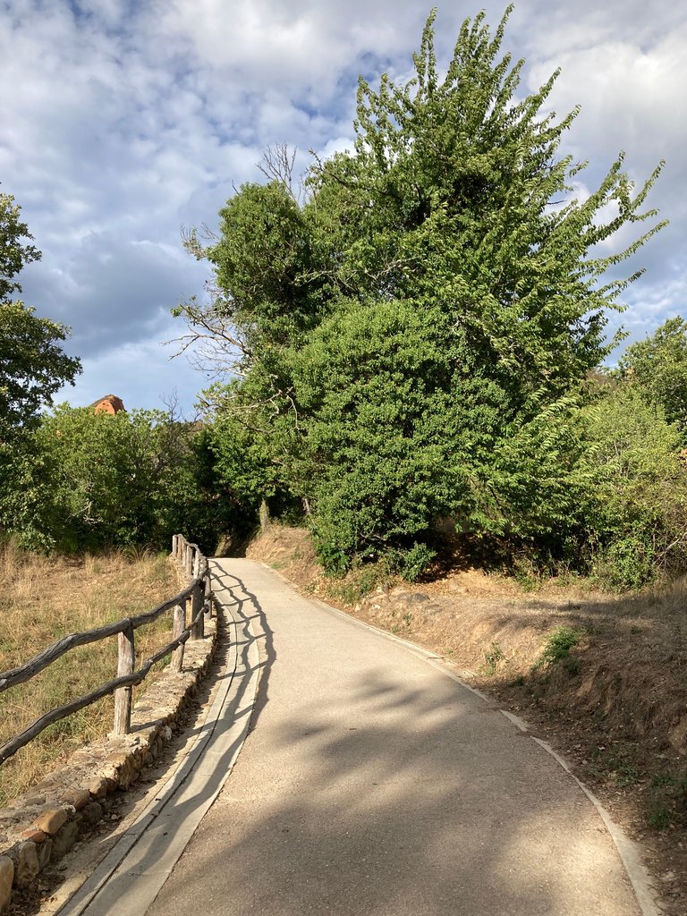
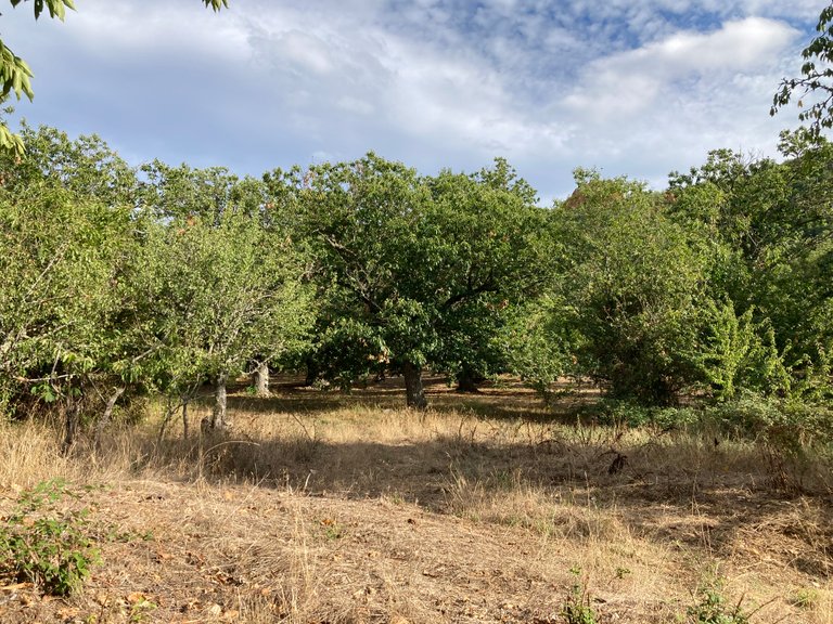
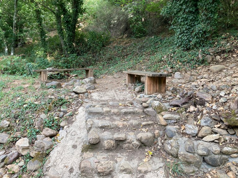
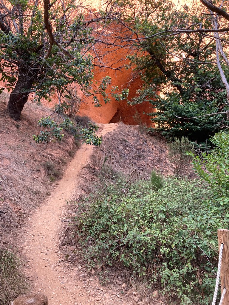
The beginning of this route, as you can see, runs along a perfectly paved road surrounded by vegetation consisting mainly of scrubland, some poplars and mainly chestnut plantations used by farmers in the production of chestnuts which is a very typical product of this area of Spain.
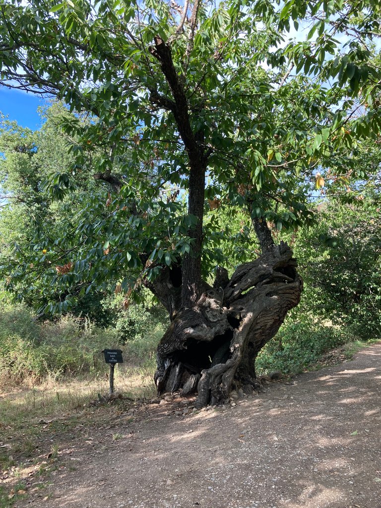
After leaving the first 200 meters of the route, one is already on an unpaved road and enters a winding path surrounded by young chestnut trees and other chestnut trees that may be over a century old.
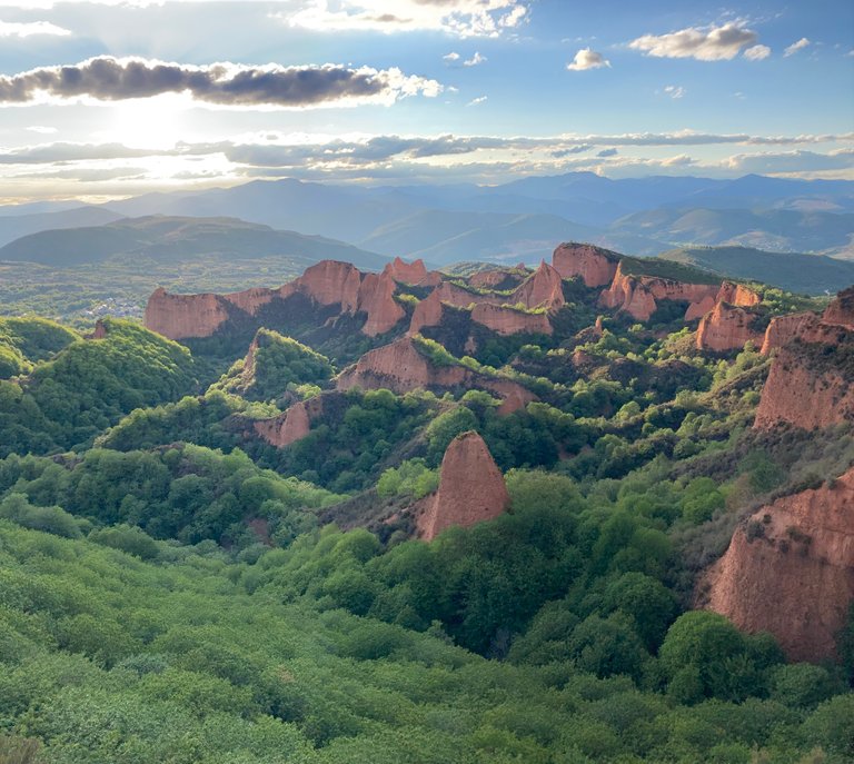
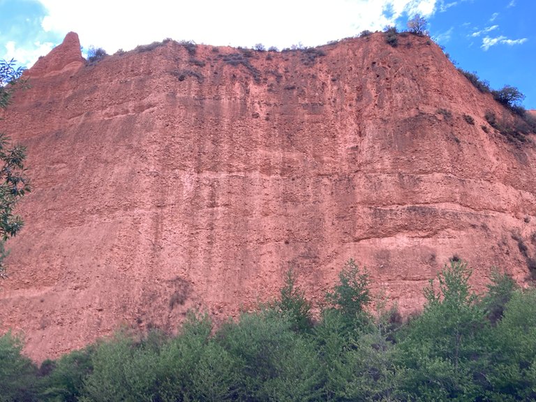
Once, one crosses the first part of the unpaved road, surrounded by the first chestnut tree hill, one finds a more or less open area where one feels very small in front of the immensity of the plumes resulting from the Roman mining activity.
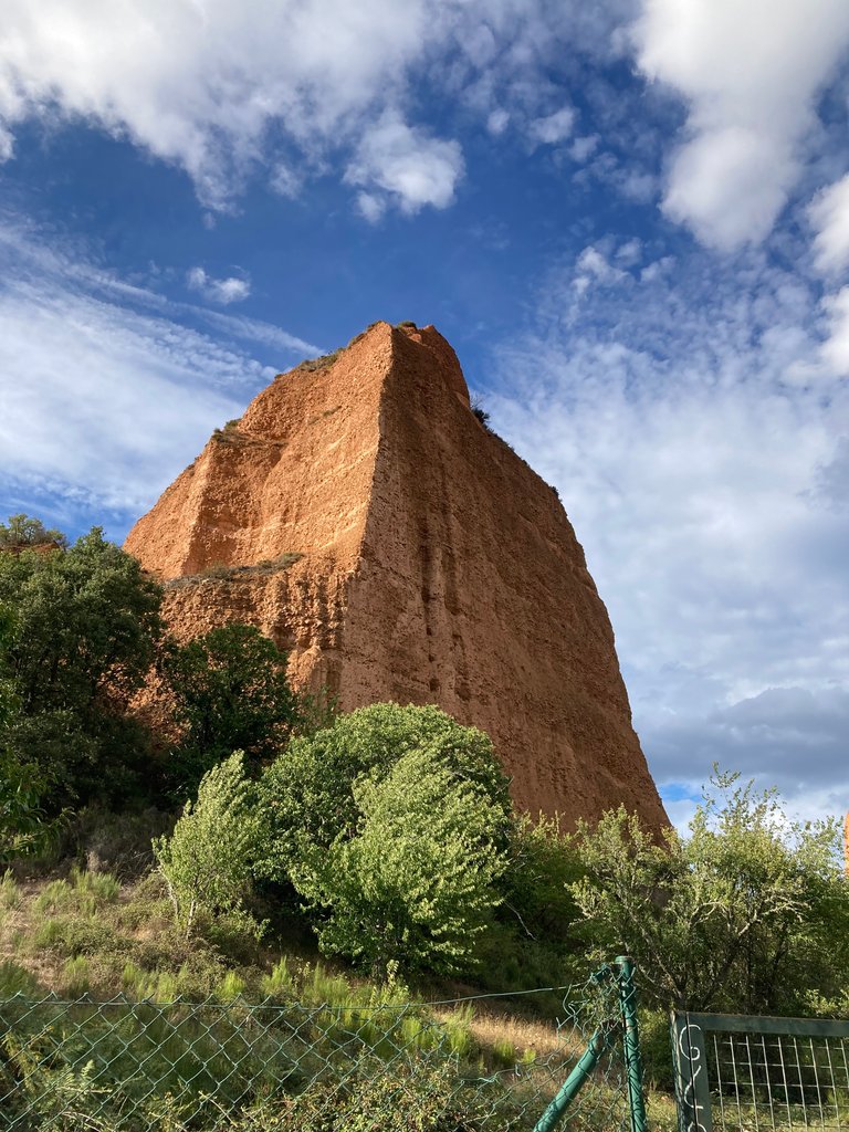
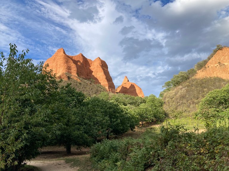
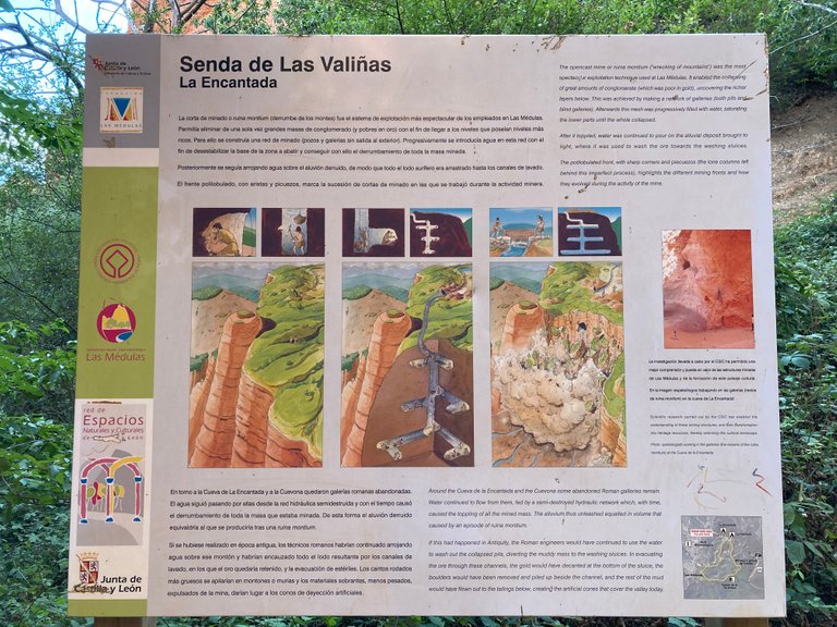
After seeing more and more plumes, I stopped for a few minutes to rest and remember some information I had read about their formation at the Orellan viewpoint the day before. As indicated by the information panels seen the day before, the Romans made large vertical wells, then built horizontal galleries and finally carried water by channeling rivers and caused the vertical collapse of the mountain. If you look at the following image, one can still observe the horizontal lines of the galleries made more than 2000 years ago.
After this moment of rest, I continued my route towards the great cave "La Cuevona" being each time the way more complicated due to the increase of the slopes and above all that the ground was more irregular, finding a stretch of about 100 meters where you had to walk on stones that were loose and that just coincides with the point of greater unevenness of the route.

Finally, I arrived at my marked destination which was "La Cuevona", which is a large cave within this enclave for which it is necessary to go with a guide to access safely, since an inexperienced person could enter through an inappropriate place and fall into one of the wells of the rock. Because I did the route without a guide, I could only zoom in as much as possible on my camera and see the mouth of the large cave.
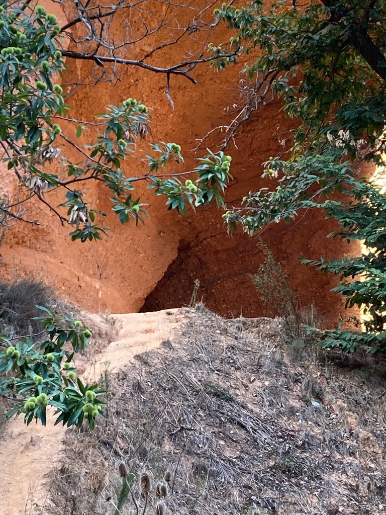
Additionally, at this point there are a series of information panels that explain very well the excavation process carried out in Roman times for the extraction of gold inside the mountain.
After reaching this point, I decided to make the way back with the satisfaction of having made a walk through a place with a lot of charm, a lot of history and wonderful views.
I hope you like this walk that I think I remember I did on a Wednesday.
Best regards.
Own photograph taken with my Iphone SE.
Cover, separators and banner created with www.canva.com (free version).
Translated with www.DeepL.com/Translator (free version).

0
0
0.000
Congratulations, your post has been added to Pinmapple! 🎉🥳🍍
Did you know you have your own profile map?
And every post has their own map too!
Want to have your post on the map too?
WOW this was such an interesting read, I never knew the Romans had such extensive gold mining like you shared with us here
Thanks for joining Wednesday Walk :), I truly enjoy exploring the world virtually each Wednesday seeing walks from all around the globe and feeling I am there and experiencing it all myself, such as I did in your post just now :)
Thank you very much.
If you are interested in more information about this Roman gold mine I leave you a link to the UNESCO website.
Regards
https://whc.unesco.org/en/list/803/
thanks for the link I will check it out
Wow - the scenery is stunning there !
It is the natural landscape that has impacted me the most in recent years. A marvel for the eyes.
Yay! 🤗
Your content has been boosted with Ecency Points, by @castri-ja.
Use Ecency daily to boost your growth on platform!
Support Ecency
Vote for new Proposal
Delegate HP and earn more