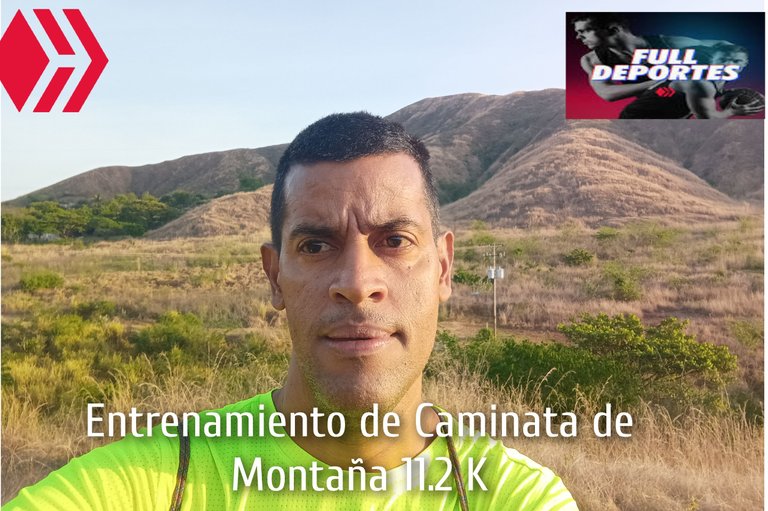
Entrenamiento de Caminata de Montaña 11.2 K
Greetings friends of Hive and @fulldeportes, today I am going to share with you my training hike on the route El Samán -Nueva Ruta - Dimas, which I did today, Sunday, in the community of Villa de Cura, Aragua state, Venezuela.
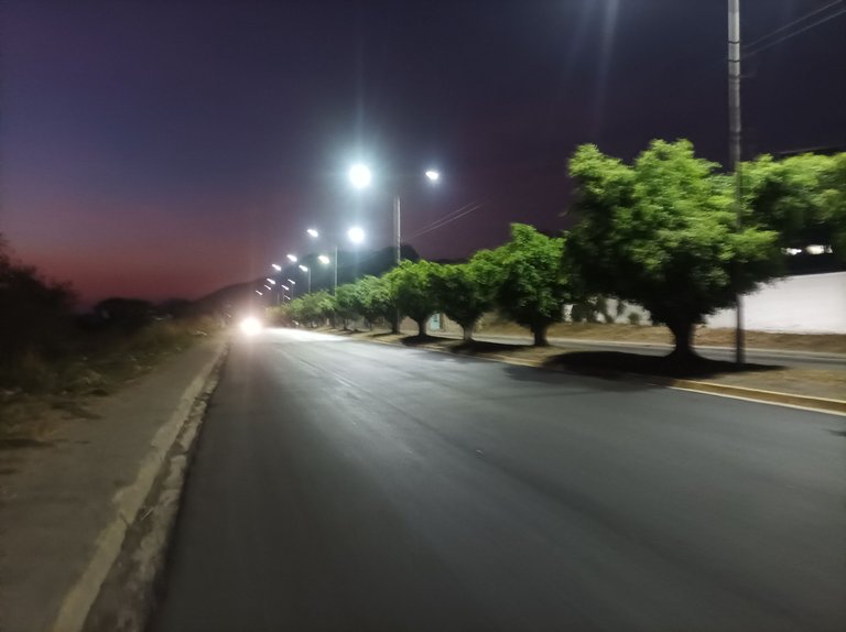
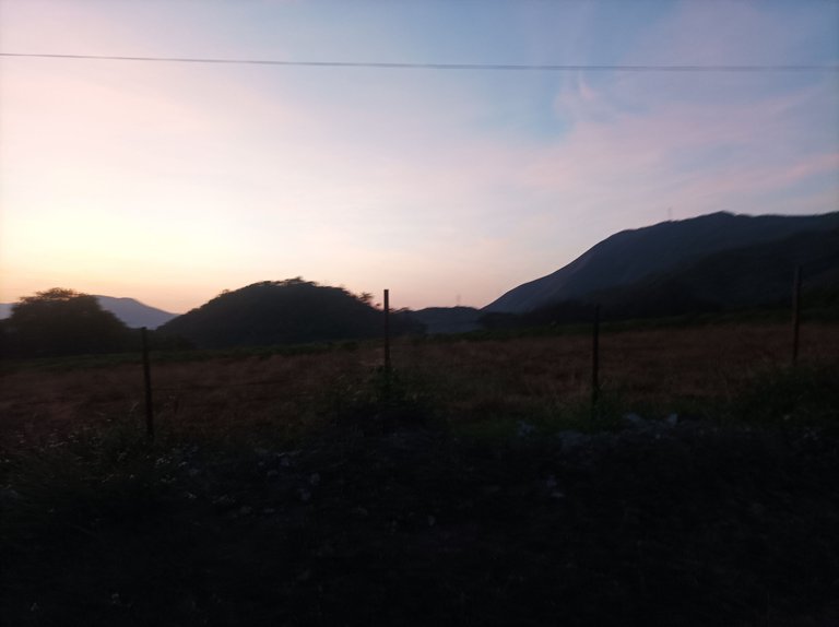
Cabe destacar que me pare muy temprano y esperé porque todavía estaba oscuro y sali a la 5:49 am, recorriendo la avenida Lisandro Hernández, a un ritmo
suave, al llegar al.monumento de Ezequiel Zamora mi reloj marco un tiempo de 21 minutos, encontrándome con un amigo corredor que me preguntó si iba hacia Las Antenas y le contesté que hacia El Samán y luego subiría el cerro El Toquito.
It should be noted that I stopped very early and waited because it was still dark and I left at 5:49 am, running along Lisandro Hernandez Avenue, at a gentle pace, when I reached the monument Ezequiel Zamora my watch marked my time 21 minutes. When I arrived at the monument of Ezequiel Zamora my watch marked a time of 21 minutes, meeting with a runner friend who asked me if I was going to Las Antenas and I answered him that I was going to El Samán
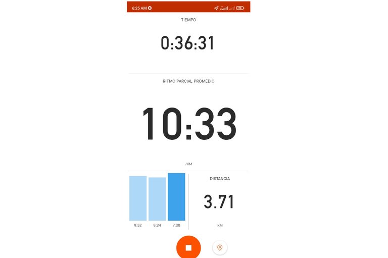
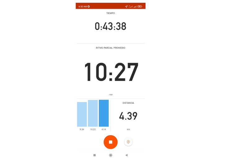
Asimismo continúe caminando por toda la carretera nacional Villa de Cura - San Juan de los Morros, al llegar en la entrada del asentamiento campesino El Samán, con un tiempo de 27 minutos, después de pasar en la primera esquina, con una distancia de 3.71 K, y un tiempo de 36 minutos, aquí decidí tomar la nueva ruta que me lleva cerca de la montaña donde se podría llegar a Las Antenas, pero todo está cerrado con cercas de alambre, completando la distancia de 4.39 K y un tiempo de 43 minutos.
Also continue walking along the entire national road Villa de Cura - San Juan de los Morros, arriving at the entrance of the peasant settlement El Samán, with a time of 27 minutes, after passing the first corner, with a distance of 3.71 K, and a time of 36 minutes, here I decided to take the new route that takes me near the mountain where you could reach Las Antenas, but everything is closed with wire fences, completing the distance of 4.39 K and a time of 43 minutes
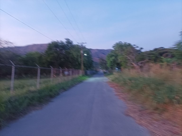
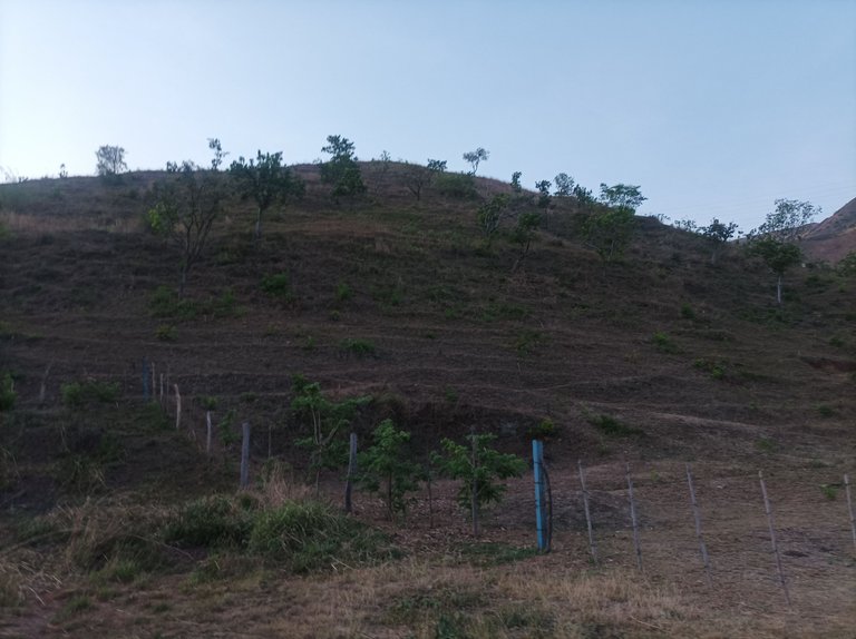
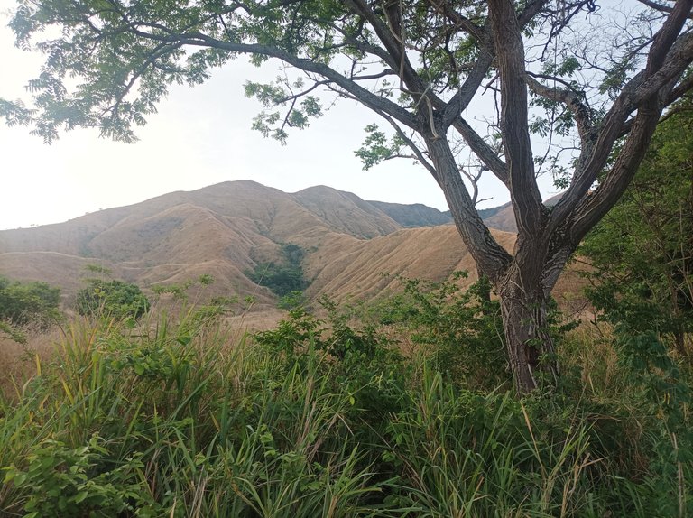
Después me regresé y retomé la ruta de El Samán, al continuar caminando, comencé a subir por la esquina del sector Dimas, está carretera está llena muchas piedras y es de pura tierra, una vez que llegue al final, con una distancia de 6.5 y un tiempo de 1 hora 6 minutos, me detuve unos segundos para hidratarme y tomar algunas fotografías, luego me regresé, para continuar mi recorrido para salir frente a las montañas.
Then I returned and resumed the route of El Samán, as I continued walking, I began to climb the corner of the Dimas sector, this road is full of stones and is pure dirt, once I reached the end, with a distance of 6.5 and a time of 1 hour 6 minutes, I stopped for a few seconds to hydrate and take some pictures, then I returned, to continue my journey to leave in front of the mountains.
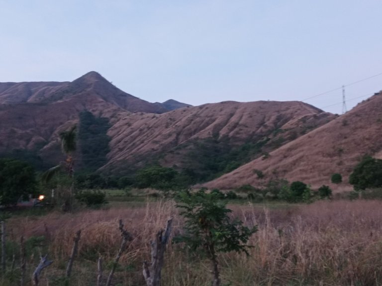
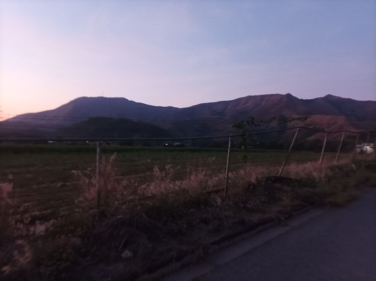
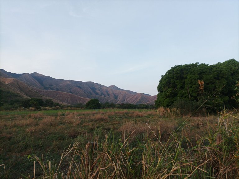
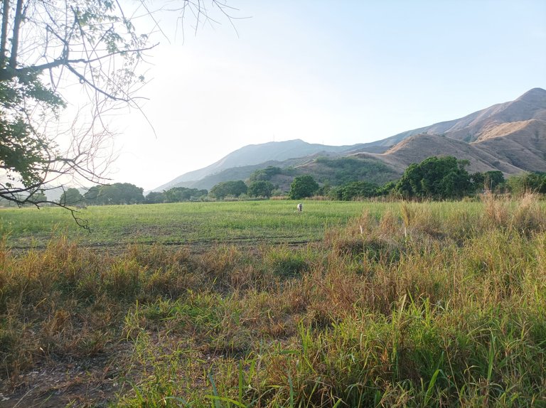
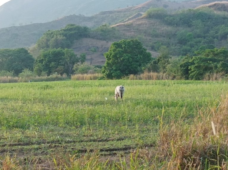
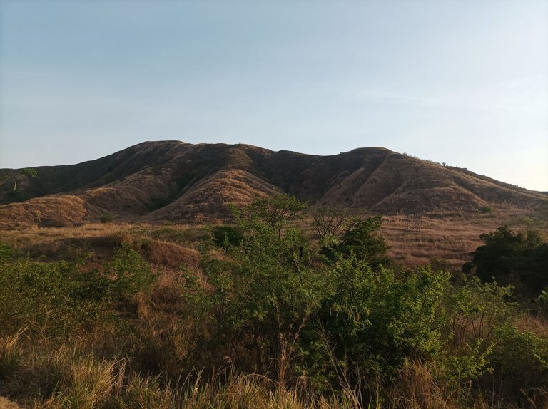
Una de las cosas que me gusta de esta ruta es la belleza de la montaña y las siembras de maíz y caraotas que se ven en algunas de las parcelas de este asentamiento campesino, así como también la cria de ganado y ovejos, que hacen de esta ruta una vista muy agradable y placentera.
One of the things I like about this route is the beauty of the mountain and the corn and beans that can be seen in some of the plots of this peasant settlement, as well as the cattle and sheep breeding, which make this route a very pleasant and enjoyable view.
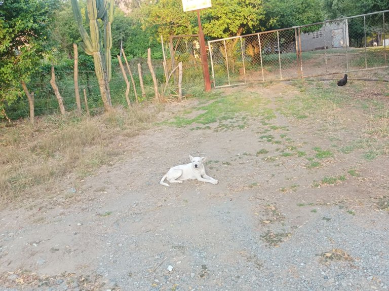
En este entrenamiento me encontré con un perrito que estaba esperando para tomarle una fotografía, al llegar a dónde se ven las montañas la aplicación Strava marco 8.33K y un tiempo de 1 hora 27 minutos, ya me quedaba por recorrer casi 3K. Después decidí no subir el cerro El Toquito porque ya el sol comenzó a salir, después llegué al Samán en 1 hora 34 minutos, aquí se presenta una pequeña pendiente para llegar al sector Santa Eduviges.
In this training I met a little dog who was waiting to take a picture, when I got to where you see the mountains the Strava application marked 8.33K and a time of 1 hour 27 minutes, I had almost 3K to go. Then I decided not to climb the hill El Toquito because the sun began to rise, then I reached the Samán in 1 hour 34 minutes, here there is a small slope to reach the Santa Eduviges sector.
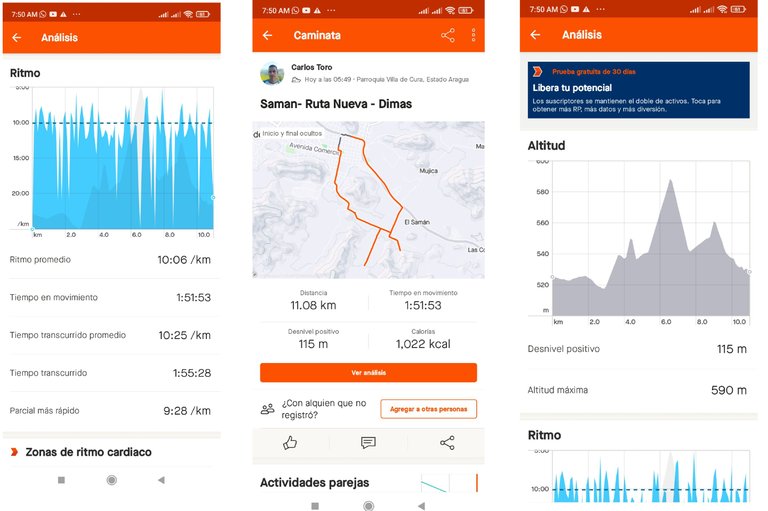
Una vez recorrido las calles de este sector, llegué a La Represa y luego L centro de la comunidad, pasando por la avenida Bolívar y llegar nuevamente a la avenida Lisandro Hernández, finalizando mi entrenamiento con una distancia de 11.08 K y un tiempo de 1 hora 55 minutos, con un ritmo promedio de 10 minutos por Kilometros, altura máxima de 590 n y un desnivel positivo de 115 m.
Once through the streets of this sector, I reached La Represa and then the center of the community, passing through Bolivar Avenue and arrive again to Lisandro Hernandez Avenue, finishing my training with a distance of 11.08 K and a time of 1 hour 55 minutes, with an average pace of 10 minutes per kilometer, maximum altitude of 590 n and a positive difference in altitude of 115 meters.
Espero que les haya gustado este entrenamiento, nos vemos en una próxima publicación.
I hope you liked this training, see you in a future post.
Fotografías: Teléfono Redmi Note 10
Portada realizada en APP GridArt
Logos utilizados de Hive y de fulldeportes
Traductor utilizado: Traductor de Google
Photos: Redmi Note 10 Phone
Cover made in The APP GridArte
Used logos of Hive and fulldeportes
Translator used: Translator used: Google Translate

Vote la-colmena for witness By @ylich

!HUESO
Click on this banner, to be directed to the Virtual World Discord and learn more about the curation project.
!LUV
Greetings, thank you very much
Saludos muchas gracias por valorar mi publicación
Denada🤗
Hola amigo, tienes razón, esa montaña tiene una belleza única. Excelente caminata, llevas in buen ritmo. Un saludo 👍👋
Muy bellas las imágenes que nos muestras y mucha disciplina en tu comportamiento hacia la actividad física. Admiro esa capacidad que tiene con estos entrenamientos de montaña y la creación de contenidos. Feliz jornada. Salud y saludos.
Saludos amigo, muchas gracias por tus palabras.
Buen entrenamiento, buenas fotos, la ultima me encantó...sigue sumando vida, un abrazo!
Hola que bueno, muchas gracias amiga, abrazos .
https://twitter.com/FullDeportes6/status/1769969602698645634
nada mejor que una caminata por la naturaleza para despejar la mente
Saludos, gracias por tu comentario,