Entrenamiento de Caminata de Montaña - 9.4 K [ESP/ENG]
Greetings friends of Hive and @fulldeportes, today I'm going to share with you my mountain hiking training in the El Toquito hill in the community of Villa de Cura, Aragua state, Venezuela.
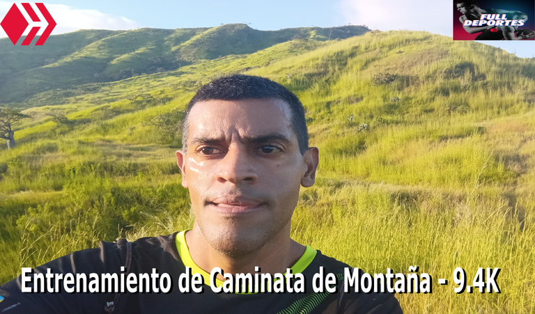
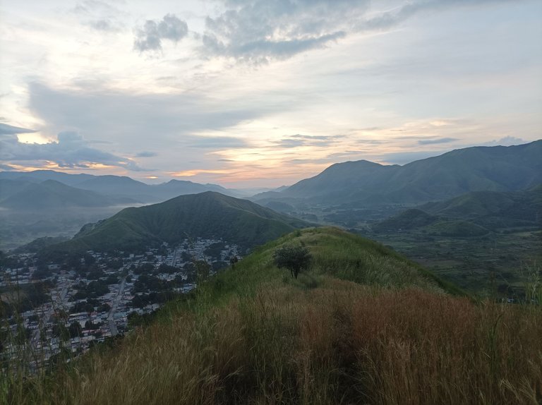
Les cuento que no entrenaba desde el día miércoles, y entonces decidí realizar esta ruta hoy sábado porque el día de mañana domingo estaré bien temprano acompañando a mi hijo en el torneo de Futsal. Me levanté a la 5:30 AM, tenía pensado subir al cerro Las Antenas, pero después cambie de opinión y me fui al sector del Toquito.
I have not trained since Wednesday, and then I decided to do this route today Saturday because tomorrow Sunday I will be very early accompanying my son in the Futsal tournament. I got up at 5:30 AM, I had planned to climb the Las Antenas hill, but then I changed my mind and went to the Toquito sector.
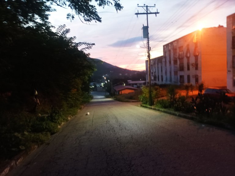
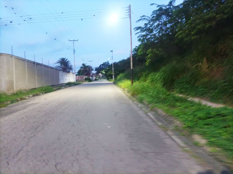
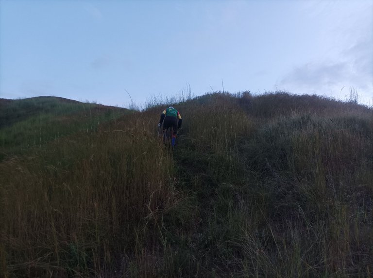
Antes de salir realice mi calentamiento de cinco minutos y luego active la aplicación Strava para registrar este entrenamiento, pase por todo el centro de la comunidad, y llegué al sector El Toquito con un tiempo de 20 minutos con 30 segundos, tenía pensado subir por otra entrada pero el camino no lo pude encontrar, entonces decidí subir por donde siempre subo.
Before leaving I did my five minute warm up and then activated the Strava application to record this training, I went through the center of the community, and arrived at the El Toquito sector with a time of 20 minutes and 30 seconds, I had planned to go up another entrance but I could not find the way, so I decided to go up where I always go up.
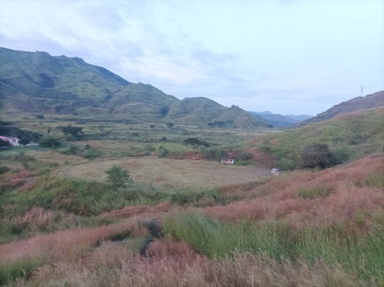
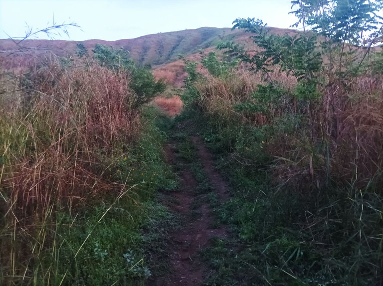
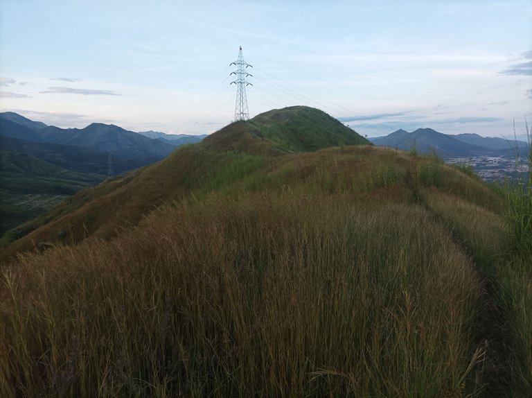
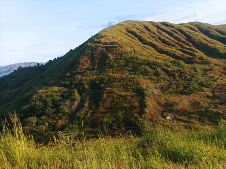
Cabe destacar que el camino estaba lleno de grandes arbustos, debido a que crecieron por la lluvia de estos días, en una parte me encontré con un amigo caminante que estaba limpiando y despejando el camino con un machete, en ese instante lo saludé y continue con mi ritmo a un paso sostenido, al llegar a la segunda pendiente mi reloj marco 30 minutos.
It should be noted that the road was full of large bushes, because they grew because of the rain these days, in one part I met a walking friend who was cleaning and clearing the road with a machete, at that moment I greeted him and continue with my pace at a steady pace, when I reached the second slope my watch marked 30 minutes.
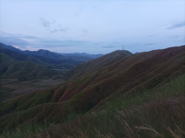
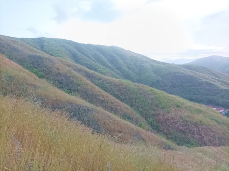
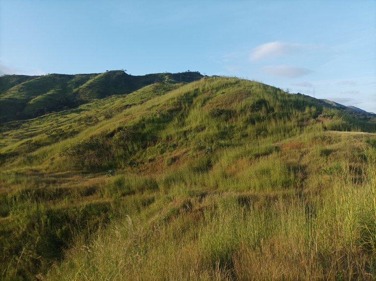
Después faltaba poco para llegar a la última subida y pude llegar con tiempo de 34 minutos, luego camine hacia la derecha hasta el final, para caminar por la nueva ruta, en este recorrido bajo como 1 Km, y después me devolví porque los arbustos estaban demasiado alto, toda esta parte que descendí me tocó ahora subir, en un buen ejercicio para tener una mayor resistencia en la subida.
Then it was not long to reach the last climb and I could arrive with a time of 34 minutes, then I walked to the right until the end, to walk the new route, in this route I went down about 1 km, and then I turned back because the bushes were too high, all this part that I descended now I had to climb, in a good exercise to have a greater resistance in the climb.
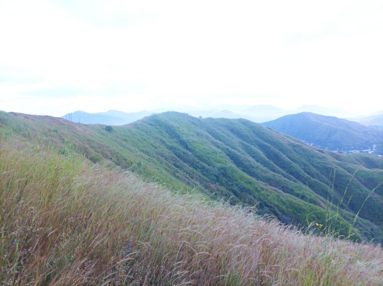
Una vez terminada esta parte, tome la dirección hacia la izquierda, que es pura bajaba, los zapatos se me humedecieron un poco porque los arbustos estaban mojados por la lluvia, continúe bajando y les cuento que perdí el camino para llegar a la parte baja donde está las pista de atletismo, sin embargo me devolví y al fin pude encontrar el camino correcto.
Once finished this part, I took the direction to the left, which is pure downhill, my shoes got a little wet because the bushes were wet from the rain, I continued down and I tell you that I lost the way to get to the lower part where the athletics track is, however I went back and finally I could find the right path.
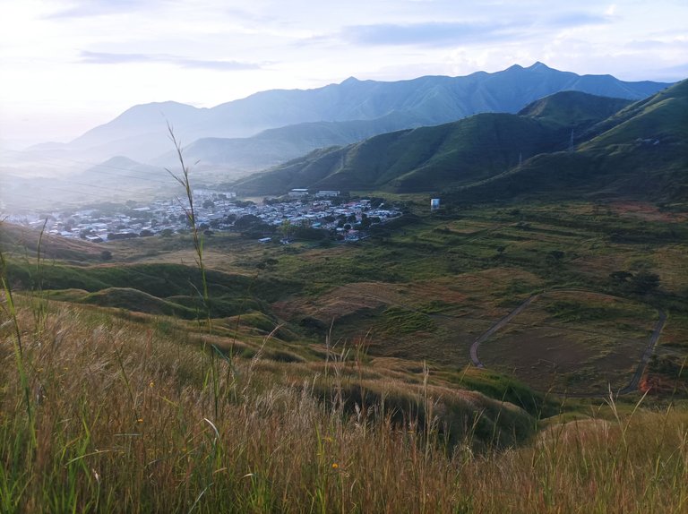
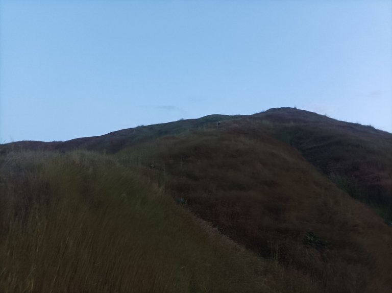
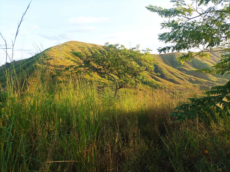
Cuando llegue a la parte baja, busque el camino para subir la montaña que está al frente de la pista y también fue positivo, esta es una pendiente de 200 metros, pensé darle la vuelta pero no pude porque los arbustos tapaban el camino, me regresé por donde mismo subí para no perderme en esta parte.
When I got to the lower part, I looked for the way to climb the mountain that is in front of the trail and it was also positive, this is a slope of 200 meters, I thought to turn around but I could not because the bushes covered the road, I went back the same way I climbed to not get lost in this part.
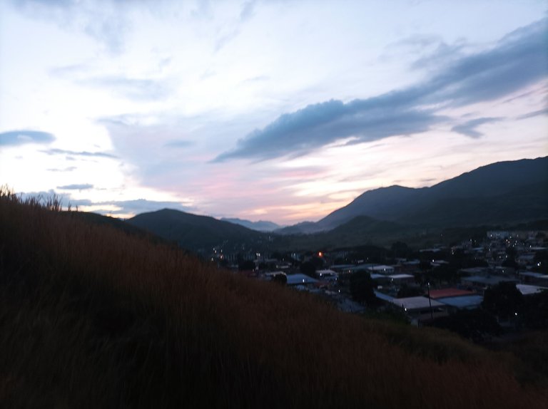
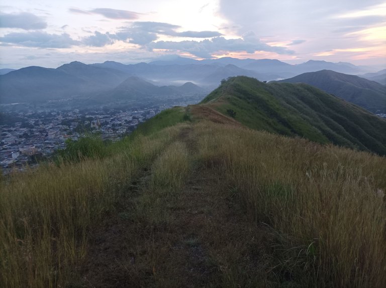
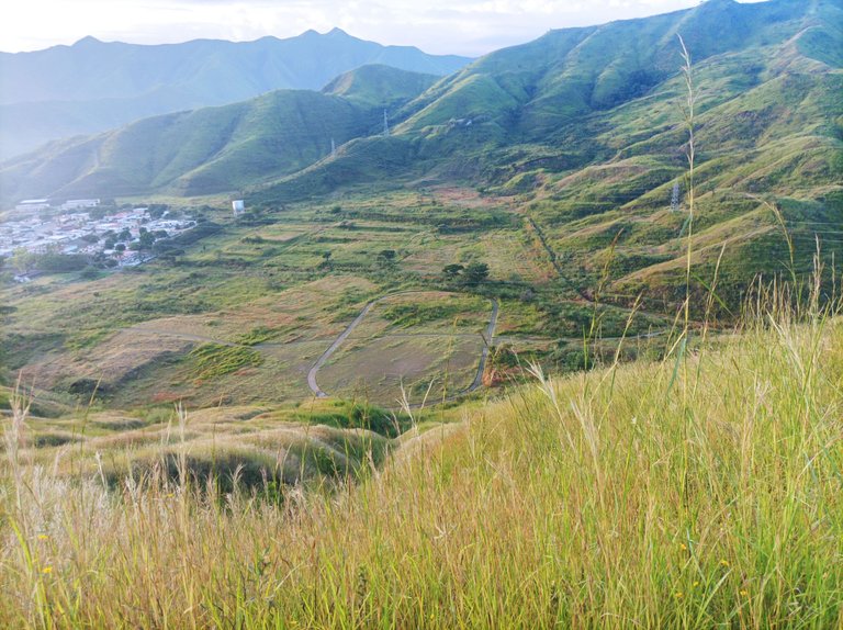
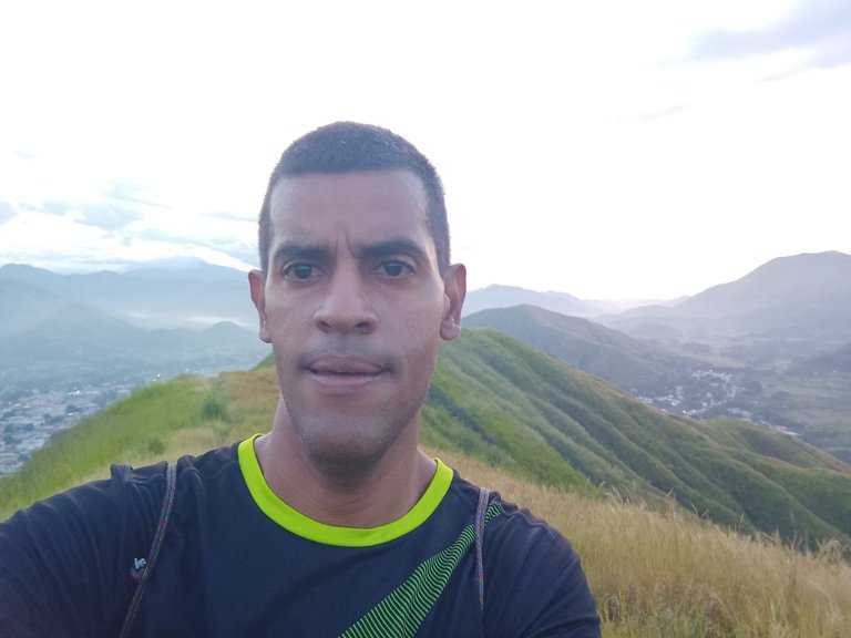
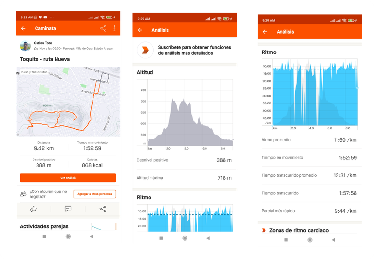
Luego de bajar la montaña, pude ver varios corredores amigos que estaban entrenando en la pista, ahora lo que me faltaba por recorrer un recorrido plano y pura bajada,pase nuevamente por el sector El Toquito, y luego por centro de la comunidad, camine por otras calles para hacer una mayor distancia, termine mi entrenamiento con un tiempo de 1 hora 57 minutos con 52 minutos, con una distancia de 9 Km con 420 metros, casi complete los 10Km.
After descending the mountain, I could see several runners friends who were training on the track, now what I had left to do was a flat route and pure downhill, pass again by the sector El Toquito, and then through the center of the community, walk through other streets to make a longer distance, I finished my training with a time of 1 hour 57 minutes and 52 minutes, with a distance of 9 km with 420 meters, almost complete the 10Km.
Espero que les haya gustado mi entrenamiento, nos vemos en una próxima publicación
I hope you liked my training, see you in a future post.
Fotografías: Teléfono Redmi Note 10
Portada realizada en Inkscape
Logo utilizado de Hive y @fulldeportes
Traductor utilizado: APP Deepl
Photos: Redmi Note 10 Phone
Cover made in Inkscape
Hive and @fulldeportes logo used
Translator used: APP Deepl

Vote la-colmena for witness By @ylich

https://inleo.io/threads/cetb2008/re-leothreads-2cx2pot3z
The rewards earned on this comment will go directly to the people ( cetb2008 ) sharing the post on LeoThreads,LikeTu,dBuzz.
Buen recorrido mi hermano, estuvieron maravillosas las fotos. Saludos!
Congratulations @cetb2008! You have completed the following achievement on the Hive blockchain And have been rewarded with New badge(s)
Your next target is to reach 30000 upvotes.
You can view your badges on your board and compare yourself to others in the Ranking
If you no longer want to receive notifications, reply to this comment with the word
STOPTo support your work, I also upvoted your post!
Check out our last posts:
Felicidades mi amigo por ese buen recorrido, hay demasíado monte crecido, mucha precaución. Los paisajes excelentes, saludos un fuerte abrazo
Hola amiga, muchas gracias .
Hola señor @cetb2008, esas rutas se ven interesantes, en familia también hemos realizado caminata de este tipo, el contacto con la naturaleza es especial, saludos