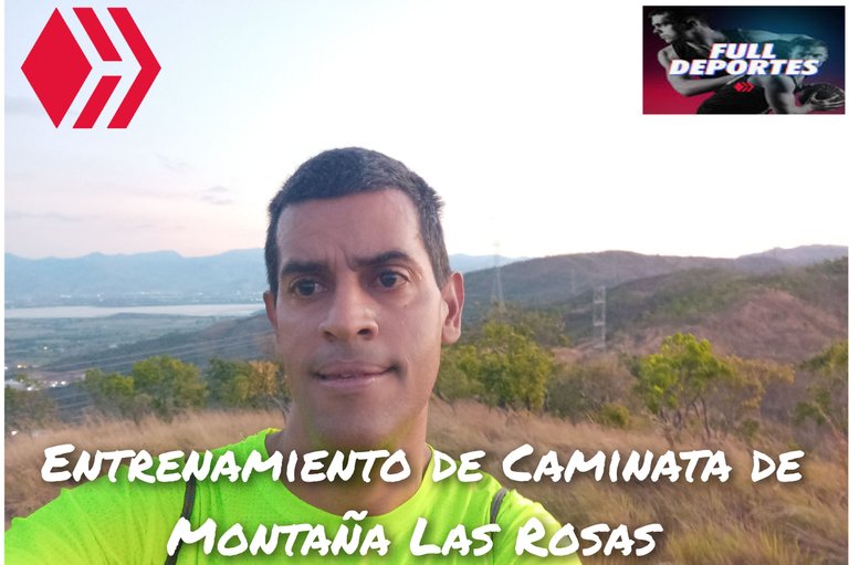
Entrenamiento de Caminata de Montaña Las Rosas [IESP/ENG]
Greetings friends of Hive and @fulldeportes, today again I'm going to share with you my mountain hiking training on the route Las Rosas - Chivos, in the community of Villa de Cura, Aragua state, Venezuela.
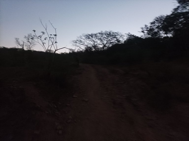
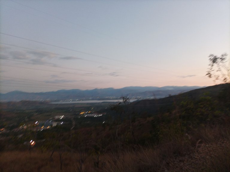
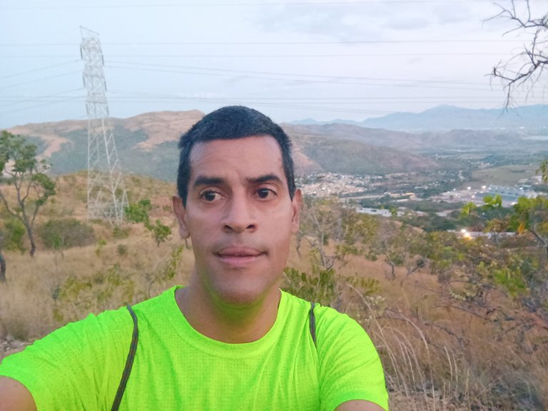
En este entrenamiento había contactado a un.amigo para entrenar, pero no me contestó, entonces decidí subir solo, me levanté a la 5:10 am, para salir a la 5:40 am, todavía a esta hora estaba un poco oscuro, active la aplicación Strava y Actifit, con un ritmo a un 70 por ciento, avanzando en la carretera nacional Cagua - Villa de Cura, al llegar al llegar a la entrada en el cerro Las Rosas mi reloj marco un tiempo de 29 minutos con 31 segundos, con una distancia de 3.52 K.
In this training I had contacted a friend to train but he did not answer me, so I decided to go up alone, I got up at 5:10 am, to leave at 5:40 am, still at this time it was a little dark, at active the application Strava and Actifit, with a pace at 70 percent, advancing on the Cagua - Villa de Cura national highway, upon arriving at the entrance to Las Rosas Hill, my watch marked a time of 29 minutes and 31 seconds, with a distance of 3.52 K
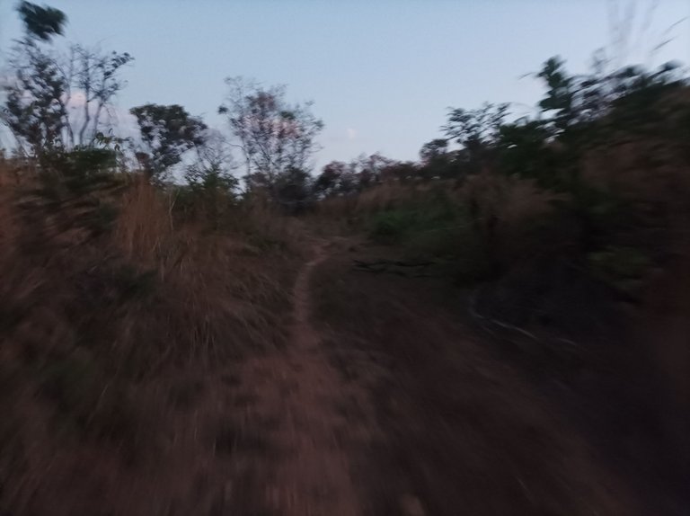
Cabe resaltar que se pierden unos segundos debido a que hay que cruzar una cerca que está en la entrada, que evita que el ganado salga a la calle, al comenzar a subir esta montaña todavía continuaba oscuro, aumente un poco el ritmo para ver si logro bajar mi mejor tiempo, mantuve al ritmo de la caminata y al llegar a los 5.29 K, la aplicación registro un tiempo de 48 minutos.
It should be noted that a few seconds are lost because you have to cross a fence at the entrance, which prevents the cattle from going out into the street. When starting to climb this mountain it was still dark, I increased the pace a little to see if I could manage lower my best time, I maintained the pace of the walk and when I reached 5.29 K, the application recorded a time of 48 minutes.
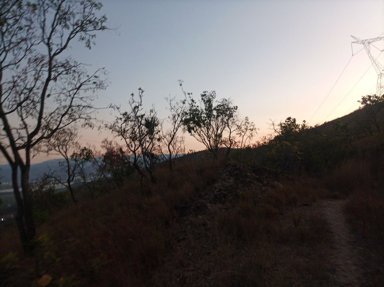
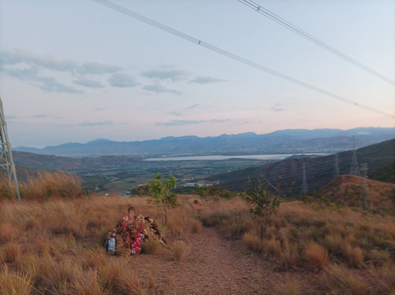
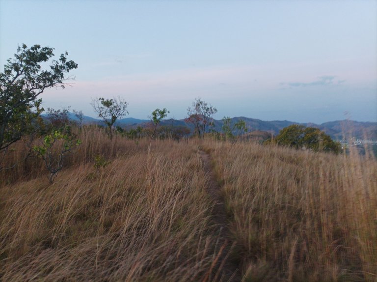
Este recorrido es variado, con subidas algunas cortas y con algo de plano que sirve para recuperarse del esfuerzo en las pendientes. Después llegué a donde está el Anima Sola con un tiempo de 50 minutos y una distancia de 5.4 K, luego ya me estaba acercando a las torres donde se ve la laguna de Taguaguay, del municipio Sucre, aquí hay una pequeña subida, y comienzo a ver la salida del sol en el firmamento.
This route is varied with some short climbs and some flat terrain that serves to recover from the effort on the slopes. Then I arrived at where the Anima Sola is with a time of 50 minutes and a distance of 5.4 K, then I was approaching the towers where you can see the Taguaguay lagoon, in the Sucre municipality, here there is a small climb, and I begin to See the sunrise in the sky.
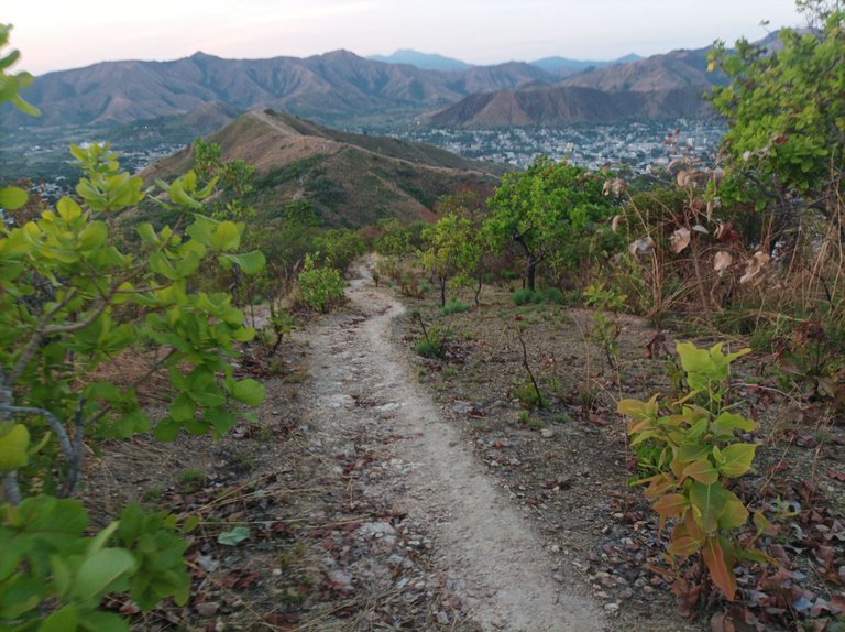
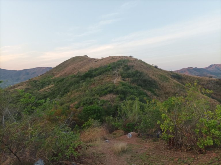
Al llegar a esta torre la aplicación marco 53:36 minutos y una distancia de 5.76 K, luego viene una parte plana con bastantes arbustos, pero el camino estuvo despejado, al terminar de pasar todo el trayecto plano, comencé nuevamente a subir para llegar a La Piedra con un tiempo de 1 hora 2 minutos y una distancia de 6.68 K, faltando poco para llegar a Las Torres.
Upon reaching this tower, the application marked 53:36 minutes and a distance of 5.76 K, then comes a flat part with a lot of bushes, but the path was clear, when I finished passing the entire flat route, I began to climb again to reach La Piedra with a time of 1 hour 2 minutes and a distance of 6.68 K, with little left to reach Las Torres.
Cabe resaltar que continúe avanzando, pasando por Las Torres y luego comencé a bajar hasta llegar al sector de Las Mercedes, con un tiempo de 1 hora 12 y una distancia de 7.79, a partir de aquí viene una subida de más de 200 metros, al finalizar la pendiente, seguí caminando y llegué a la montaña dónde están las máquinas de ejercicios con un tiempo de 1 hora 18 minutos, y una distancia de 8.29 K.
It should be noted that I continued advancing, passing through Las Torres and then I began to descend until I reached the Las Mercedes sector, with a time of 1 hour 12 and a distance of 7.79, from here comes a climb of more than 200 meters, to the Finishing the slope, I continued walking and reached the mountain where the exercise machines are with a time of 1 hour 18 minutes, and a distance of 8.29 K.
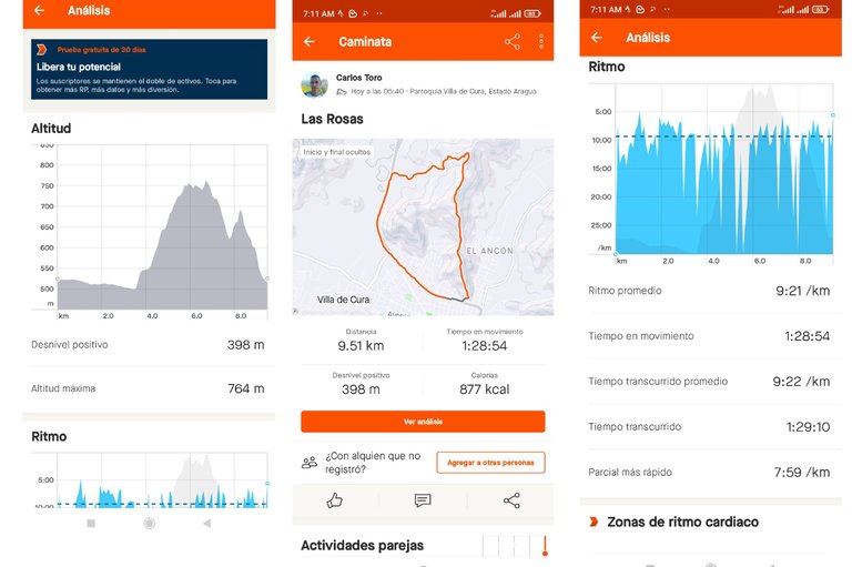
Ahora lo que quedaba es pura bajada, al comenzar a descender me encontré con varios caminantes que estaban entrenando, llegue al cerro donde está la cruz, y aumente el ritmo en la bajada y llegué a la avenida Lisandro Hernández, terminando mi entrenamiento con un tiempo de 1 hora 29 minutos y una distancia de 9.54 K, con una altura de 764 m, y un desnivel positivo de 398 metros, registrado en la aplicación Strava y 8951 en Actifit.
Now what remained is pure descent, as I began to descend I met several walkers who were training, I reached the hill where the cross is, and I increased the pace on the descent and arrived at Lisandro Hernández Avenue, finishing my training with a time of 1 hour 29 minutes and a distance of 9.54 K, with a height of 764 m, and a positive gradient of 398 meters, recorded in the Strava application and 8951 in Actifit.
Espero que les haya gustado esta ruta, nos vemos en un próximo entrenamiento.
I hope you liked this route, see you in the next training session.
Fotografías: Teléfono Redmi Note 10
Portada realizada en APP GridArt
Logos utilizados de Hive y de fulldeportes
Traductor utilizado: Traductor de Google
Photos: Redmi Note 10 Phone
Cover made in The APP GridArte
Used logos of Hive and fulldeportes
Translator used: Translator used: Google Translate

Vote la-colmena for witness By @ylich

https://inleo.io/threads/cetb2008/re-leothreads-25zyxzay3
The rewards earned on this comment will go directly to the people ( cetb2008 ) sharing the post on LeoThreads,LikeTu,dBuzz.
Como siempre tus caminatas son excelentes, deleitándome con tus paisajes nuevamente, espero algún día visitarlas, saludos amigo.
Que bueno sería amiga, gracias por tu comentario, saludos.
Gracias a ti, muchas bendiciones. Saludos
una pena que no eres de maracaibo si no haciamos un meet ahi rapido! mañana parto por aquellos lados de visita! un abrazo!
Saludos amigo que bueno que vienes a Venezuela, abrazo.