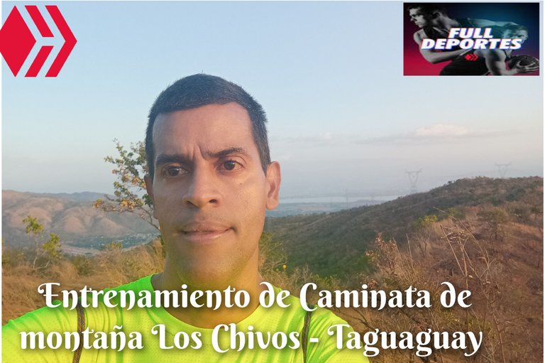
Entrenamiento de Caminata de Montaña Los Chivos - Taguaguay
Greetings friends of Hive and @fulldeportes, today I'm going to share with you my mountain hiking training on the route Los Chivos - Laguna de Taguaguay, in the community of Villa de Cura, Aragua state, Venezuela.
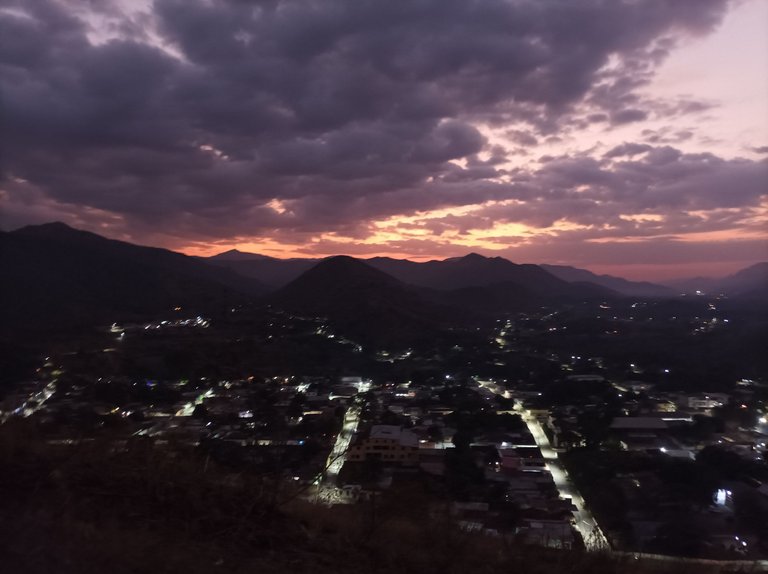
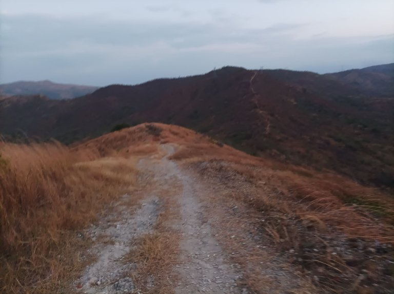
Les cuento que no había entrenado desde el día domingo, descansando dos días, y me levanté temprano pero no salí antes porque estaba muy oscuro para subir la montaña, salí a la 6:22 AM, activando la aplicación Strava para registrar el entrenamiento, pensé ir a un ritmo tipo competencia, pero después cambie de ideas, y caminé a un paso constante, en la primera subida me encontré con una persona que venía detrás de mi, en la primera subida mi reloj marco 8:35 minutos.
I tell you that I had not trained since Sunday, resting two days, and I woke up early but did not leave before because it was too dark to climb the mountain, I left at 6:22 AM, activating the Strava app to record the training, I thought to go at a competition type pace, but then I changed my mind, and walked at a steady pace, on the first climb I met a person who came behind me, on the first climb my watch marked 8:35 minutes.

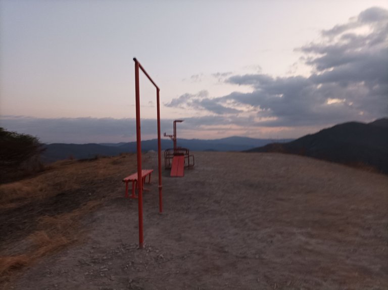
Después de pasar la primera subida, aumente el ritmo, y fui dejando atrás a la persona, en cuanto al clima estuvo bastante fresco y fue aclarando a medida que iba subiendo, al terminar de llegar a la segunda subida, llevaba un registro de 13 minutos, y me faltaba subir la tercera loma, dónde está la máquinas de ejercicios, llegué a la cima con tiempo de 16 minutos, mi mejor marca hasta aquí es de 14 minutos.
After passing the first climb, I increased the pace, and was leaving behind the person, as for the weather was quite cool and was clearing as I was going up, when I finished reaching the second climb, I had a record of 13 minutes, and I had to climb the third hill, where the exercise machine is, I reached the top with a time of 16 minutes, my best mark so far is 14 minutes.
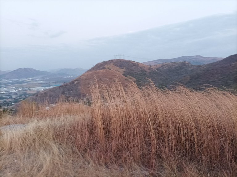
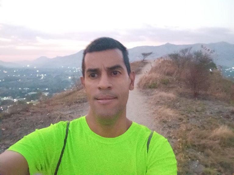
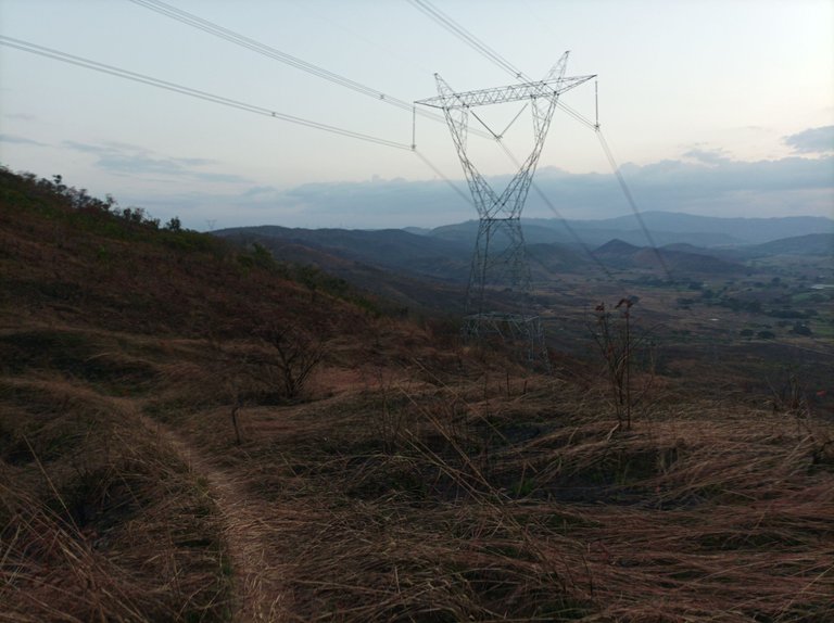
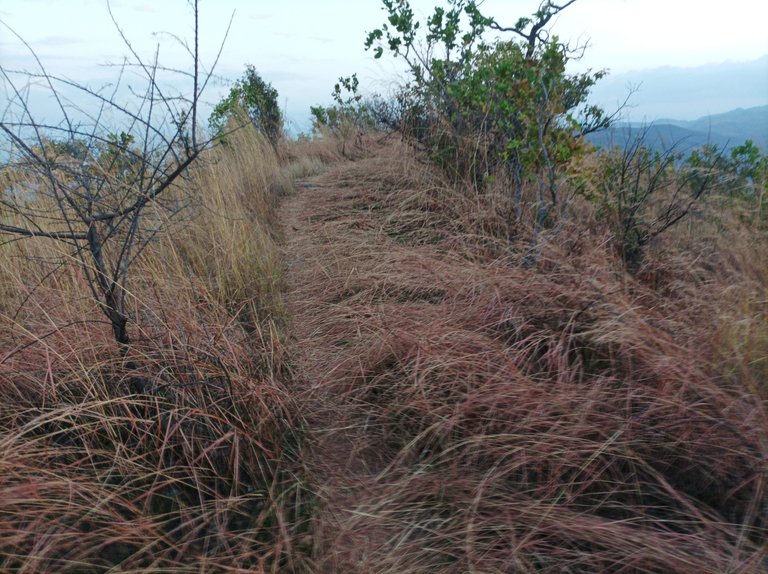
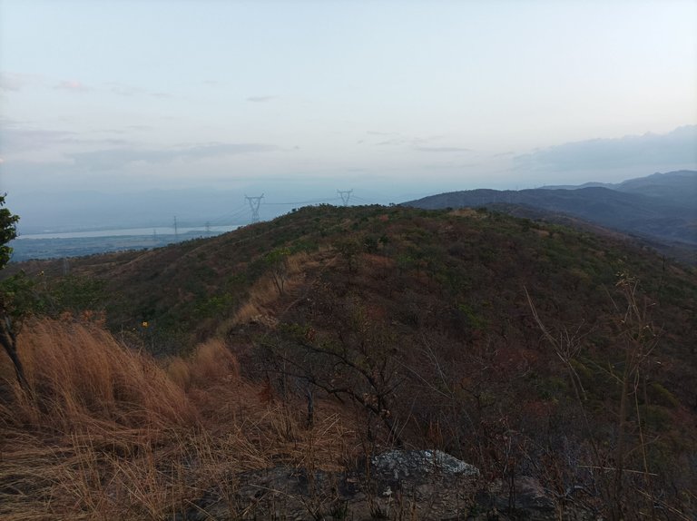
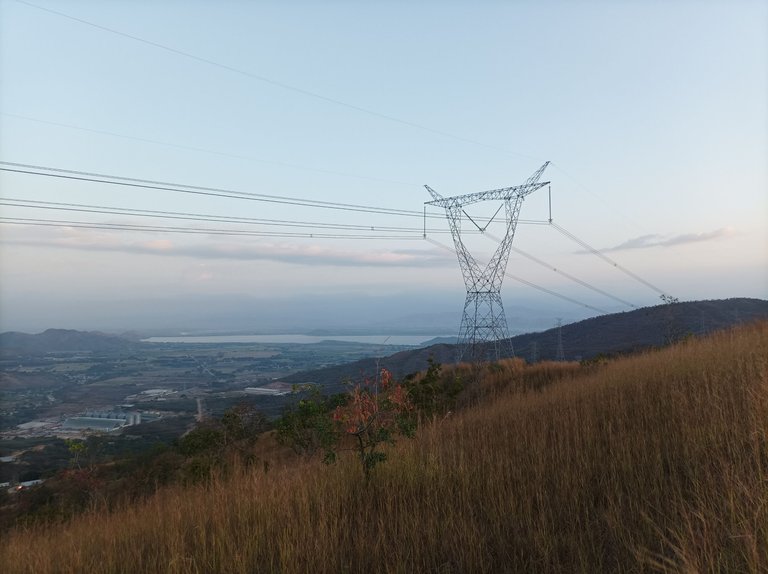
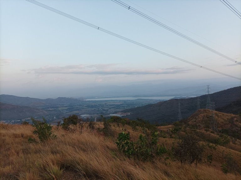
Cabe destacar que me detuve unos segundos para tomarme unas fotografías con la valla nueva que colocaron en el cerro, continúe bajando y al llegar al sector de Las Mercedes llevaba un registro de 23 minutos, pude observar que se quemó mucho más, esto sucede por las altas temperaturas, lo único bueno es que se despejó el camino y está más visible para caminar, termine de subir a la cuarta subida y llegué a las torres con 32 minutos.
It should be noted that I stopped for a few seconds to take some pictures with the new fence that was placed on the hill, I continued descending and when I reached the sector of Las Mercedes I had a record of 23 minutes, I could see that it burned much more, this happens because of the high temperatures, the only good thing is that the road was cleared and is more visible for walking, I finished climbing to the fourth climb and reached the towers with 32 minutes.
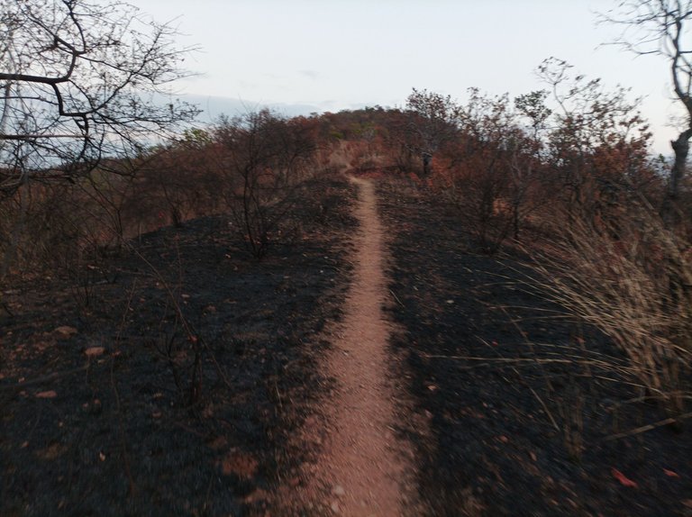
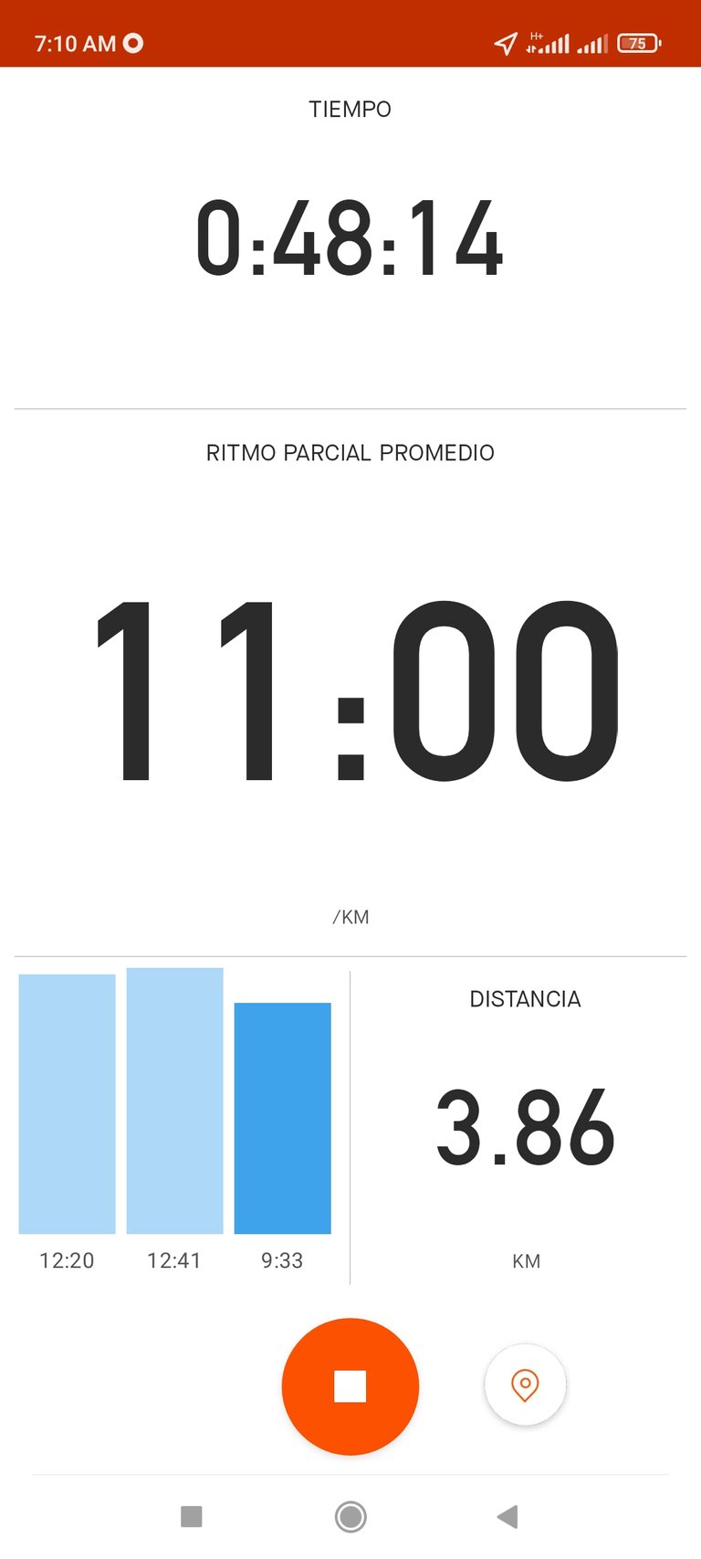
Después continúe avanzando, para llegar a la piedra con un tiempo de 37:22 minutos, me detuve unos segundos y continúe caminando para hacer una mayor distancia, en esta parte los arbustos si están muy altos, porque la candela no los ha afectado, llegué al frente dónde podemos ver la laguna de Taguaguay, con un tiempo de 48 minutos y una distancia de 3.86 K , me hidrate un poco y luego me devolví por el mismo camino.
Then I continued advancing, to arrive to the stone with a time of 37:22 minutes, I stopped a few seconds and continued walking to make a greater distance, in this part the bushes if they are very high, because the candela has not affected them, I arrived to the front where we can see the lagoon of Taguaguay, with a time of 48 minutes and a distance of 3.86 K, I hydrated a little and then I returned by the same road.
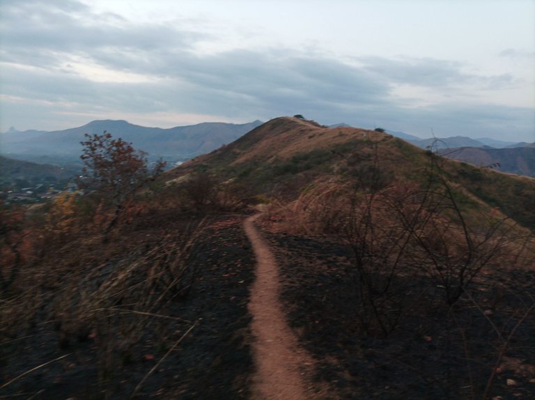
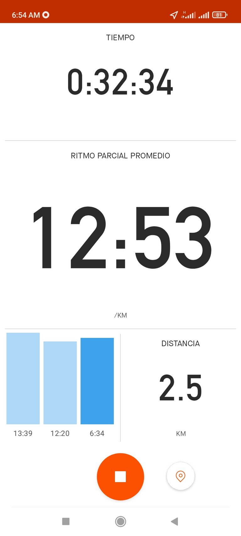
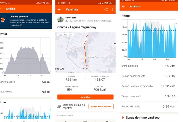
Así mismo, mantuve el mismo pasó, de regreso es una parte plana y dos subidas, cuya última es la más larga, al llegar al cerro dónde está las máquinas de ejercicios me encontré con varias personas que estaban haciendo ejercicios, luego continúe bajando hasta terminar de llegar a la avenida Lisandro Hernández con un tiempo de 1 Hora 34 minutos y 30 Segundos, 7.66 K, una altura de 768 m.
Likewise, I kept the same pace, on the way back is a flat part and two climbs, whose last one is the longest, when I arrived to the hill where the exercise machines are, I found several people who were exercising, then I continued down until I reached the Lisandro Hernandez Avenue with a time of 1 Hour 34 minutes and 30 Seconds, 7.66 K, a height of 768 meters.
Espero que les haya gustado este entrenamiento, nos vemos en un próximo entrenamiento.
I hope you enjoyed this training, see you in a future training.
Fotografías: Teléfono Redmi Note 10
Portada realizada en la App GridArt
Logos utilizados de Hive y de fulldeportes
Traductor utilizado: Traductor de Google
Photos: Redmi Note 10 Phone
Cover made in The App GridArt
Used logos of Hive and fulldeportes
Translator used: Translator used: Google Translate

Vote la-colmena for witness By @ylich

Saludos muchas gracias por apoyar mi publicación.
Entrenando, con mágicos paisajes...hoy estaba yendo de camino al trabajo a las 5 de la mañana con un hermoso amanecer y tenía que ir subiendo cuestas.
Saludos amigo,que bueno te gusto, gracias por tu comentario.
Se nota que el verano ha estado fuerte, pero aún así las montañas siguen hermosas, sigue sumando kilómetros, vida y salud, un abrazo!
Saludos, muchas gracias por tu comentario, abrazos.
Ya el camino, las hierbas árboles estás algunos secos, con estas altas temperaturas, se espera eso, ojalá no ocurra mayores cosas, sería una pena que el paisaje que se percibe se distorsione, es cosa de la naturaleza y debemos aprender de ella, por acá el calor está fuerte y la temperatura es vapor caliente que sofoca.
Espero ver más de tus recorridos amigo, saludos
Si amiga lo que viene es mucho calor, gracias por tu comentario, saludos.
Aquí está insoportable. Saludos