All Rights Reserved.
All the images contained in this post are taken, created and/or edited by me. All the contents in this post are copyright-protected. All the uses of the contents - and their derivatives -, except for the spread without modifications through social media channels, are strictly prohibited without the explicit consent of the author.
Hello Hive!
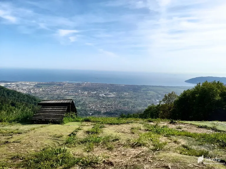
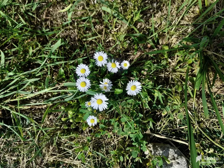
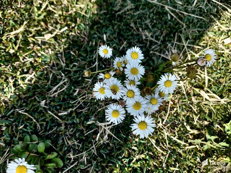
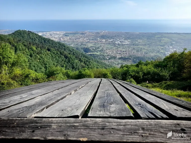
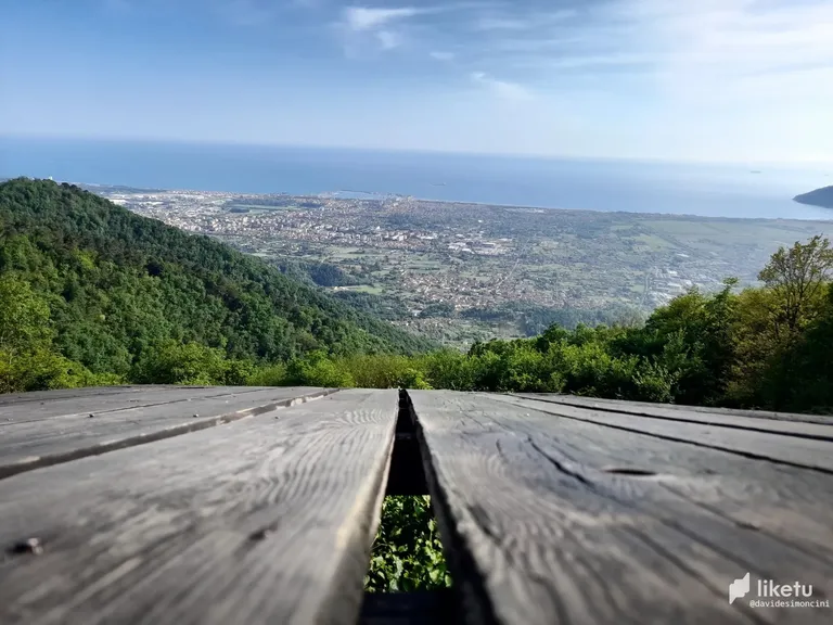
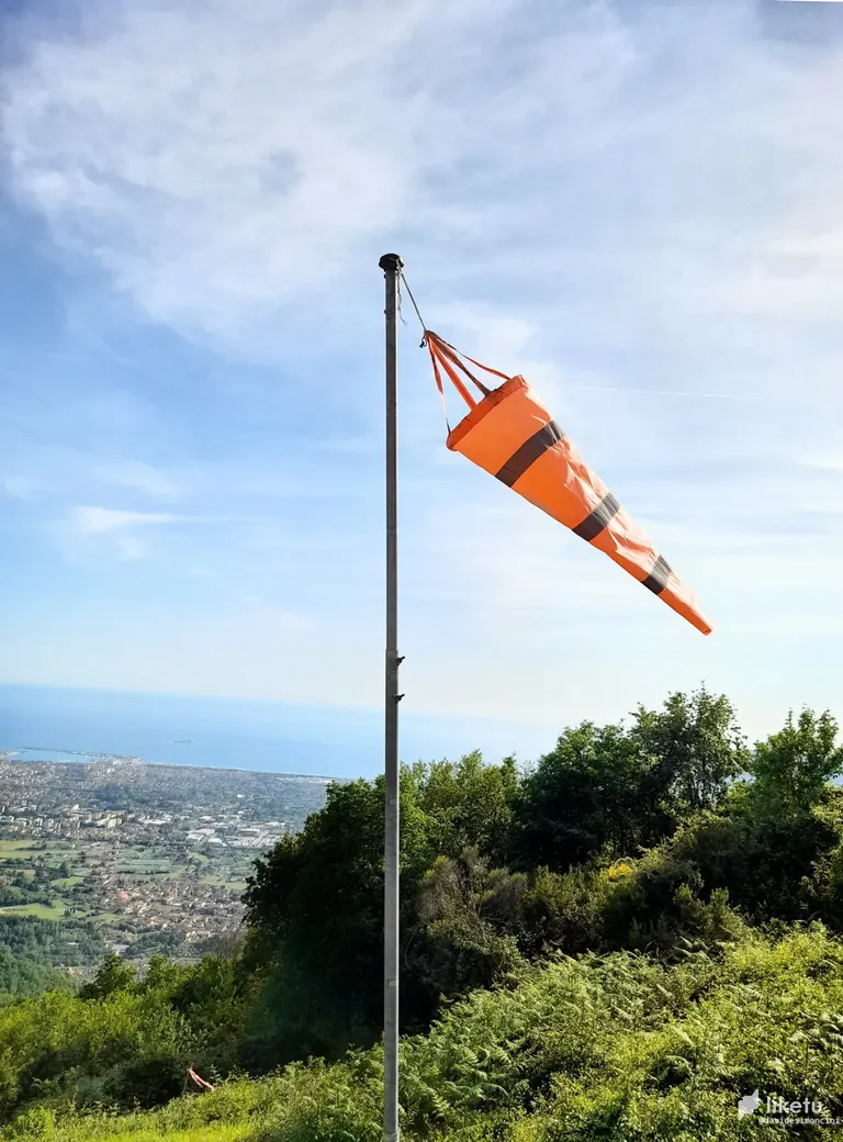
Today I shared a few photos taken by a smartphone. I took them in the last weeks, when I reached the top of the climb after passing by Santa Lucia locality. On the top, there is a little green space also suitable for landing small aircraft. I reached the place on my bike and stopped there, watching around me. I saw some beautiful flowers and some wild mint plants; maybe, some leftovers of human passage, but that was another story.
I saw some paths near the place, but I don't know where they arrive. One day, maybe, when I'll reach the place on the mountain bike. In the end, I took again my bike and returned home.
At home, I edited a little bit the photos, increasing the contrast, the dark and the bright points, the saturation, and other little adjustments.
The Route
Using the asphalted road, there are two ways to reach the place.
The first, leaving the Via Aurelia near Ortonovo's Dogana, continuing towards Casano and then passing by Ortonovo and entering between the first buildings in Fontia. There, you can turn into a road on the right and continue to Santa Lucia and over there. The road ends near a place with radars, where a path starts. After some meters, you can find the place where I took the photos. This first way is a climb from Casano to a little bit over Ortonovo, then again climb from Fontia to the described place.
The second way is passing by Viale XX Settembre and turning towards Fossola. There starts the climb, which continues after Fontia. You should turn to Santa Lucia thanks to a road on the left (the same one you find on your right passing by Ortonovo's side). Then, you should follow the main road, the main one you always find on your left. When the road ends, you find the path to the photographed place.
Greetings and see you next time!
Photo taken by smartphone / automatic mode
Tutti i diritti riservati.
Tutte le immagini contenute in questo post sono state scattate, create e/o modificate da me. Tutti i contenuti di questo post sono protetti da diritto d'autore. Tutti gli usi dei contenuti - e di qualsiasi loro derivato -, ad eccezione della diffusione senza modifiche attraverso canali social media, sono strettamente proibiti senza l'esplicito consenso dell'autore.
Ciao Hive!
Oggi ho condiviso qualche foto che ho scattato con uno smartphone. Le ho ottenute nelle scorse settimane, quando ho raggiunto la cima della salita dopo essere passato dalla località di Santa Lucia. Sulla vetta, c'è un piccolo spazio verde anche adatto all'atterraggio di piccoli velivoli. Ho raggiunto il luogo sulla mia bici e mi sono fermato là, guardandomi attorno. Ho visto alcuni bei fiori e altrettante piantine di menta selvatica; forse, qualche resto del passaggio umano, ma quella era un'altra storia.
Vicino ho visto alcune tracce di sentiero, ma non so dove arrivino. Un giorno, forse, quando raggiungerò il posto con la mia mountain bike. Per finire, ho ripreso la bici e sono tornato a casa.
Ho modificato un po' le foto, aumentando i contrasti, modificando i punti chiari e scuri, la saturazione, e altri piccoli aggiustamenti.
Il Percorso
Usando la strada asfaltata, ci sono due modi principali per raggiungere il luogo.
Il primo, lasciando la Via Aurelia vicino a Dogana di Ortonovo, continuando verso Casano e poi passando da Ortonovo ed entrando tra i primi edifici di Fontia. Lì puoi svoltare in una strada sulla destra e continuare fino a Santa Lucia e oltre. La strada termina vicino a una postazione con dei radar, dove inizia una strada sterrata. Dopo qualche metro, potrai trovare il posto nel quale ho scattato le foto. Questo primo modo di raggiungerlo è in salita da Casano fino a poco dopo Ortonovo e poi di nuovo in salita tra Fontia e la fine della strada.
Il secondo modo è passando da Viale XXSettembre e svoltando verso Fossola. Là inizia la salita, che continua fin dopo Fontia. Dovrai poi svoltare verso Santa Lucia grazie a una strada sulla sinistra (la stessa che trovi sulla tua destra passando dal versante di Ortonovo). Poi devi seguire la strada principale, quella che trovi sempre sulla tua sinistra. Quando la strada terminerà, troverai il sentiero verso il posto fotografato.
Un saluto e alla prossima!
Foto scattate con uno smartphone / modalità automatica
Modificate grazie a Paint.net
For the best experience view this post on Liketu
https://twitter.com/EveryWork1/status/1527651635295567874
The rewards earned on this comment will go directly to the person sharing the post on Twitter as long as they are registered with @poshtoken. Sign up at https://hiveposh.com.
Congratulations, your post has been added to Pinmapple! 🎉🥳🍍
Did you know you have your own profile map?
And every post has their own map too!
Want to have your post on the map too?