PhotoJournal – road trip to Palouse Falls, Washington
Back into geological time
East through Vantage
It is always fun to take a road trip through Washington state, with its variety of landscapes – rain forest, mountain passes, cattle and ranch country, desert, scablands, Palouse farm fields.
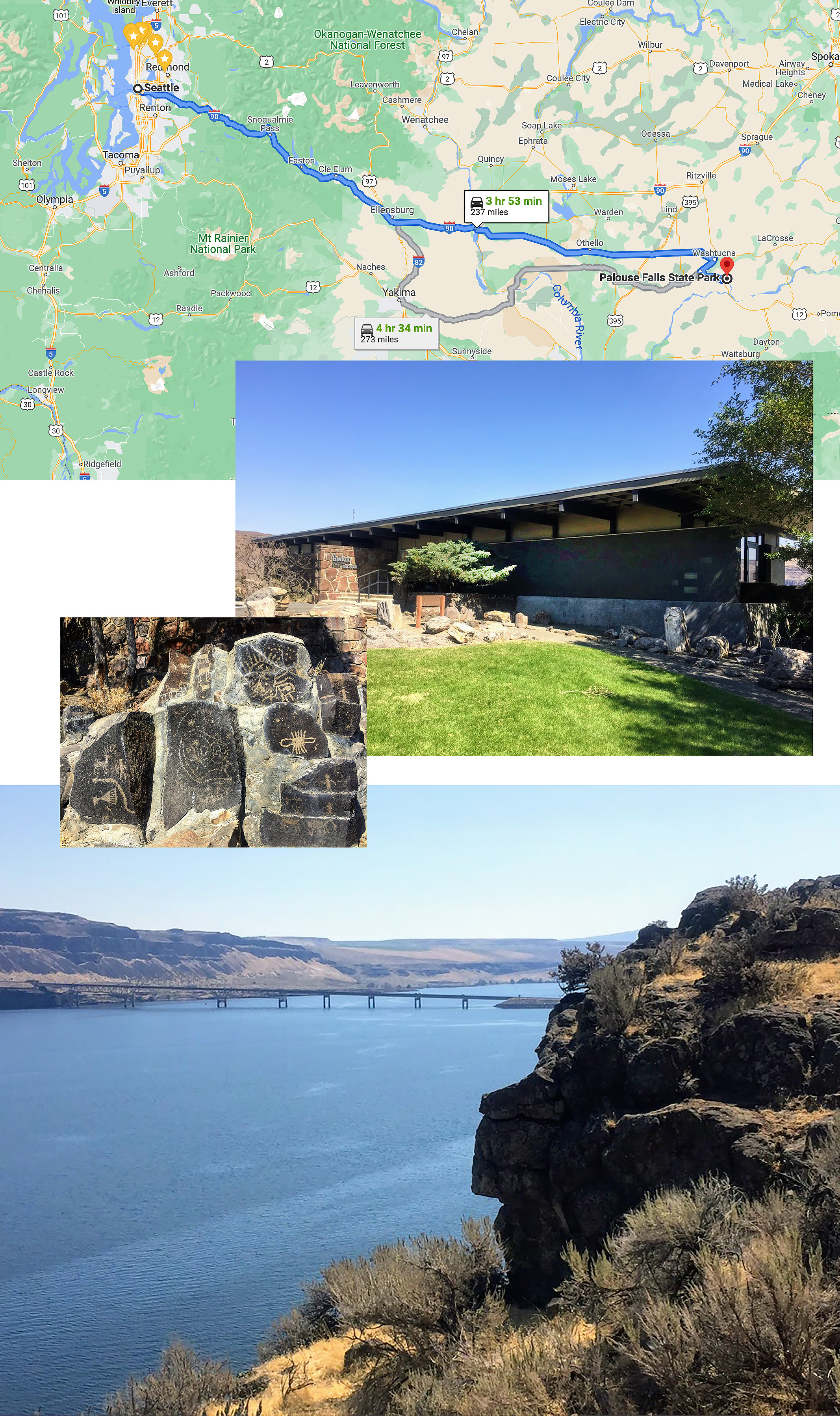
When we go to see Palouse Falls, we generally take I-90 east to Vantage on the Columbia River. After ascending the Cascade Mountains to the summit of Snoqualmie Pass, we continue along the high plateau as the forests gradually give way to dryer ranch land. Past Ellensburg the highway (1-90) descends into a 10 mile long canyon down to the Columbia River and the tiny community of Vantage.
There is a small visitor center here with many kinds of rocks and fossils. They also have a good collection of Native American petroglyphs, saved from the rising waters of Wanapum Dam and on display outside. The visitor center sits high up on the cliffs overlooking the Columbia River.
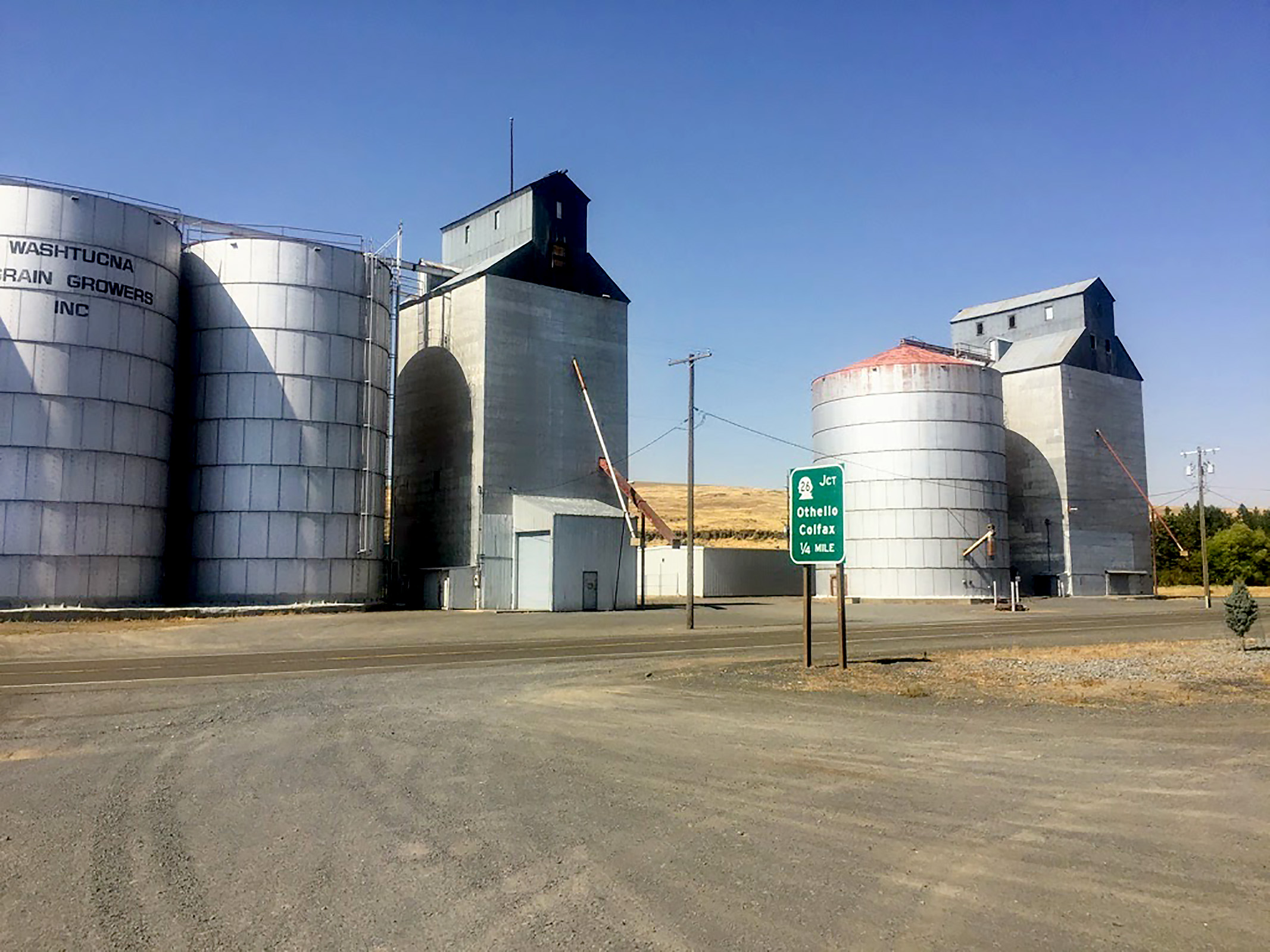
On to Washtucna
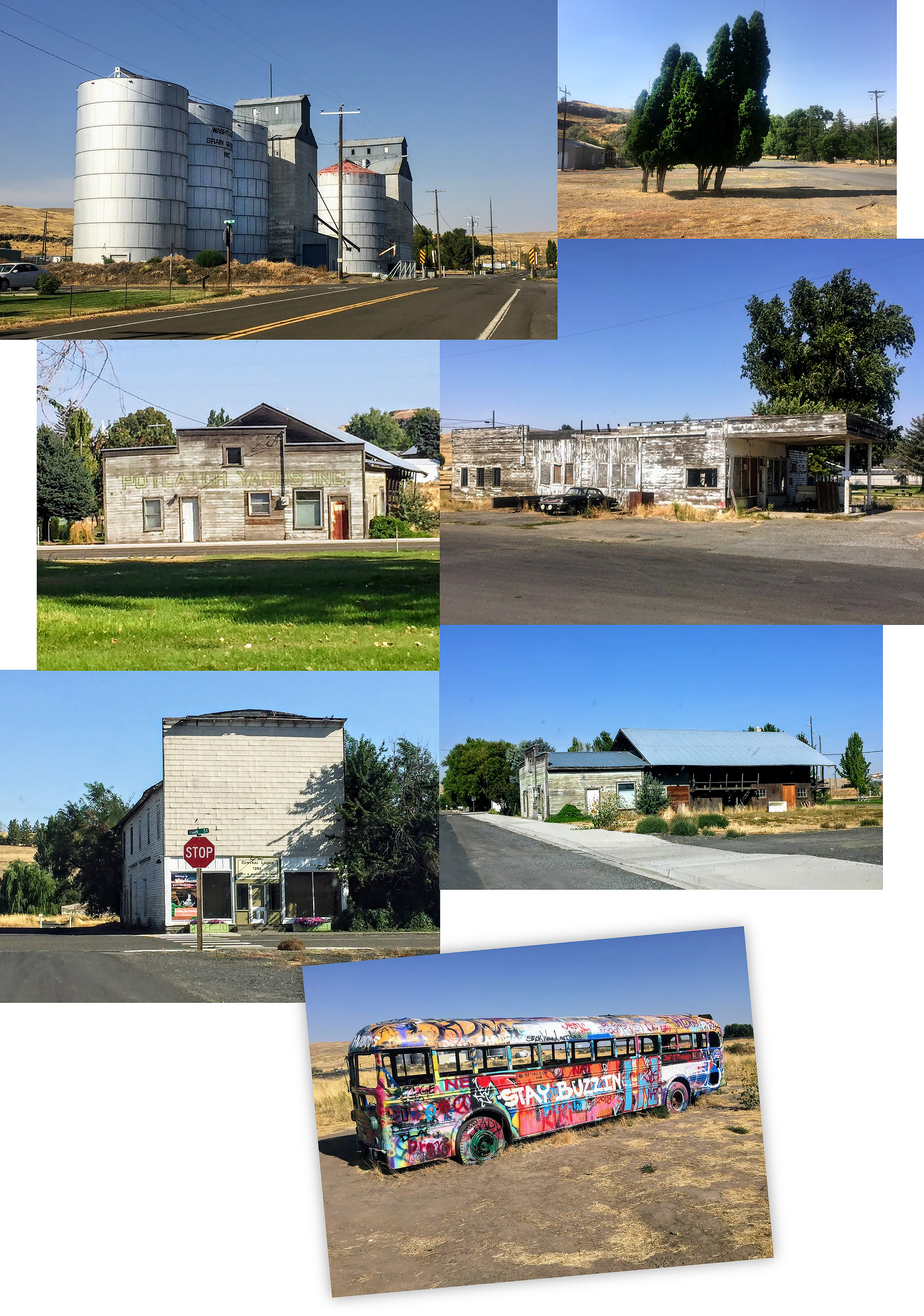
Leaving Vantage we cross the long bridge over the Columbia River and turn south and then east again, through the Quincy area farmland all the way to the crossroad for Washtucna. There is an old graffiti-covered school bus near the intersection, adding to the overall desolation of the area. Washtucna feels like it is the middle of nowhere, and it is true to a degree. Boarded up buildings on a main street that dried up long ago. We once stopped for burgers here, but that place is long gone as well.
Palouse Falls
However, for those seeking geological formations, Washtucna is the gateway to a fantastic place by the name of Palouse Falls. While it feels like you are in the middle of nowhere, you are witness to increasingly amazing bluffs and outcroppings of rock. Created by the back-cutting waters from the biblical-sized flood known as the Scabland Flood (or the Spokane Flood), The Palouse River falls 200 feet down from the basalt cliffs into the great bowl left from that flood, a basin way too large to have been carved by the river we see running through it today.
The flood occurred around 12,000 to 13,000 years ago, the result of rapid melting of the 2-mile thick ice sheets covering Western Canada. Palouse Falls is in the middle of this vast floodplain, which is often referred to as the channeled scablands.
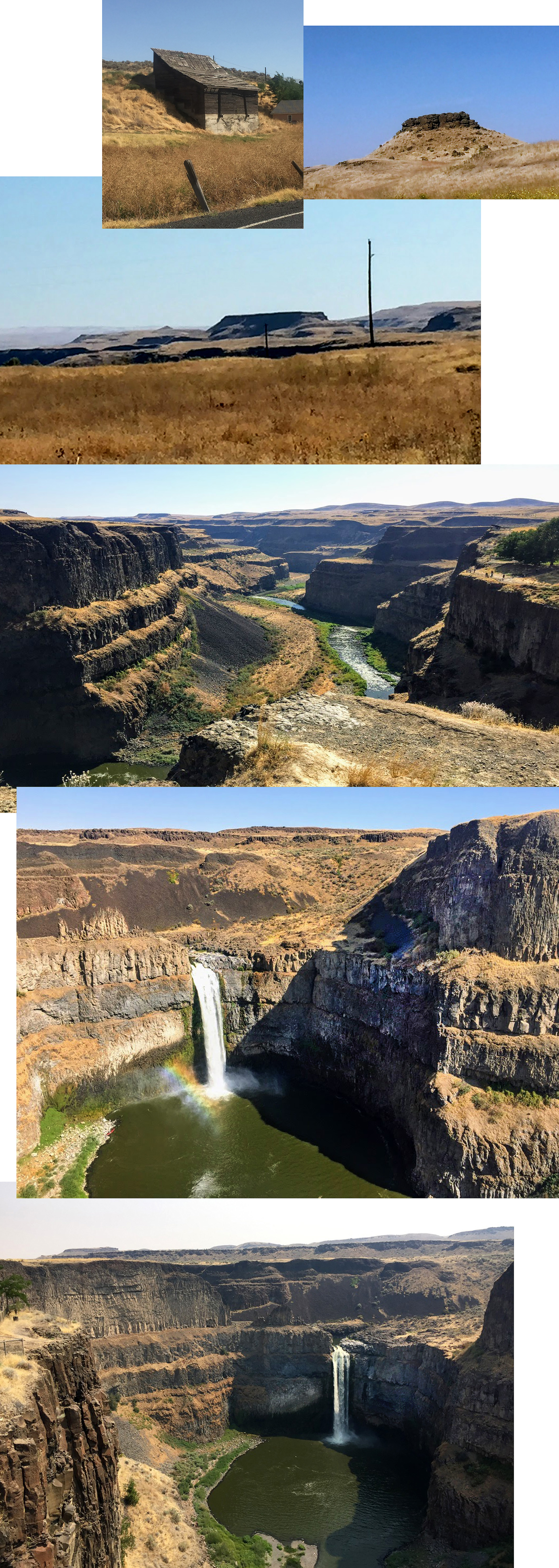
What makes this whole scabland area so impressive is that it was mostly carved out by a giant flood. Some geologists believe it was many floods at work, but we can see that the enormous coolies, canyons and dry falls that remain today had to have been created by an overwhelming catastrophe.
There is camping here, a small park with picnic tables, ample parking, and porta potties at the overlook, but no visitor center. You are required to display your state Discover Pass. If you don't have one you can purchase a day pass at a kiosk for $10. The location may seem remote but it is well worth a visit. The sheer immensity of this wild and rugged area, along with the natural forces that created it, draws me back again and again.
