Clarence Drive mountain pass.
Falling rocks, coming down the mountains, damaged the road in several places, during the recent storm.
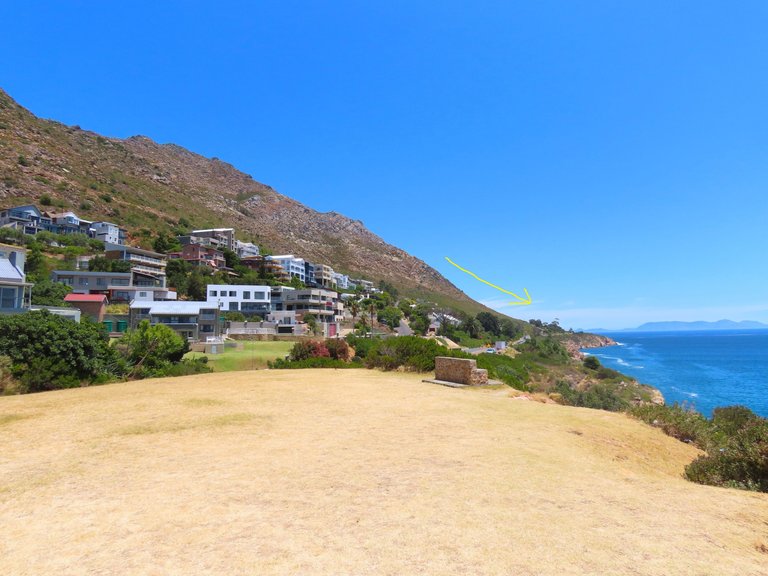
You can see the road at the bottom just above sea level, and the yellow arrow indicates the direction of the dislodged rocks by the rain.
Incidentally, the first stop and go control point can be seen in the distance on the road at the bottom of the photo.
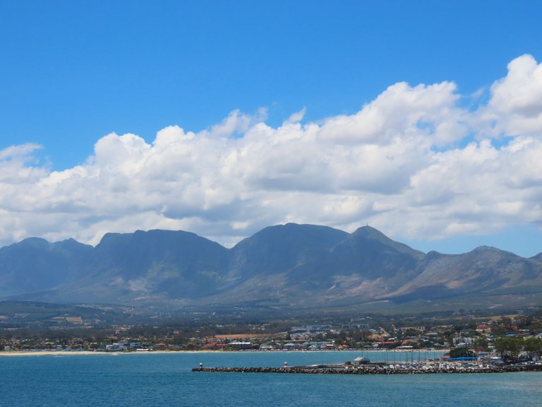
Clarence Drive is a world-famous road that runs at the bottom of mountains for 22 kilometers. Just above the wide-open Atlantic Sea level.
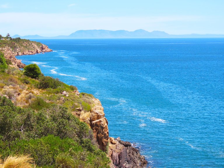
Clarence Drive is a mountain pass crossed by the R44 road between Gordon's Bay and Rooi-Els. The tourist route is 22 km long and provides a panoramic view of False Bay, the coastline, Table Mountain, and parts of the Cape Peninsula. The nearby coast is popular with anglers and whale watchers, and Kogel Bay Resort is particularly sought after by surfers.
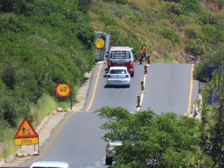
This was the first stop and go control point at the start of the drive, and there are several more, as the road was changed to single lanes, at the bad places, where repair works are being done.
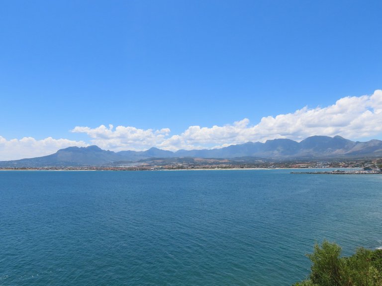
No ways were we going to go on the drive, as it takes a long time to get through, and I stopped here at the whale look out point to take all of the photos.
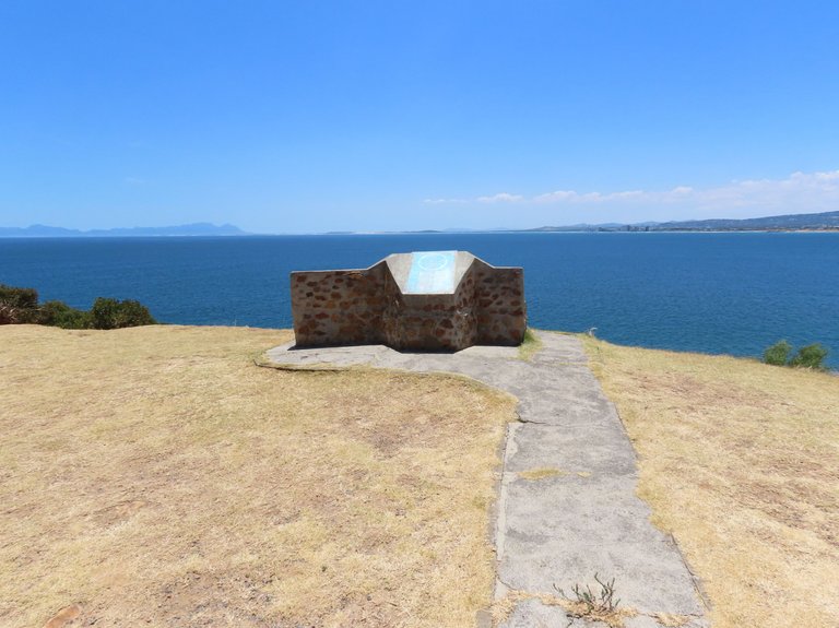
The whale lookout point is above the coastal town of Gordon's Bay.
Gordon's Bay (Afrikaans: Gordonsbaai) is a harbour town in the Western Cape province of South Africa. It is included in the City of Cape Town metropolitan municipality as a suburb of the Helderberg region (formerly called Hottentots Holland). It is situated on the shores of Gordon's Bay in the northeastern corner of False Bay about 58 km from Cape Town to the south of the N2 national road and is named after Robert Jacob Gordon (1743–1795), the Dutch explorer of Scottish descent.
Gordon's Bay is the smallest of three towns in the Helderberg region (Somerset West, Strand and Gordon's Bay), so named after the Helderberg Mountain which is part of the Hottentots-Holland Mountains which border the locality on two sides. Gordon's Bay was originally named "Fish Hoek", many years before the town of the same name, located on the western side of False Bay, was founded. Evidence of this can be seen on the outside wall of the local Post Office.

Yes, Clarence drive was badly damaged during the storm, but they are used to it and thankfully there were no deaths. It is not the first time, and it will not be the last time for the road to be repaired. The old mountains are very high up from the road as it runs along the scenic route, and as I said, it is a very popular route around the mountains.
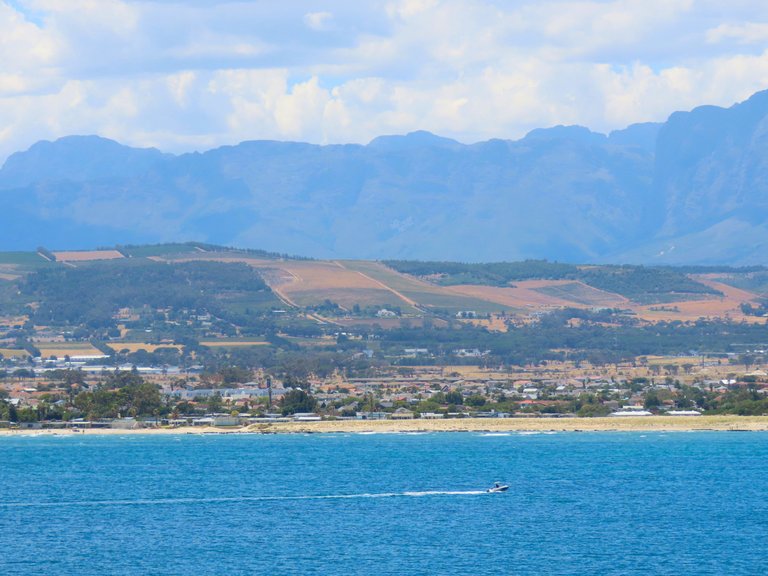
I have posted our trip along the route a long time ago, and the ocean views are fantastic, as one can also see much of the sea life like birds and other types of animals. And maybe get lucky and also see a shark or a whale along the way.
One can also take the Clarence drive route during the whaling season to get from Gordons Bay to the popular town of Hermanus, as we did, and I got plenty shots of the whales at Hermanus.
Such is life.
I hope that you enjoyed the pictures and the story.
Photos by Zac Smith-All Rights Reserved.
Camera: Canon PowershotSX70HS Bridge camera.
Thank you kindly for supporting this post.
Beautiful landscapes!
Thank you!
Thank you for the support @ewkaw and the @qurator team!
wow the natural views and lakes are extraordinary
😍😍
Thank you and we love all of the sights over here.
!WINEX
A very beautiful place. And what water, what a pleasant color!
Thank you and that water is the color of the cold Atlantic Ocean my friend.
!BEER
View or trade
BEER.Hey @ratel, here is a little bit of
BEERfrom @papilloncharity for you. Enjoy it!We love your support by voting @detlev.witness on HIVE .
It is exactly like the way you are seeing these pictures, it is natural beauty places, very beautiful and it is very relaxing to see such things. Their name is a must for people to believe in such a place.
Natural beauty is always the best and yes, it relaxes one.
!WINEX