My Experience so far as a Design Engineer
Hello designers, welcome to my blog, I hope you are having a good day, I wish each and everyone the best in all our ramifications. This is my first post on this community, I hope you will like it.
So I will love to share my experience as a design engineer in a telecommunication Company I am currently working for.
I graduated as Quantity Surveyor, which gave me an opportunity to have the skill of using Autocad during my studies. So it is boldly writing on my CV that I am an Autocad User.
I was employed into the telecommunication company in February 2022.

Though, I was not having any knowledge about telecommunication, but my knowledge in using Autocad gave me the opportunity, despite the fact that all the design I have ever laid my hands on was always residential building, in fact small residential building always, don't forget I studied Quantity Surveying.
And the sad part of it was that, the previous Design Engineer resigned a week before I was employed, there was know design guy to put me through if there is any difficulty.
So, I took up the challenge since I know myself to be a fast learner, plus I saw it as an opportunity to have another experience.
Here comes the challenge
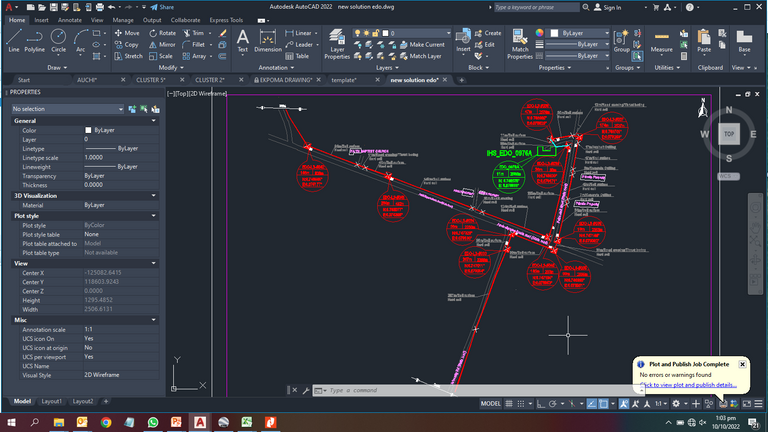
We got a project to work on, it is called "Edo State Fibre metro Link", which covers three cities in Edo state, we had to do the survey and come out with the design.
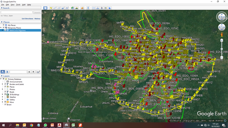
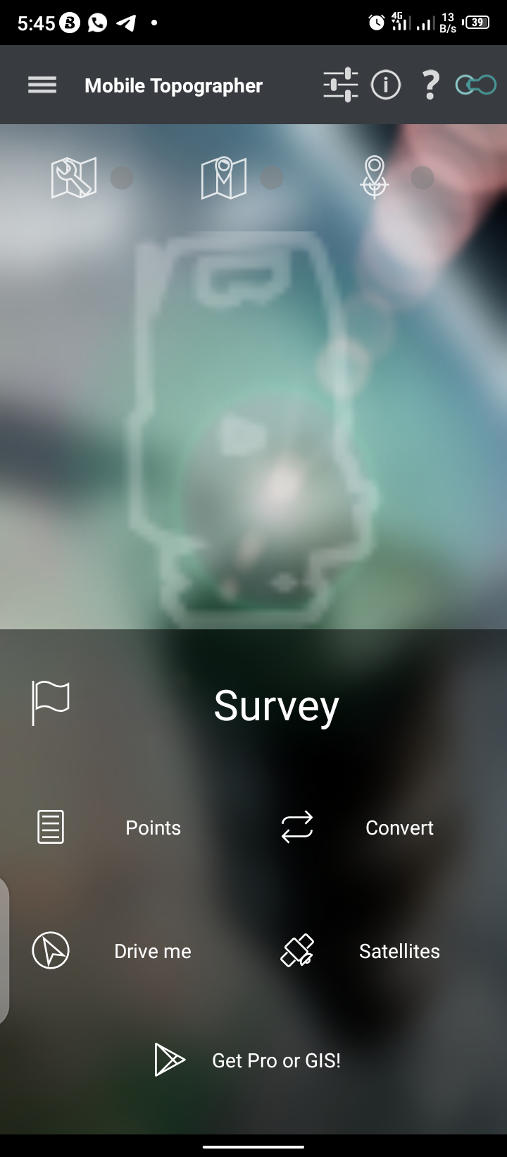
I went there with the survey team since I am the only design guy in the company and we came back. During the survey, I always watch YouTube videos about External Line Plan of optic Fiber implementation whenever I got back to the hotel in the night, and this gave me some heads to go about the project. Fortunately, another design guy was employed who I was sending the sketches to,but unfortunately, he is also a graduate of Quantity Surveying, smiles. He also see me as his superior who will put him through the knowledge. But I tried to take the responsibility due to the fact that I've gone far a little in line of telecommunication on my own, which made it more easier for him. I used "mobile topography app" to pick up coordinates during the survey.
Then when I got back, I loaded the 'Kml' file on Google earth, some were not formed well, but the beautiful part of the "Mobile Topography app" is that, as you are saving your data as kml, you can also save them as 'csv'. So, the kml files that did not formed well, I had to load them as csv on Google earth.
After I linked all the points with paths on Google earth, something came to my mind that, there should be a way to import the kmz file on Autocad, but I watched a lot of videos on YouTube that doesn't give answers to my questions. So I decided that, there's no way to import the road layout to CAD format, and I decided to be drawing them bit by bit with the support of the new design engineer, with the mind that I will join them together later.
But, it doesn't result to what we needed, so, I decided to submit it in bits like that.
When I got the feedback on the job, it broke my heart because no body will love to get a bad feedback on any job done, because I have invested a lot on the project, we are talking of over 600km.
Fortunately, they gave me another Chance to prove myself, this time, I was given a template to follow, which finally convinced me that there is definitely a way to bring out the road layout to the Autocad, due to the way all the road linked to each other.
So, I started contacting different architects I know as friends, non of them had a clue, but finally someone made a suggestion to contact a surveyor, which I did. The surveyor told me that the government of each state are having the files called vector, but it will take a lot of effort and longer period to get it from them, and I am having a limited time.
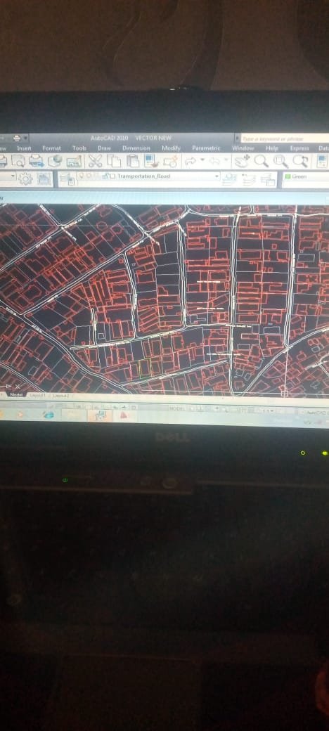 a part of vector file of Lagos State
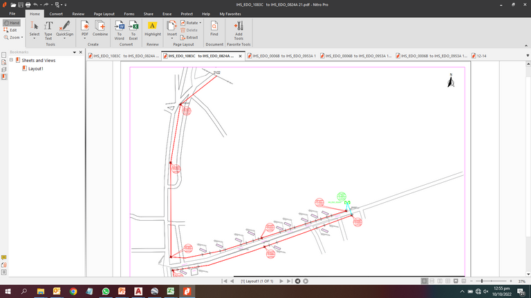
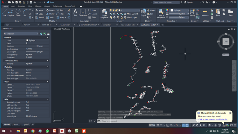
So I had to get the contact of the former designer engineers of the company, I mean the experienced ones. Thanks to the man, he told me to work on a software called expertGPS, I searched a lot on how to use the app, but I couldn't find the exact video that sow me how I can export the road map of an area to CAD format. So I worked all night to figure out something, which I later came up with something like this picture below. It reveals the center line of all the streets, the path drawn on Google earth and the major roads in that city.
 *this is the road layout needed in Auchi, Edo state.
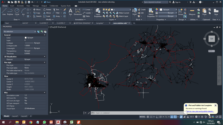
So, I decided to be doing offset to the center lines, then, another issue arises, offset command was not working on the file, then I discovered that the file is in 3D, so I had to flatten it, then exploded it. Then offset command begins to work.
After the offset, I started clearing the road that are not needed, I mean the roads that the cables are not passing through, to get a neat work area.
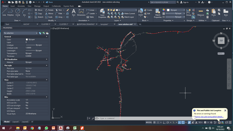
Then, I scaled it to the enough size that will make the details to be added visible.
I started feeling myself on the Job even before getting it done.
Shortly, everything resulted to what I, my company and our clients were expecting. And that was one of the biggest projects I've laid my hands on.
Thank you for the time.
Congratulations @qidos! You have completed the following achievement on the Hive blockchain and have been rewarded with new badge(s):
Your next target is to reach 50 comments.
You can view your badges on your board and compare yourself to others in the Ranking
If you no longer want to receive notifications, reply to this comment with the word
STOPTo support your work, I also upvoted your post!
Support the HiveBuzz project. Vote for our proposal!
Thank you so much for your support
You're welcome @qidos
Support us back and vote for our witness.
You will get one more badge and may get bigger upvotes from us when we notify you.