Greetings friends and lovers of nature and landscapes. In the north of Havana there is a chain of coastal elevations made up of limestone rocks, which were once ancient seabeds on the submerged flanks of ancient islands, millions of years ago, before the current Cuba was configured. These insular flanks, due to tectonic uplifts of the terrain through faults, were gradually raised, leaving the bottoms of those seas as the top of the current coastal heights, separated from the contemporary valleys (which were once the ancient islands) through steep escarpments.
Saludos amigos y amantes de la naturaleza y los paisajes. En el norte de La Habana existe una cadena de elevaciones costeras constituidas por rocas calizas, que en otro tiempo fueron antiguos fondos marinos en los flancos sumergidos de antiguas islas, hace millones de años atrás, antes que quedara configurada la Cuba actual. Estos flancos insulares a causa de los levantamientos tectónicos del terreno a través de fallas fueron levantados gradualmente, quedando los fondos de aquellos mares como la cima de las alturas costeras actuales, separadas de los valles contemporáneos (que en otro tiempo eran las antiguas islas) a través de pronunciadas escarpas.
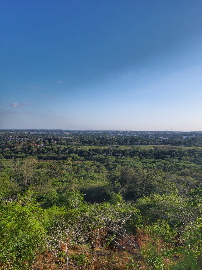
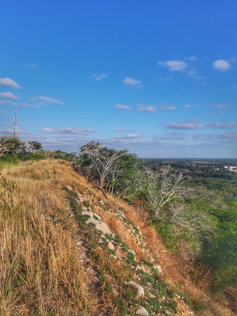 View of the summit and escarpment of the coastal heights north of Havana.//Vista de la cima y escarpa de las alturas costeras del norte de La Habana
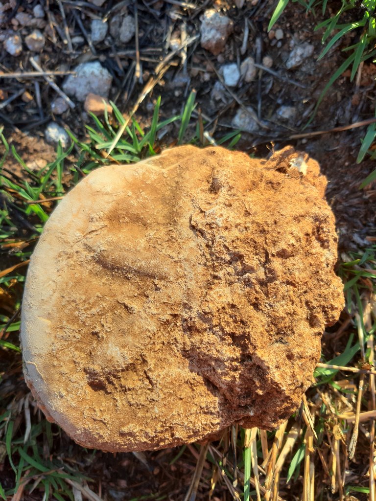 Starfish fossil on top of coastal heights as evidence that the land was once under the sea.//Fósil de estrella de mar en la cima de las alturas costeras, como prueba de que el terreno estuvo en otro tiempo bajo el mar
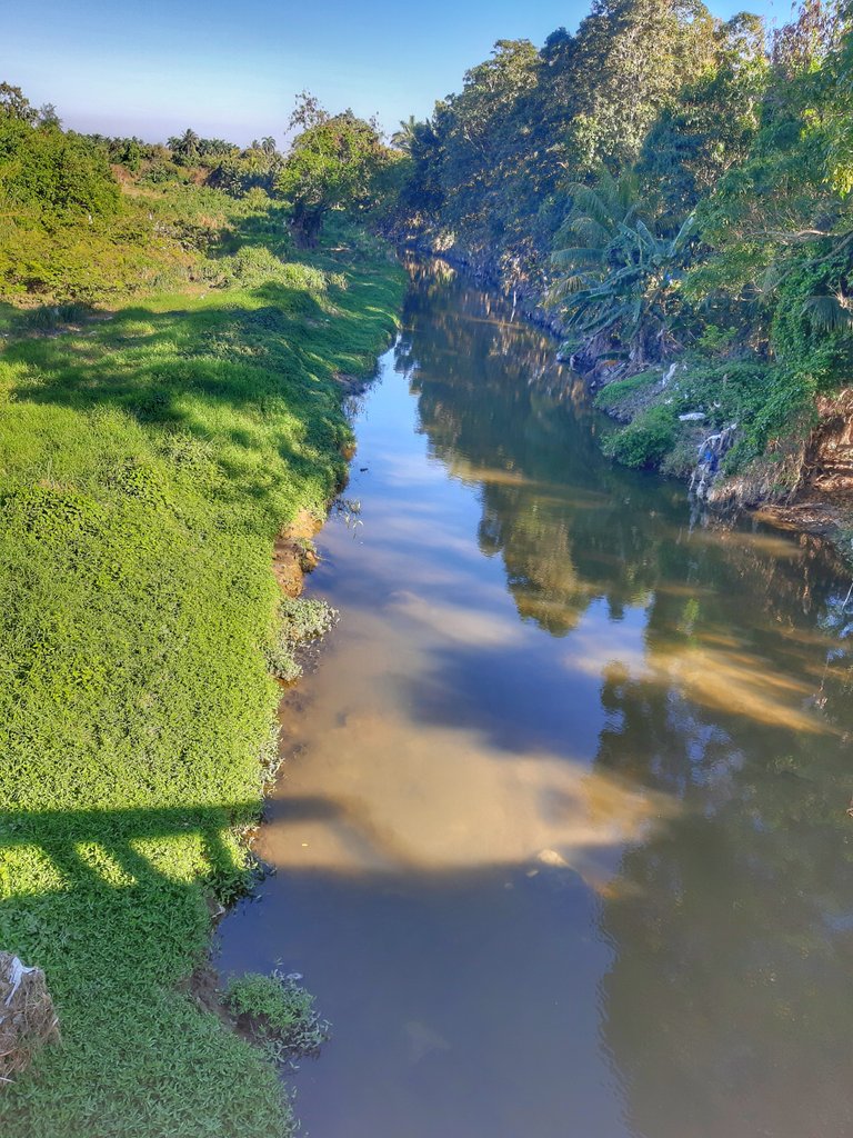
The present valleys, antecedents in time and in their origin to the elevation of the coastal heights, are modeled by the action of rivers that form fluvial plains, with exuberant vegetation of beautiful greenery. One of these rivers that flows through the valleys is the Cojímar River, so called because of its mouth in the town of the same name, on the northern coast of eastern Havana.
Los valles actuales, antecedentes en el tiempo y en su origen al elevamiento de las alturas costeras, están modelados por la acción de ríos que conforman llanuras fluviales, con exuberante vegetación de hermoso verdor. Uno de estos ríos que discurre por los valles es el río Cojímar, denominado así por su desembocadura en el poblado del mismo nombre, en el litoral norte del este habanero.
 Cojimar river.//Río Cojímar
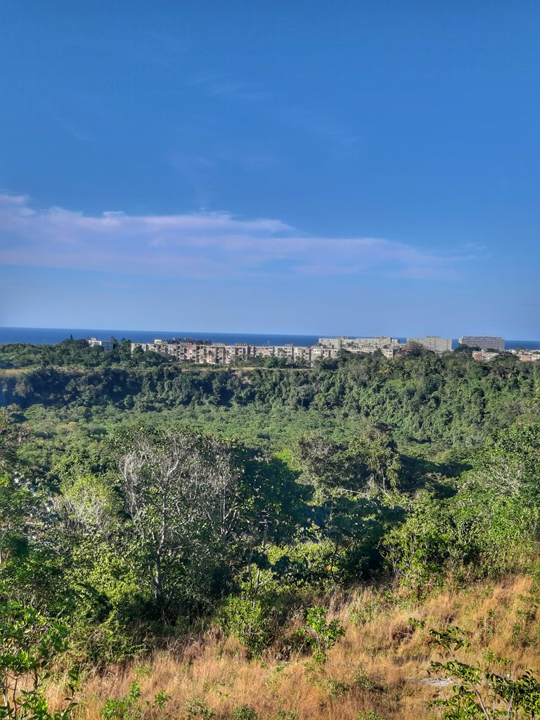
 Cojímar river valley as seen from the coastal heights.//Valle del río Cojímar visto desde las alturas costeras.
However, as these rivers existed even before the rise of the coastal heights, it turns out that during the rise of these in their emersion, the rivers in their course cut their surface through areas of weakness of the rocks, becoming canyons and creating one of the most beautiful forms of relief of the fluvial-marine landscapes: the estuarine canyons (fluvial canyon of rivers at their mouth to the sea).
Ahora bien, como estos ríos existían ya desde antes del levantamiento de las alturas costeras, resulta que durante el elevamiento de éstas en su emersión, los ríos en su curso cortaron su superficie a través de zonas de debilidad de las rocas, encañonándose y creando una de las formas del relieve más hermosas de los paisajes fluvio-marinos: los cañones estuarinos (cañón fluvial de ríos en su desembocadura al mar).
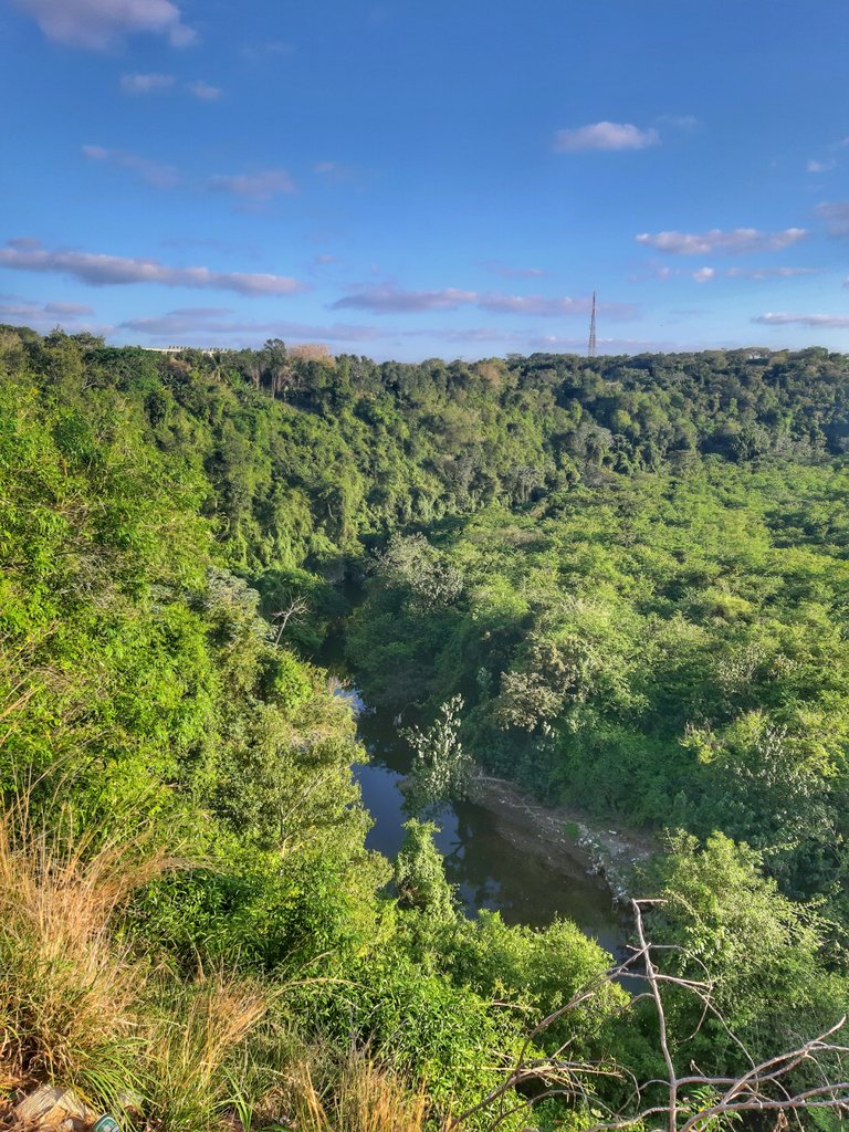
In this way, the Cojímar River carved in its course towards the north coast a canyon in the coastal heights, which is characterized by a deep incisive cut of more than 30 meters deep, where the river runs until it flows into the sea between two very steep almost vertical surfaces of asymmetrical profile, in a landscape marked by a very exuberant vegetation. This landscape element is one of the most beautiful in the north of Havana, and a proof of the dynamics and continuous transformation of the living and surprising nature.
De esta manera, el río Cojímar labró en su curso hacia la costa norte un cañón en las alturas costeras, que se caracteriza por un corte incisivo profundo de más de 30 metros de profundidad, en dónde el río corre hasta desembocar en el mar entre dos superficies muy escarpadas casi verticales de perfil asimétrico, en un paisaje marcado por una muy exuberante vegetación. Este elemento paisajístico constituye uno de los mas hermosos del norte habanero, y una prueba de la dinámica y transformación continua de la viva y sorprendente naturaleza.
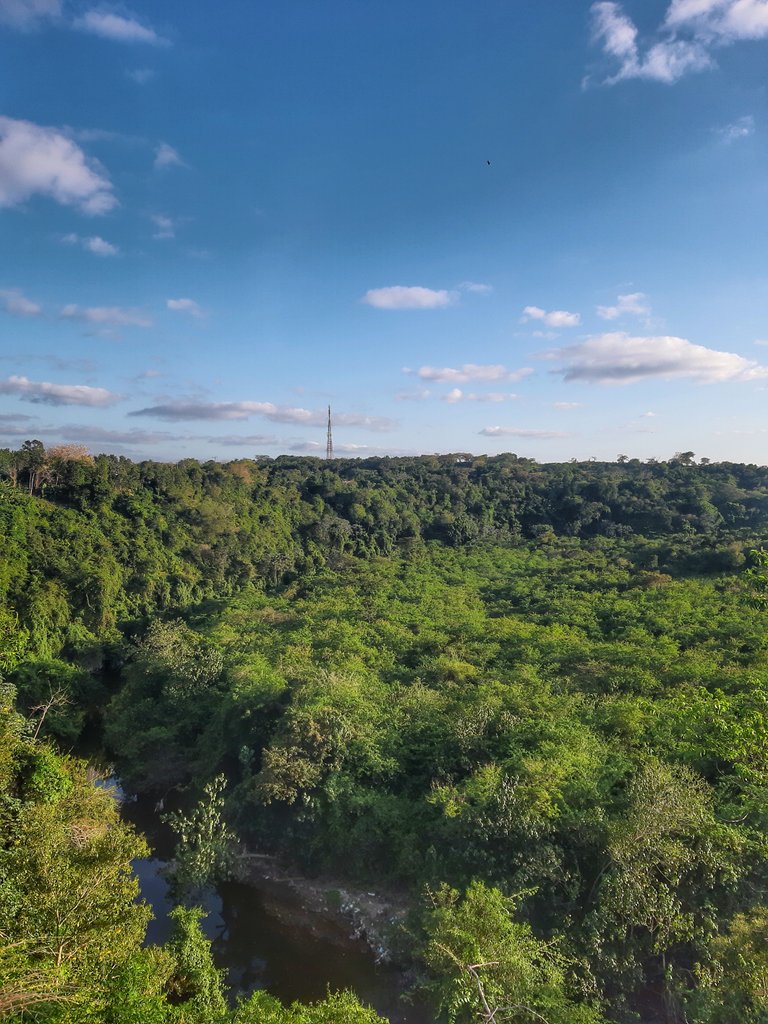 View of the Cojímar river canyon from its upper rim.//Vista del cañón del río Cojímar desde su borde superior
 View of the Cojímar river canyon from its upper rim.//Vista del cañón del río Cojímar desde su borde superior
 View of the Cojímar river canyon from the south of the coastal heights.//Vista del cañón del río Cojímar desde el sur de las alturas costeras
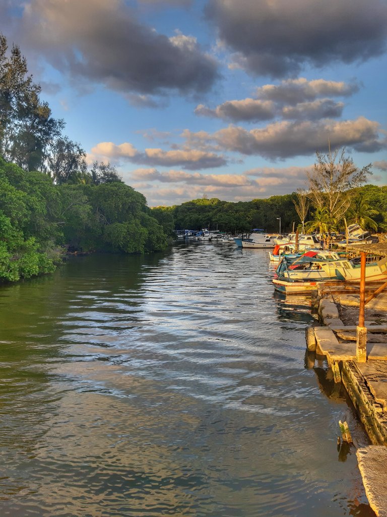 Estuary of the Cojímar river at its mouth to the sea.//Estuario del río Cojímar en su desembocadura al mar.
I hope it has been of your liking and interest. I reiterate my greetings and wish you a happy day.
Espero haya sido de su agrado e interés. Les reitero mis saludos y les deseo un feliz día.

****
| Herramientas de edición y Producción | Editing and Production Tools |
|---|
| Traductor: DeepL | Translator: DeepL |
| Tamaño de la fotografía 📷 4:3 (24 MP) |
|---|
| Photo size📷 4:3 (24 MP) |
Todas las imágenes son de mi propiedad, capturadas con la cámara de mi teléfono móvil Samsung Galaxy A7.
All images are my own, captured with the camera of my Samsung Galaxy A7 cell phone.
Qué interesante. En la penúltima foto se ve mejor