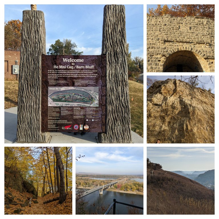
Day Trip Red Wing MN - Barn Bluff Hike 2.6 Miles
Day Trip with the kids
We had a couple of days off of school for the kids for in-service learning days for the teachers. We got quite lucky this year as the weather was forecasted to be absolutely perfect, the truth will still turning colors, and they had not all fallen off the trees yet. We decided to take a short trip to go check out some of state parks and hiking trails in the neighboring cities within a few hours.
As you can see we got really lucky with nothing but Sunny and 75 plus degrees each day, gorgeous Fall foliage and beautiful hiking trails and State parks. I wish every fall day was as good, and I wish that I didn't have this tremendous amount of backlog at work building up
Barn Bluff Trail History
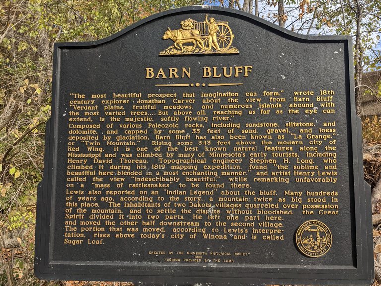
This city park had tremendous signage around the park giving a historical context to the park, it's foundation, and it's deep connection with native American tribes who were from the area.
Historic Kiln
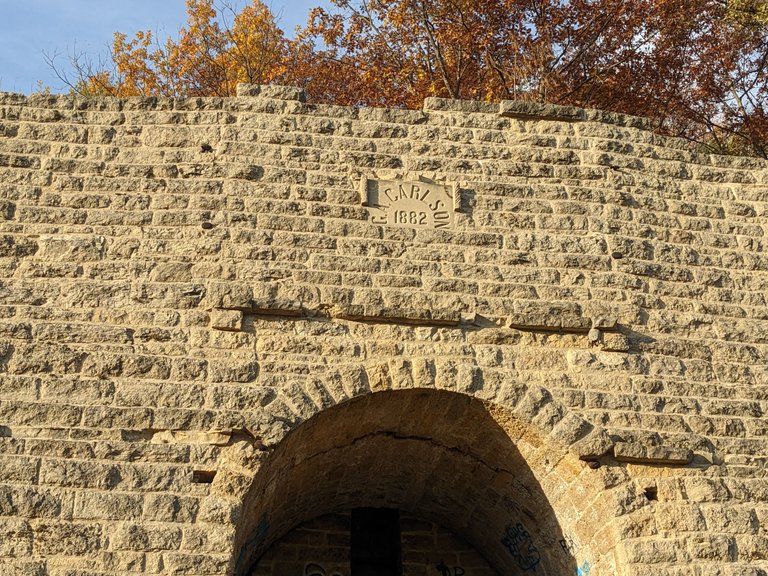
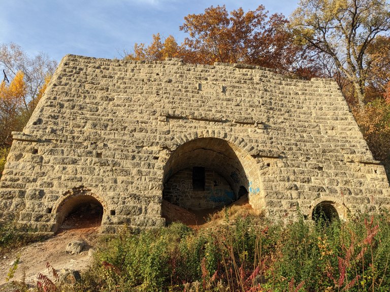
There was this very cool kiln that was built in 1882 at the park. It was one of many kilns in the area that helped to provide some of the significant building materials used around the area. They used the raw limestone Rock to turn it into commercial lime or quick lime which is used in mortar or plaster a common building material of the time. They would put it all in the kiln, use lumber to start the fire and burn it at 2,000° for several hours until the finished product was ready.
Perfect Fall Weather
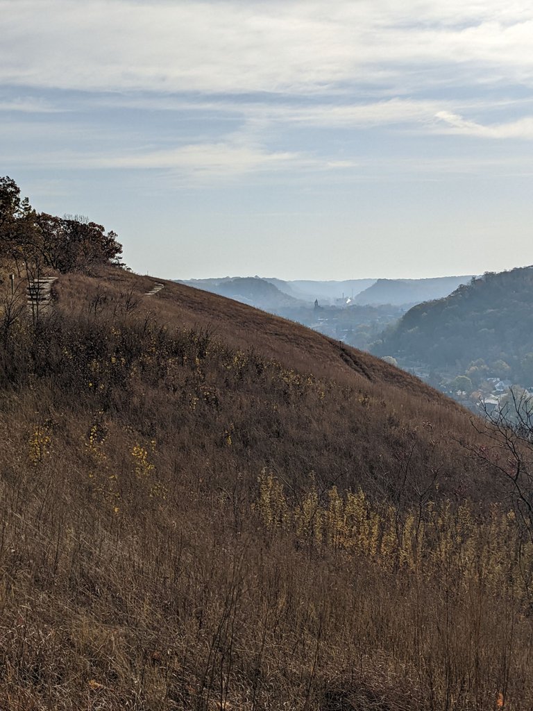
Talk about getting lucky on this hike it was absolutely crazy beautiful to go hiking over the hills and to look through the valleys of a beautiful fall day some low-hanging haze, church is often a distance, a town running through the valley and just an overall picturesque hike
Fall Colors
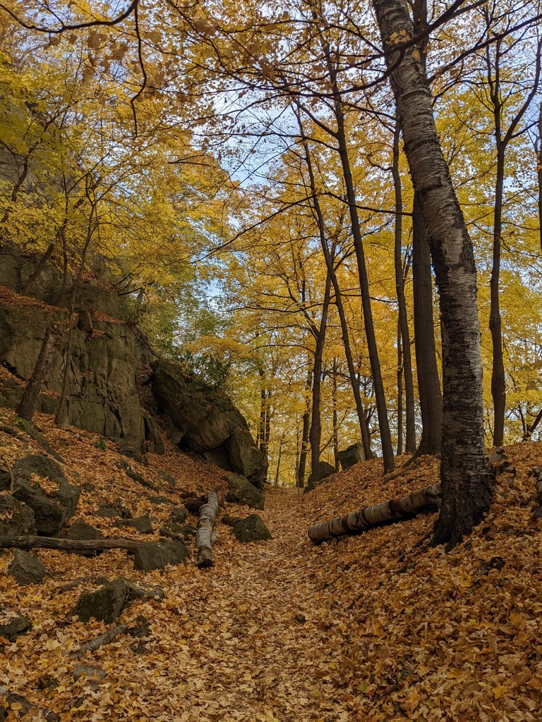
Hiking through the woods here almost didn't feel real, it felt like a hiking through a picture or a movie where everything was just perfect. All the trees were yellow, the leaves were falling, the ground was soft and the weather was perfect. It's one of the few fall hikes I've actually done with the resist much foliage on the trees and on the ground. There's been no brainer wind to make them all fall and was very calm and peaceful day. I would love to do this hike again but I know by the time I get back it won't be this pretty..
Trail Head
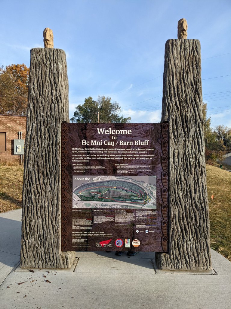
The trailhead of the hike had additional signage talking about the trails, the paths, and 12 or more additional signs talking about the native American history, how they used it, and it's significant importance and how we should all treat the blood with respect.
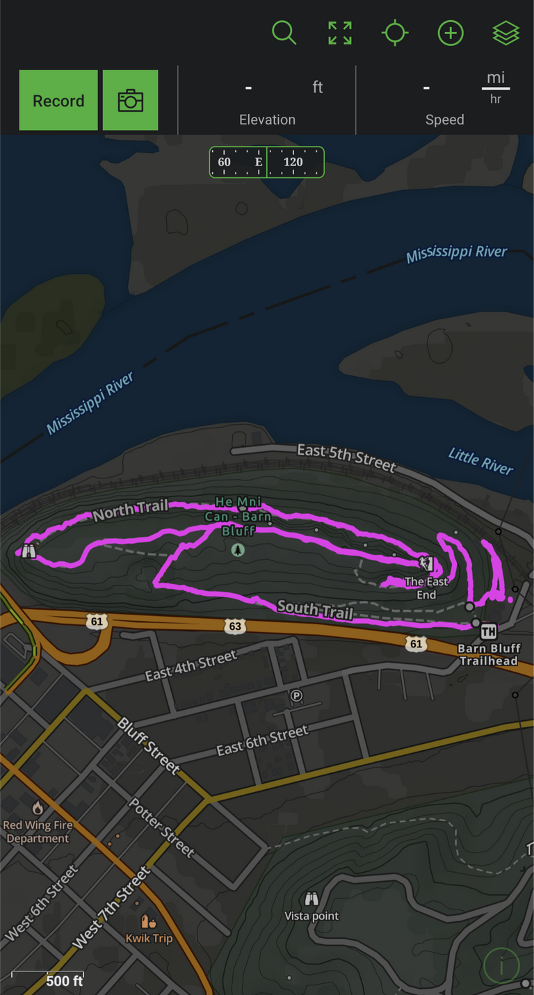
MAP
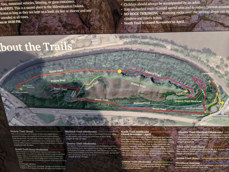
As you can see from the map there are plenty of hiking trails, and if you take the same loop that we did you can get over two and a half miles in going all around. There are great overlooks at multiple places and I don't really think there's a bad way to hike it. I took this picture just in case I needed to figure out which way to go.
Climbing Walls
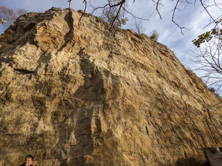
There are pre-planned and designated areas for climbing. Many of these areas have anchors and routes already laid into the stone, we let the kids jump around and play here and then real climber showed up with lots of gear and wanted to get ready to climb so we moved along, even though the kids still wanted to mess around.
Stars to the TOP!!
Overlook from before the stairs
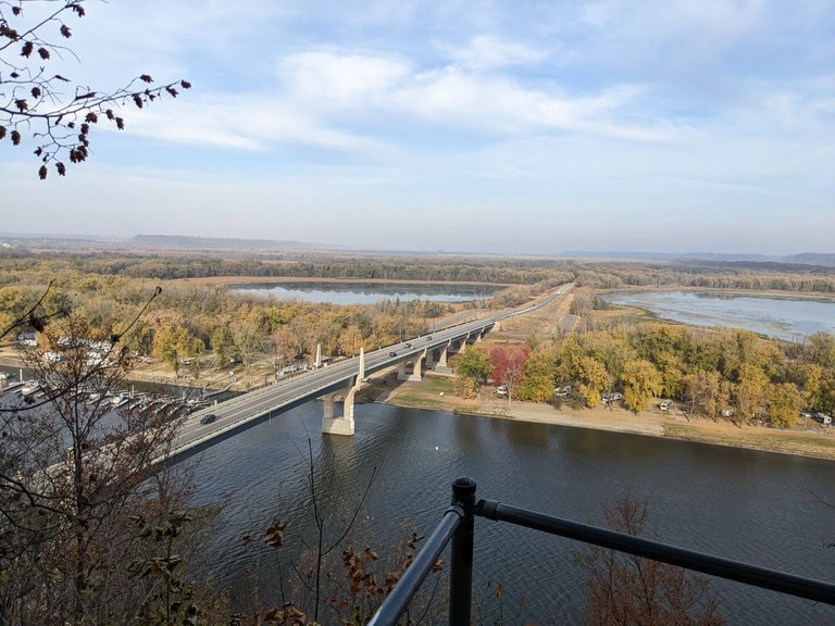
This is at the section right before the stairs start to go up it is a great overlook with a different vantage point and the rest. It shows you the bridge that was built to connect Minnesota and Wisconsin together and it really provides a pretty view of the river in the back Waters
Stairs
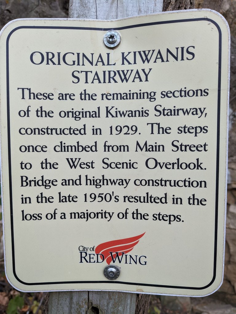
When I see projects like this that were donated from the people of the city back in 1929 it makes me realize that towns have always been together to complete big projects. It's too bad that this highway construction ruined the stairs not even 30 years after being built
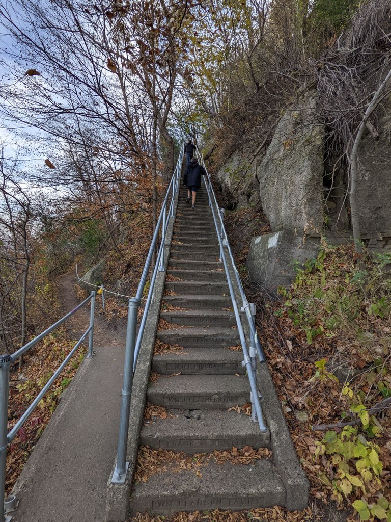
As you can see there's a fair number of stairs and they actually go up around the corner. According to the sign these stairs actually went all the way down the hill all the way down to main Street which would have been really cool to do and probably quite a workout quite honestly
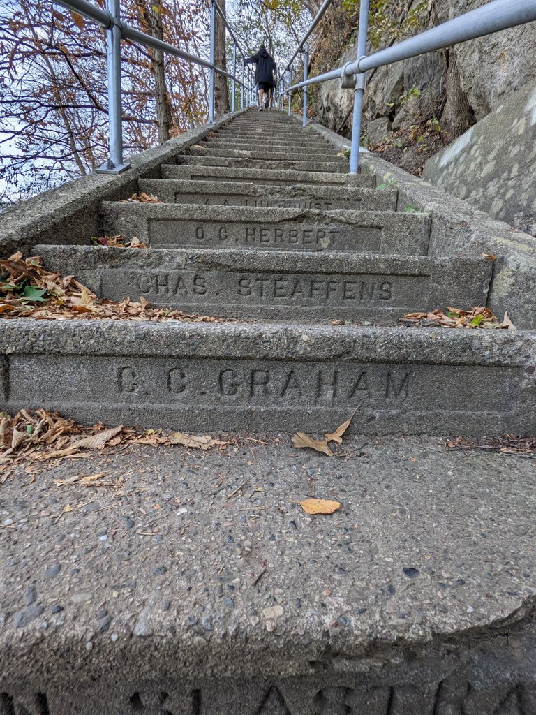
The cool thing that I noticed was that each stair had names of who donated money to get their name on each stair. Instead of focusing on the number of stairs we had to climb I would try to read off the names for each step as I stepped on it I think I was able to butcher most names close enough but there were a few I just skipped and chuckled because they were clearly foreign names with more vowels and consonants than I thought possible
Overlook from the top of the stairs
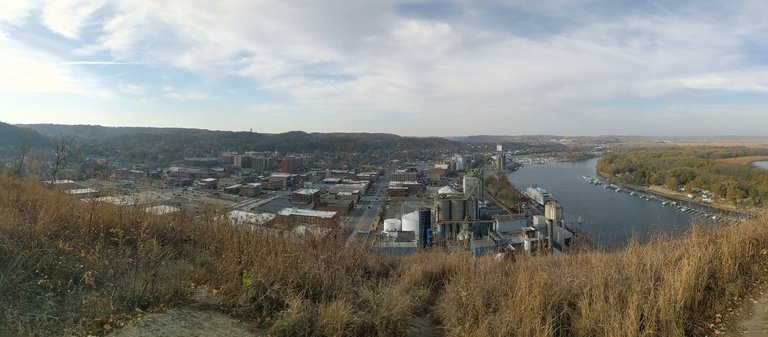
When you're all finished with the stairs you get to another overlook plateau that gives you a nice overview of the river and the city below. This was a city that you would have taken stairs from down on main Street below as you can see to get up here. Just imagine making that climb in a 1920s dress, or suit or Nice clothing that people seem to wear back then and not the I can choose in shorts but I'm wearing now.
Hike Stats
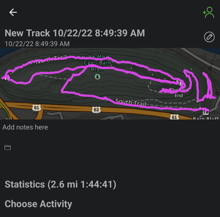
These are just some quick stats, I am trying a new app out versus all trails which was okay. This app was phenomenal for mapping out the routes and for tracking a progress and allowing me to take a picture but what it didn't do is give me really good stats of hike afterwards. It did say that I hiked 2.6 miles in an hour and 44 minutes. There was quite a large stoppage time in their multiple times as the kids played or checked out cool things they found, I do miss the tracking of elevation and speed and average moving time how big into the app to see if I can find anything else closer to all trails type tracking

check it out if you get a chance
After getting lunch we drove back by in the parking lot was absolutely full and the cars are parked all the way out on the road to the park. It is clearly a very popular Park so if you want to hike it without parking issues I would say get there very early in the morning and stay away from my anytime from 11:00 a.m. to 3:00 p.m. I think it's one of the best parks have hiked in a long time the trail was super nice and the views are just spectacular and unique.
#sbi-skip
Congratulations, your post has been added to Pinmapple! 🎉🥳🍍
Did you know you have your own profile map?
And every post has their own map too!
Want to have your post on the map too?
The place look cool, wish I can visit it in the future.
Congratulations @senstless! You received the biggest smile and some love from TravelFeed! Keep up the amazing blog. 😍 Your post was also chosen as top pick of the day and is now featured on the TravelFeed.io front page.
Thanks for using TravelFeed!
@invisusmundi (TravelFeed team)
PS: You can now search for your travels on-the-go with our Android App. Download it on Google Play
Cool hike, fuck stairs though ;)
!PIMP
You must be killin' it out here!
@summertooth just slapped you with 1.000 PIMP, @senstless.
You earned 1.000 PIMP for the strong hand.
They're getting a workout and slapped 1/1 possible people today.
Read about some PIMP Shit or Look for the PIMP District
Hiya, @lizanomadsoul here, just swinging by to let you know that this post made it into our Honorable Mentions in Daily Travel Digest #1678.
Your post has been manually curated by the @pinmapple team. If you like what we're doing, please drop by to check out all the rest of today's great posts and consider supporting other authors like yourself and us so we can keep the project going!
Become part of our travel community:
Thank you for the support !LUV !PIZZA
@senstless(1/10) gave you LUV. tools | wallet | discord | community | <>< daily
HiveBuzz.me NFT for Peace
I gifted $PIZZA slices here:
senstless tipped pinmapple (x1)
senstless tipped roadtrip.prepper (x1)
@senstless(2/10) tipped @arcange (x1)
Join us in Discord!
Looks like a great time! The app I use is called Gaia. It's free and tracks elevation, distance, time and it works offline. Check it out if you don't already use it.
That was my new app I tried. I think it works really well. I just got used to all the stats and tracking that Alltrails did. Only reason I was looking for different apps was All trails had so many user submitted names it was confusing. !LUV !PIZZA
@senstless(1/10) gave you LUV. tools | wallet | discord | community | <>< daily
HiveBuzz.me NFT for Peace
Another app we tried was onX. I liked Gaia better and it saved us a couple times on our last trip to the UP.
Dear @senstless,
May I ask you to review and support the new proposal (https://peakd.com/me/proposals/240) so I can continue to improve and maintain this service?
You can support the new proposal (#240) on Peakd, Ecency, Hive.blog or using HiveSigner.
Thank you!
Done and Done - love all the work you do.
!LUV !PIZZA
@senstless(2/10) gave you LUV. tools | wallet | discord | community | <>< daily
HiveBuzz.me NFT for Peace
Thank you for your support and feedback about my work @senstless, really appreciate it! ❤️
!BEER