Camino de los Españoles [ENG-ESP]
I always try to make some record of the places I visit, but sometimes we don't carry the right device, on this occasion I didn't take any precautions (my camera was discharged) and on this hike I only took an old cell phone, which was the one I used to take these pictures. They don't have a very good resolution, but I think that the beauty of the landscapes improves them a little and that's why I wanted to share them, what do you think?
Siempre procuro hacer algún registro de los lugares que visito, pero a veces no llevamos el dispositivo adecuado, en esta ocasión no tomé previsiones (mi cámara estaba descargada) y a este paseo sólo llevé un viejo celular, que fue con el que hice estas fotos. No tienen muy buena resolución, pero me parece que la belleza de los paisajes las mejora un poco y por eso quise compartirlas, ¿ustedes qué opinan?
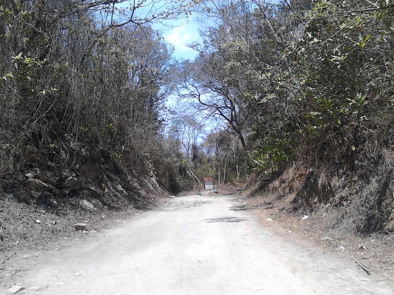
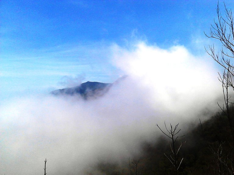
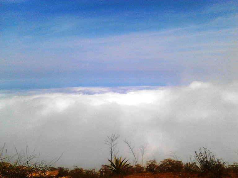
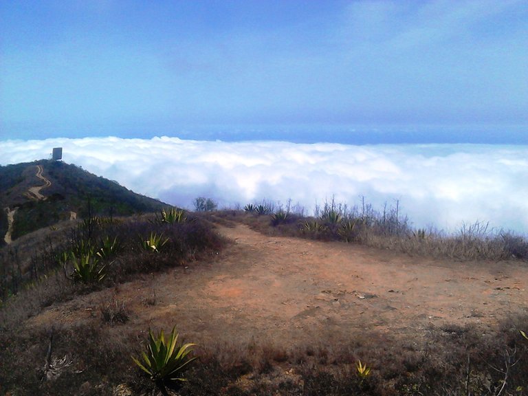
Although we went early to do this route, the day was quite hot, there was shade only for a short stretch where there was some tall vegetation, but I really liked the vibrant blue sky and how it looked in the photos, it looks painted.
Aunque fuimos temprano para hacer esta ruta, el día estaba bastante caluroso, sombra sólo hubo durante un corto tramo en el que había un poco de vegetación alta, pero me gustó mucho el vibrante cielo azul y cómo quedó en las fotos, parece pintado.
This place that is inside the Waraira Repano or Avila National Park, is called El Camino de los Españoles (The Path of the Spaniards), and is located in the area of La Pastora in Caracas. It is a path opened by the indigenous people that has been maintained despite its years of existence. Imagine, the Spanish colonizers took advantage of it and it was through here that they had access to the valley of Caracas from the coastal town of La Guaira. This road was used for about 300 years until a highway was built between the two cities in 1845.
Este lugar que está dentro del Parque Nacional Waraira Repano o Ávila, se llama El Camino de los Españoles, y queda por la zona de La Pastora en Caracas. Es un sendero abierto por los indígenas que se ha mantenido a pesar de sus años de existencia, imagínense, lo aprovecharon los colonizadores españoles y fue por aquí que tuvieron acceso al valle de Caracas desde la población costera de La Guaira. Esta vía se usó como por 300 años hasta que en 1845 fue construida una carretera entre las dos ciudades.
This route is about 18 km in total and as it was used to transport merchandise arriving at the port of La Guaira to Caracas, it has several control or surveillance points, which are fortresses built by the Spaniards to protect themselves from pirate or other attacks. Today only ruins of them remain.
Esta ruta tiene unos 18 Km en total y como era usada para transportar la mercancía que llegaba al puerto de La Guaira hacia Caracas, posee varios puntos de control o vigilancia, que son fortalezas construidas por los españoles para protegerse de ataques piratas o de otra índole. Hoy sólo quedan ruinas de ellos.
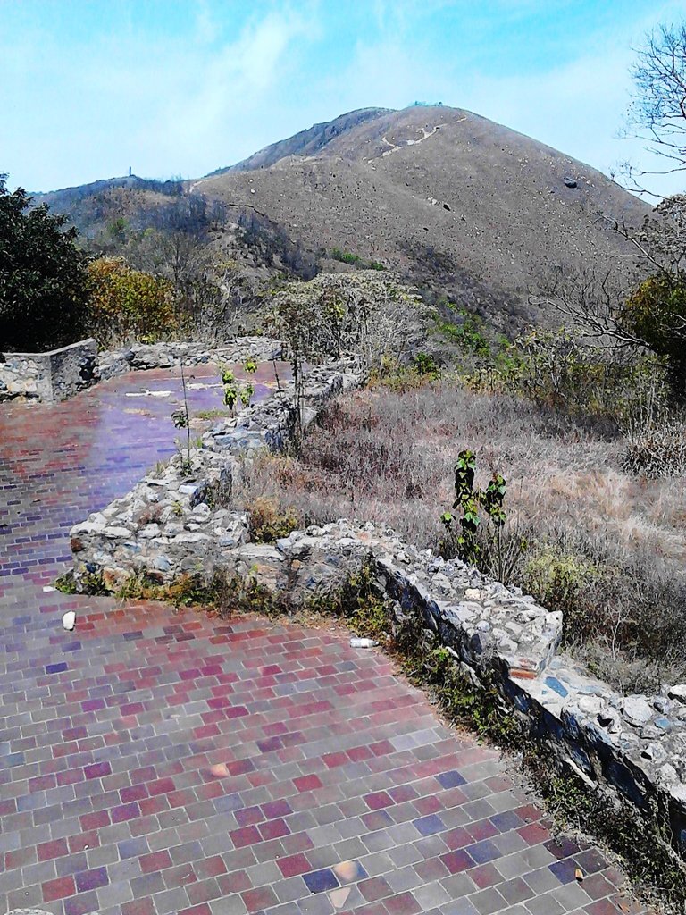
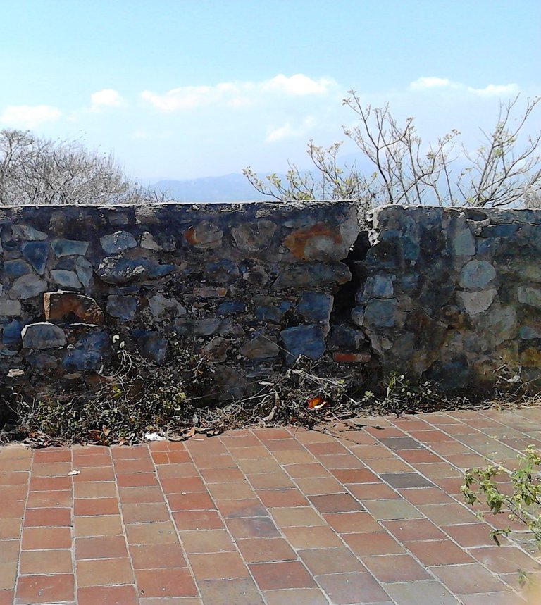
This one I show you in the photos is the Castillo de San Joaquín, also known as Fortín de la Cumbre or de la Cuchilla, well, what is left of it. It dates from 1770 and is the largest of the five that were built on this route and the one that is in the best condition. There are some walls still standing and we can also see a ceramic floor that was placed during a restoration in 1981, which is completely out of tune with the antiquity of the place.
Este que les muestro en las fotos es el Castillo de San Joaquín, también conocido como Fortín de la Cumbre o de la Cuchilla, bueno, lo que queda de él. Data de 1770 y es el más grande de los cinco que se levantaron en esta ruta y el que en mejores condiciones está. Hay algunas paredes y muros en pie y también podemos ver un piso de cerámica que le colocaron durante una restauración en el año 1981, el cual desentona completamente con la antigüedad del lugar.
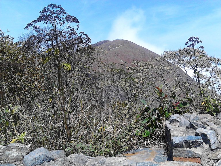
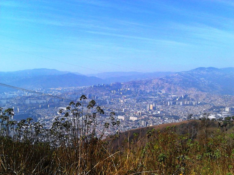
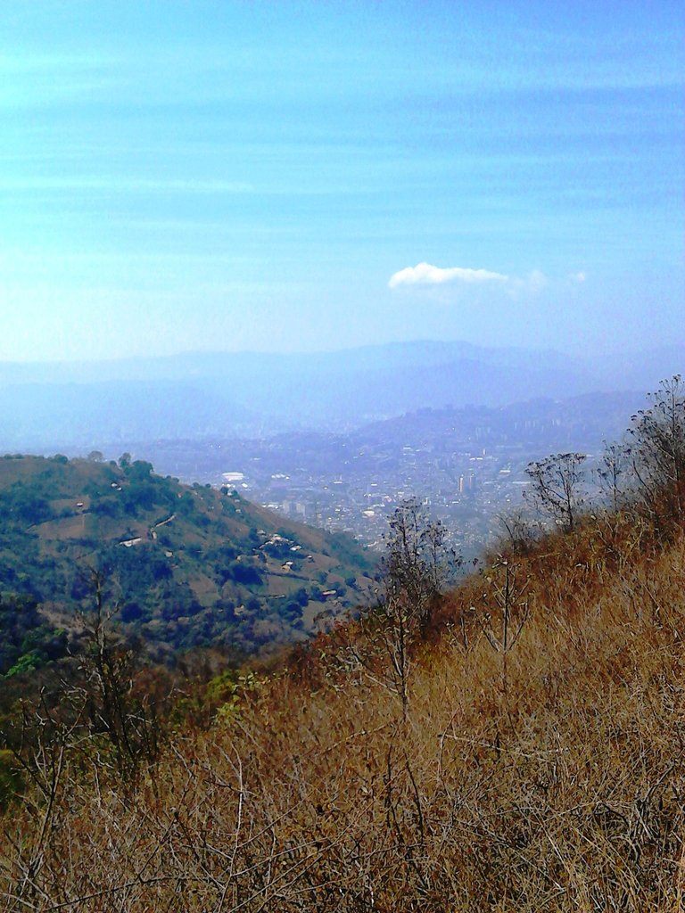
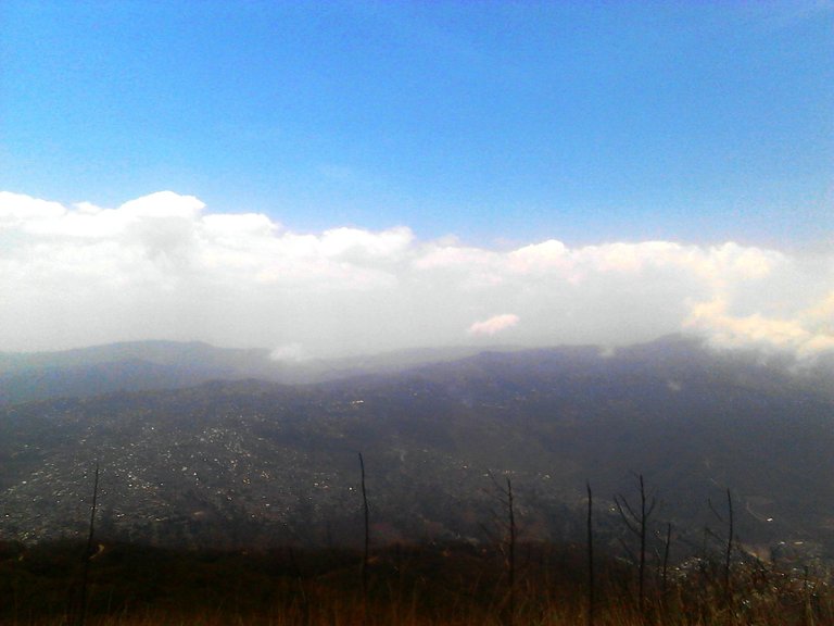
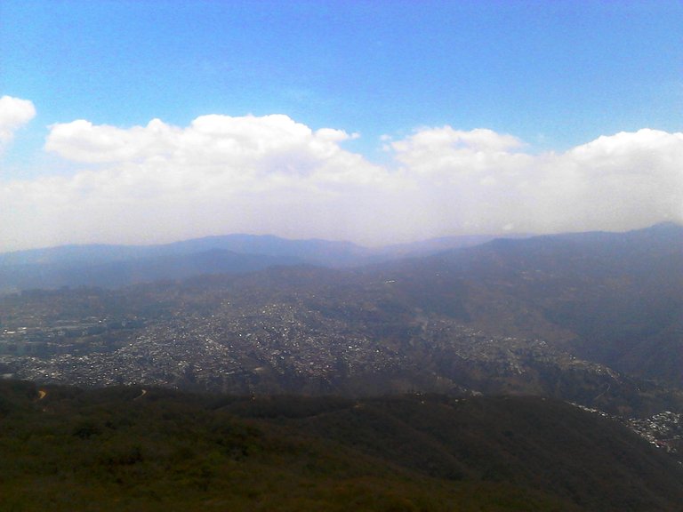
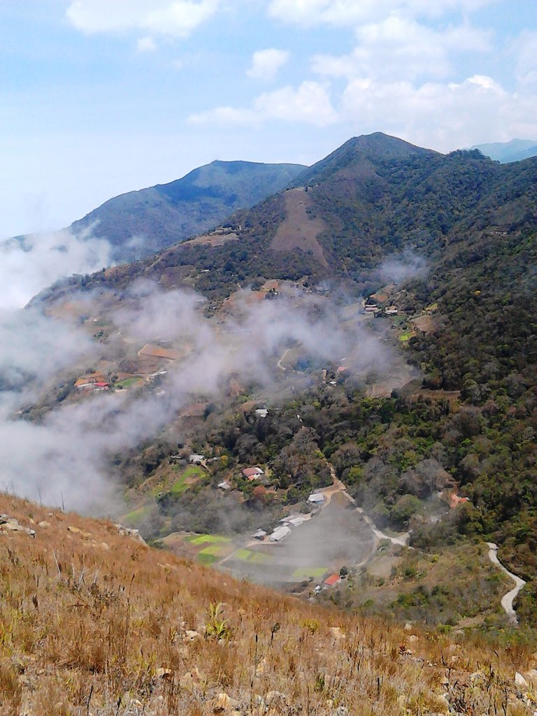
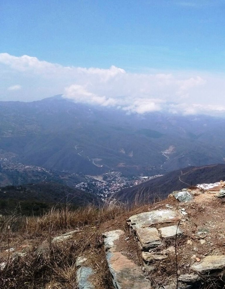
The landscapes around here are gorgeous, there are some very nice hills, the view of the city below and also in the distance you can see some villages of people who live and plant in this mountainous area.
Los paisajes por aquí son preciosos, hay unas lomas muy bonitas, la vista de la ciudad abajo y también a lo lejos se ven algunos caseríos de personas que viven y siembran en esta zona montañosa.
We didn't do the complete route that takes you to La Guaira, to the sea, we reached maybe half of the trail, I hope to return soon to go to the end.
Nosotros no hicimos la ruta completa que te lleva a La Guaira, al mar, llegamos quizás a la mitad del sendero, espero volver pronto para ir hasta el final.
All photos are my property / Todas las fotos son de mi propiedad
https://twitter.com/1148004611934117889/status/1611373589516947457
The rewards earned on this comment will go directly to the people( @sofathana ) sharing the post on Twitter as long as they are registered with @poshtoken. Sign up at https://hiveposh.com.
Ño, tremendas imágenes, lindisimas, una altura tremenda, no te sumbaron los oídos 😂😂
Saludos hermano, un abrazo buen post
¡Muchas gracias! Jejeje no sentí los oídos tapados, seguramente porque como la subida no es abrupta sino de a poco, te vas aclimatando, saludos :)
Congratulations, your post has been added to Pinmapple! 🎉🥳🍍
Did you know you have your own profile map?
And every post has their own map too!
Want to have your post on the map too?
Muy bonito el lugar y lindas fotos . Interesante la historia que cuentas , nosotros acá también tenemos algunas fortificaciones de la época colonial, algunas se mantienen en pie otras solo se pueden ver sus restos .
Creo que no hay lugar donde hayan pasado colonizadores que no exista una fortificación jeje, ¡gracias por pasar por acá!
What a wonderful trail, the views are stunning @sofathana 😁
Great captures and information. Thanks for sharing.
I hope you can return soon to make it to the end.
Thank you @littlebee4!
Yeees, I want to come back to see those views when you get to the sea :D
You are welcome @sofathana 👋🏻😊
Have a wonderful weekend 🤗🌺
🌻🤗
Hiya, @choogirl here, just swinging by to let you know that this post made it into our Honourable Mentions in Daily Travel Digest #1752.
Your post has been manually curated by the @pinmapple team. If you like what we're doing, please drop by to check out all the rest of today's great posts and consider supporting other authors like yourself and us so we can keep the project going!
Become part of our travel community:
Thank you so much @choogirl and @pinmapple! :)
Espero visitar este lugar alguna vez, pues la vista es maravillosa, como bien puede apreciarse en las fotos que nos compartes. La altura es tremenda, imagino que el frío también. Excelente forma de comenzar el año, amigo. Saludos.
¡Es genial la vista! La altura no es tanta, el punto más elevado del recorrido son 1.800 metros sobre el nivel del mar, pero si hay nubes como en las fotos que tomé, parece que estuvieras en el cielo jejeje, tampoco hacía frío a esa hora porque había bastante sol, pero seguro en la noche la temperatura es muy baja. ¡Gracias por pasar por acá! Saludos :)
Felicitaciones por recrear el camino de los españoles con esas magníficas fotos @sofathana, esa es la posibilidad extraordinaria para desarrollar el ecoturismo desde nuestra región capital hacia el mar caribe.
Es un episodio monumental de la historia colonial venezolana.
Así es, en esa riquísima montaña hay cientos de posibilidades para el ecoturismo y la enseñanza de la historia, desarrollo sustentable. ¡Muchas gracias por apreciar mi publicación @hiramdo!