Mina Clavero, rivers, sun and more rivers. Spiritual Feelings . Cordoba, Argentina
Mina Clavero is a city in the Province of Córdoba, Argentina, belonging to the department of San Alberto. It forms the municipality of the same name and is the tourist center of the Traslasierra Valley. It is characterized by its natural landscapes, its beaches and its nightlife.
In 2019, in a contest organized by the New 7 Wonders Foundation, the Mina Clavero River was chosen as one of the "seven natural wonders of Argentina".
After the founding of the city of Córdoba, in 1573, an expedition led by Captain Hernán Mejía de Mirabal took place, who with forty soldiers arrived in the region with the purpose of carrying out a survey of populations and wealth, especially mining.
At that time the area was inhabited by the Comechingones, whose populations were subdivided into partialities that functioned independently; each commanded by a cacique. Milac Navira was the chief of the clan that inhabited the place where Mina Clavero is today, and to whom the city apparently owes its name. However, historians do not agree on the origin of the name: on the one hand they say that it is from the Comechingón cacique, but on the other hand it may come from the derivation of Mina de Clavero, since there was an important mine belonging to the family Clavero, surname that is common in the area.
With the first expedition members traveled the Spanish miner Hernando Romero, in charge of taking samples of the minerals in the area. His investigations would make that some time later, around 1898, the exploitation of some deposits in the territory of the Ticas, in the Minas department, would begin, promoting the development of the region.
Later, roads and bridges began to be built to favor commercial exchange; which was followed by the arrival of postal mail and the telephone. The construction of hotels and the completion of some key public works began to position Mina Clavero as a tourist town.
Around 1890 the area was already named for its therapeutic baths, due to the properties of its waters. The population grew and gradually organized its community activities.
No certain date is known about the founding of Mina Clavero, but it is known that in 1887, the priest José Gabriel Brochero convinced Doña Anastasia Favre de Merlo to install a guest house in this place, which began to function a few years later.
On May 1, 1928, the Municipality was created and the same year, through an indirect election, Mr. José María Oviedo Allende became its first mayor. He was succeeded by two commissioned mayors, until in 1932 the first mayor elected by the popular will took office: Mr. Daniel Vila.
On October 11, 1946, Mrs. Anastasia passed away, and for this reason this day is taken as the date of the spiritual foundation of Mina Clavero.
Mina Clavero is located in the Traslasierra valley, between the Achala and Pocho mountain ranges, at 915 meters above sea level.
One of the many floods of the Mina Clavero river
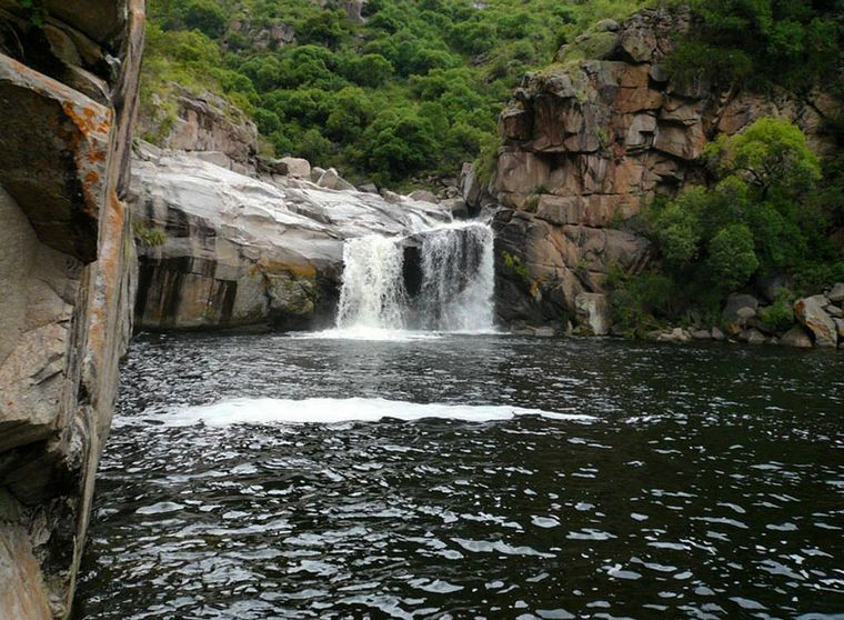
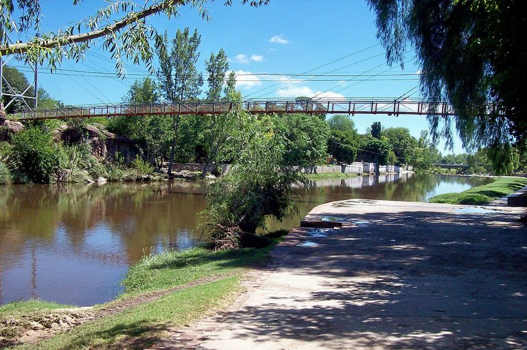
The Mina Clavero river, with its cold and crystal clear waters, which flows down from the Sierras Grandes, flows through the city and forms natural spas with golden beaches on its way. In 2009, different warning systems were installed in the event of flash floods, since sometimes it rains in the high mountains, at the source of the river, only 25 km from the city, while it remains sunny.
In the limits with Villa Cura Brochero, there is the confluence of this river with the Panaholma that comes from the north bringing temperate waters. Both currents form the Río de los Sauces, to finish later flowing into the lake of Dique La Viña or Embalse Ing. A. Medina Allende.
In Mina Clavero the climate is healthy. The days are radiant and the nights cool, with low percentages of humidity. And thanks to the high concentrations of ozone and the low environmental pollution in the valley, you can breathe pure air.
The city has a microclimate that means that the average annual temperature is 15 °C, and there are 320 sunny days a year. The rainy season is from November to March.
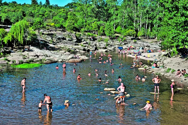
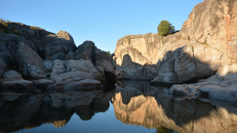
The area is very attractive for its 14 km of sandy and rocky beach, small waterfalls, spas and natural pools, and for its cultural options such as the Bell Museum (with a collection of more than 600 pieces from around the world) or the mineral museum.1
The topography of the terrain and the climate of the region contribute to the fact that the town is a good setting for trekking, horseback riding, excursions in quadricycles and 4x4 journeys through different mountain roads with different levels of difficulty.
Congratulations, your post has been added to Pinmapple! 🎉🥳🍍
Did you know you have your own profile map?
And every post has their own map too!
Want to have your post on the map too?
What a nice view. The rivers were clear, green lushes. Its so cool. The rock formations were captured perfectly.
Thanks for reblogging
!PIZZA
@thetyper, sorry! You need more to stake more $PIZZA to use this command.
The minimum requirement is 20.0 PIZZA staked.
More $PIZZA is available from Hive-Engine or Tribaldex