The Nevados National Natural Park - Road to Nevado del Ruiz Volcano. Part 1 |ENG||ESP|
Parque Nacional Natural Los Nevados - Camino al Volcán Nevado del Ruiz. // The Nevados National Natural Park - Road to Nevado del Ruiz Volcano.
*Pinmapple kink: [//]:# (!pinmapple 4.93890 lat -75.34965 long Road to Nevado del Ruiz Volcano d3scr) *
Versión en español
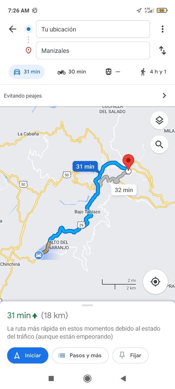
Hola amigos mochileros, excursionistas y turistas, como están? Hoy por fin vuelvo a compartir con ustedes uno de los sitios turísticos mas increíbles y fríos que visite en mi estadía en el eje cafetero de Colombia. Recordando que este viaje comenzó a las 5:30am un domingo, desde Santa Rosa de Cabal hasta la ciudad de Manizales donde se encontraba mi hermano esperándome, para luego poder ir en moto a este lugar, el recorrido desde Manizales hasta el PNN Los Nevados, era de 1h:30min aproximadamente, y esto se debe a las curvas y subidas que hay en el camino, además de ir con cuidado por que en la ruta hay muchos ciclista.
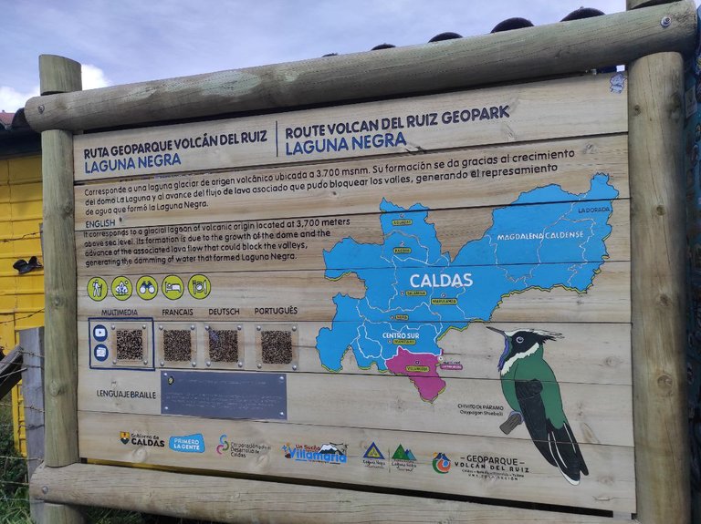
La distantica entre estos dos puntos es de 50km, y el Parque Nacional Natural Los Nevados se considera el corazón del eje cafetero ya que se comparte con 3 departamentos de Colombia, lo que corresponde a Caldas, Tolima y parte del Quindío (aunque con el tercero aun estoy en dudas pero así me comentaron algunos guías turísticos).
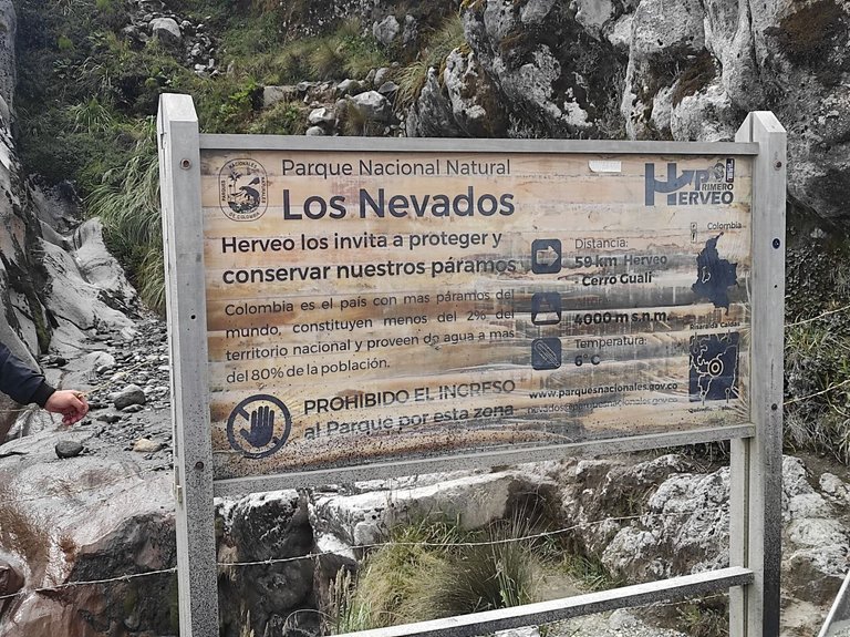
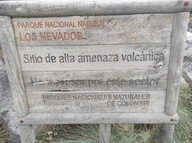
El Parque esta conformado por 3 volcanes, el Nevado Del Ruiz, Nevado del Tolima y Nevado de Santa Isabel, solo tengo conocimiento del Nevado del Ruiz, su apodo es el león dormido ya que fue el causante de una de las peores tragedias de Colombia como lo fue la tragedia de Armero en 1985, donde la erupción del volcán fue causante de la desaparición completa de este pueblo. Su historia es increíble y la pueden encontrar en internet.
Es un volcán que esta en alerta amarilla pues esta en actividad volcánica y emite cenizas al ambiente, incluso cuanto mas nos acercamos al volcán se siente el olor a azufre, además siempre presenta sismos por lo cual el acceso turístico a veces es un poco restringido.
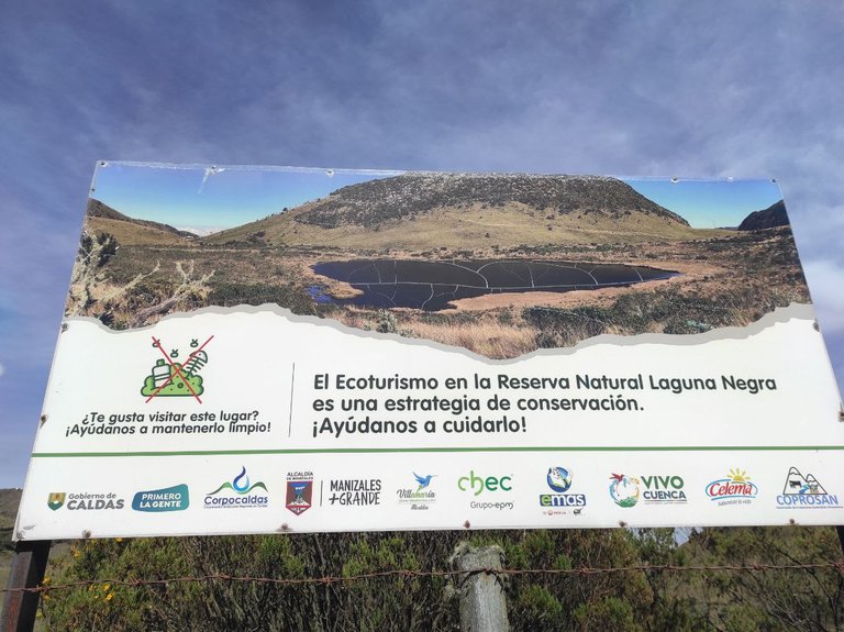
El PNN Los Nevados también tiene otros atractivos, como la Laguna Negra, los paramos, miradores, pequeñas nacientes de agua, aguas termales entre otros.
Así que comencemos el viaje desde 0, vamos.
English version
Hello backpackers, hikers and tourists, how are you? Today I finally come back to share with you one of the most incredible and coolest tourist sites that I visited during my stay in the coffee region of Colombia. Remembering that this trip began at 5:30am on a Sunday, from Santa Rosa de Cabal to the city of Manizales where my brother was waiting for me, to then go by motorcycle to this place, the journey from Manizales to the PNN Los Nevados, was about 1h:30min, and this is due to the curves and climbs that are on the road, plus go carefully because on the route there are many cyclists.
The distance between these two points is 50km, and Los Nevados National Natural Park is considered the heart of the coffee axis as it is shared with 3 departments of Colombia, which corresponds to Caldas, Tolima and part of Quindio (although with the third one I am still in doubt but some tour guides told me so).
The Park is formed by 3 volcanoes, Nevado del Ruiz, Nevado del Tolima and Nevado de Santa Isabel, I only know about Nevado del Ruiz, its nickname is the sleeping lion because it was the cause of one of the worst tragedies in Colombia as was the tragedy of Armero in 1985, where the eruption of the volcano was the cause of the complete disappearance of this town. Its history is incredible and you can find it on the internet.
It is a volcano that is on yellow alert because it is in volcanic activity and emits ash into the environment, even the closer you get to the volcano you can feel the smell of sulfur, also always has earthquakes so tourist access is sometimes a bit restricted.
The PNN Los Nevados also has other attractions, such as the Laguna Negra, the paramos, viewpoints, small water springs, hot springs and others.
So let's start the journey from 0, let's go.
Sali de mi casa muy temprano, la idea era estar en Manizales a las 7am, pero los buses comienzan a trabajar después de las 6:30am, como perdí el primero (no se quiso parar imagino que iba con muchas personas), tuve que esperar al siguiente, por lo cual llegue a las 8am a la ciudad. La idea de ir muy temprano es poder ver el volcán despejado y observar la fumarola y la emisión de gases a al a atmosfera.
El frio era demasiado, mi hermano me había advertido que tenia que ir con doble suéter o chaqueta, doble pantalón, doble medias y con zapatos cómodos.
I left my house very early, the idea was to be in Manizales at 7am, but the buses start working after 6:30am, as I missed the first one (it didn't want to stop I guess it was with many people), I had to wait for the next one, so I arrived at 8am to the city. The idea of going very early is to be able to see the volcano clear and observe the fumaroles and the emission of gases into the atmosphere.
The cold was too much, my brother had warned me that I had to wear a double sweater or jacket, double pants, double socks and comfortable shoes.
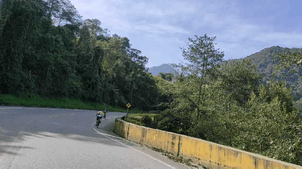
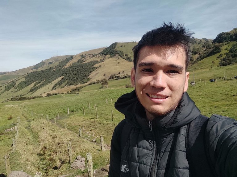
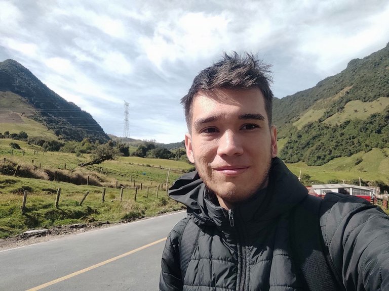
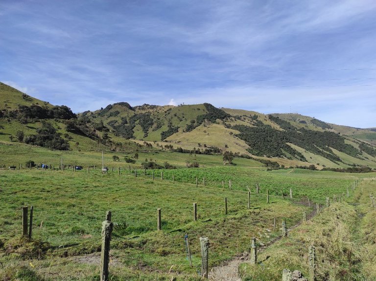
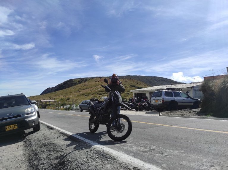
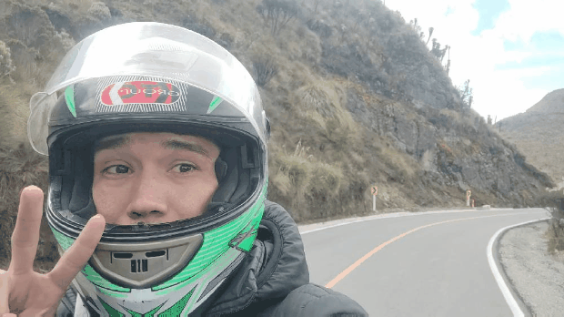
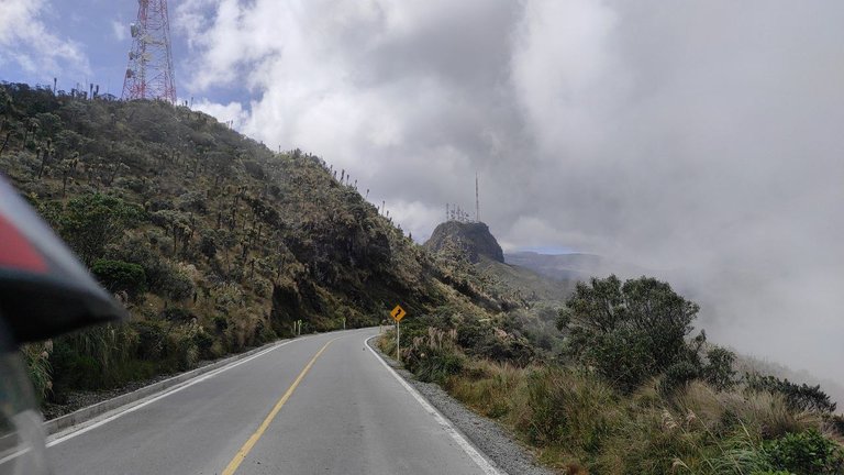
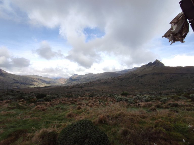
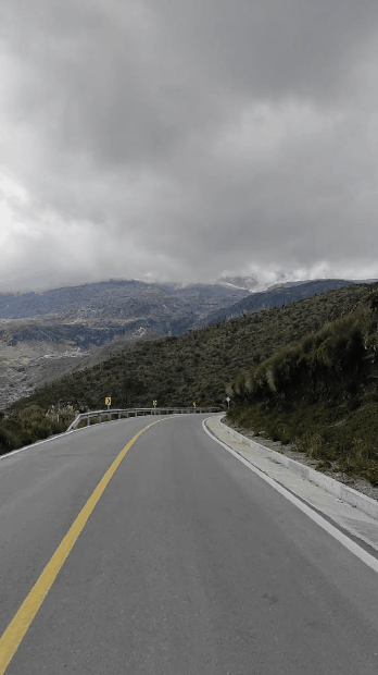
Ya estando en la ciudad nos pusimos en marcha para ir al lugar, al salir de Manizales el ambiente cambia completamente, es un ambiente de montaña, con muchos bosques de pino, paramos, colinas, todo muy verde y bonito. Hay ciclistas en la ruta que tienen el mismo destino, otros ruteros en grupos de moto, y familias que van en sus vehículos. Sinceramente me sentía como si estuviera en los Alpes suizos haciendo referencia a la caricatura "Heidi", recuerdo que iba cantando esa canción en el camino, por que nunca había visto paisajes así.
Aun me sorprende la cantidad de ciclistas que había en el camino, demasiados para contarlos y por su puesto me sorprende es por el frio que se sentía incluso teniendo 2 prendas, ellos solo tenían vestimenta deportiva.
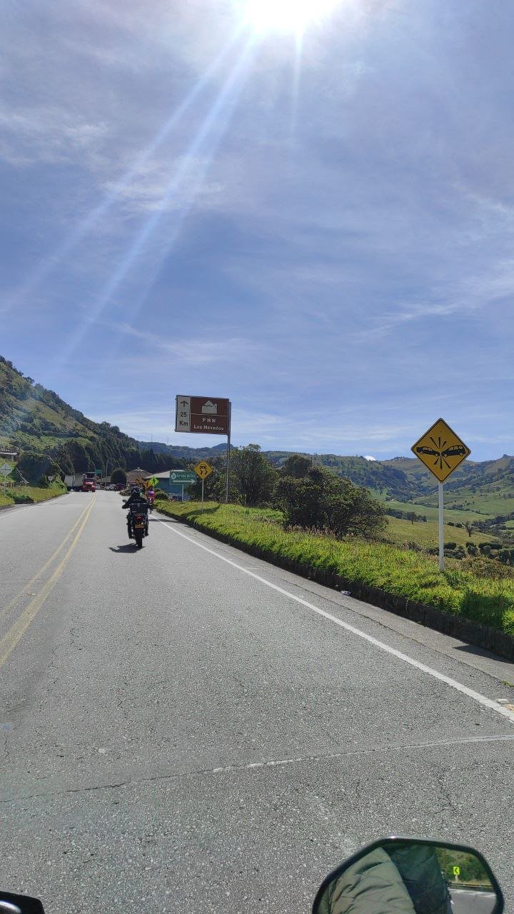
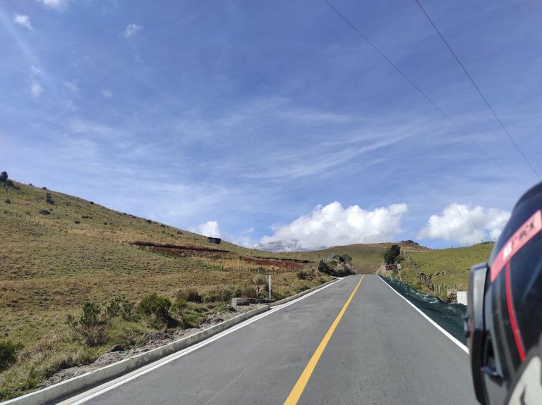
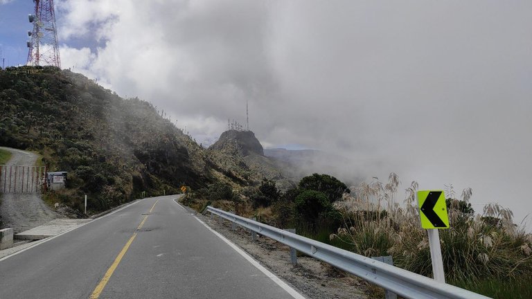
Aquí podrán observar parte del camino y ciclistas en la ruta.
Already being in the city we set off to go to the place, when leaving Manizales the environment changes completely, it is a mountain environment, with many pine forests, we stopped, hills, all very green and beautiful. There are bikers on the route that have the same destination, other riders in groups of motorcycles, and families who go in their vehicles. Honestly I felt like I was in the Swiss Alps referring to the cartoon "Heidi", I remember that I was singing that song on the way, because I had never seen landscapes like this.
I am still surprised by the amount of cyclists that were on the road, too many to count and of course I am surprised by how cold it felt even if I had 2 clothes, they only had sports clothes.
Here you can see part of the road and cyclists on the route.
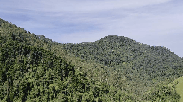
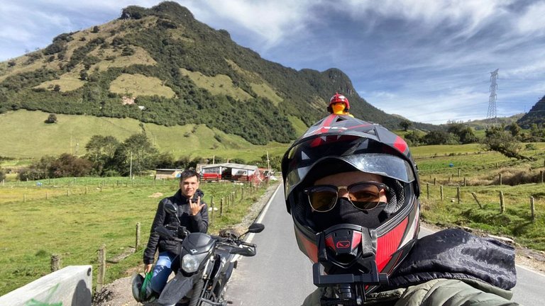
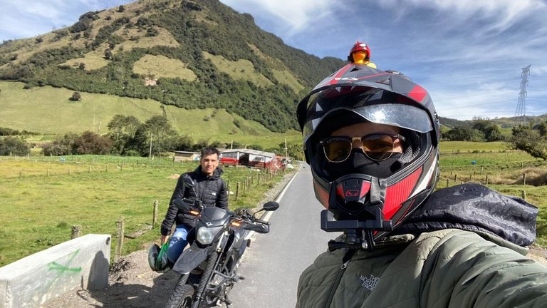
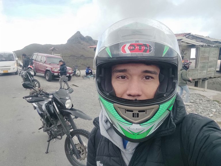
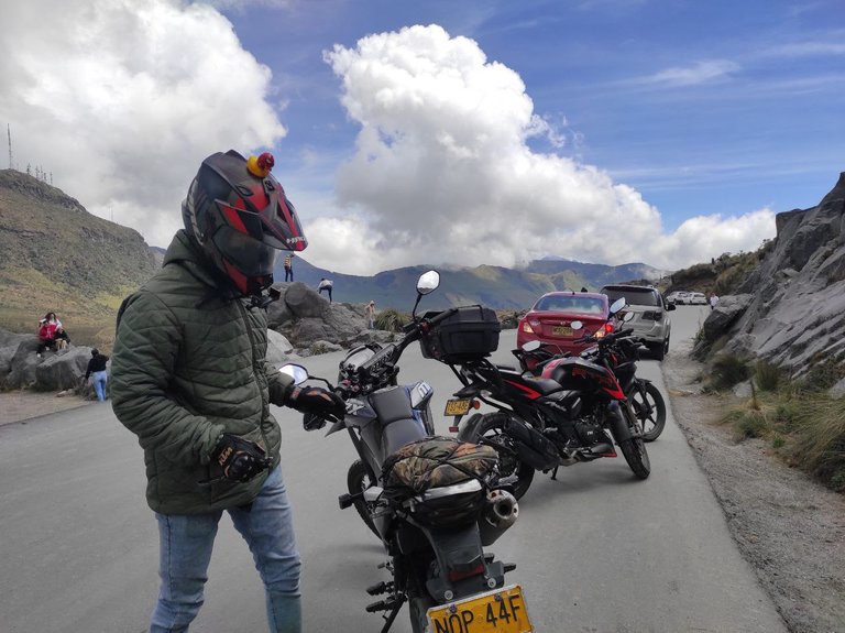
Hicimos una primera parada a los 40min desde que comenzamos a subir, para tomar algunas fotografías del lugar que se veía increíble y por que sinceramente me dolían las piernas, el camino era super inclinado y la moto al ser enduro no es muy cómoda para viajes largos. Aun así detrás de nosotros otros grupos de motos hicieron los mismo. Desde aquí ya se sentía mucho frio aunque hubiese sol, no sentíamos para los rayos del sol, había un pequeño riachuelo en la carretera y al tocar esa agua estaba helada, no pudimos ingresar a ningún pastizal por que todos eran privados.
We made a first stop after 40min since we started to climb, to take some pictures of the place that looked amazing and because honestly my legs were hurting, the road was super steep and the bike being enduro is not very comfortable for long trips. Even so, behind us other groups of motorcycles did the same. From here we already felt very cold even though there was sun, we did not feel the sun's rays, there was a small stream on the road and when we touched the water it was freezing, we could not enter any pasture because they were all private.
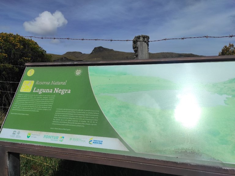
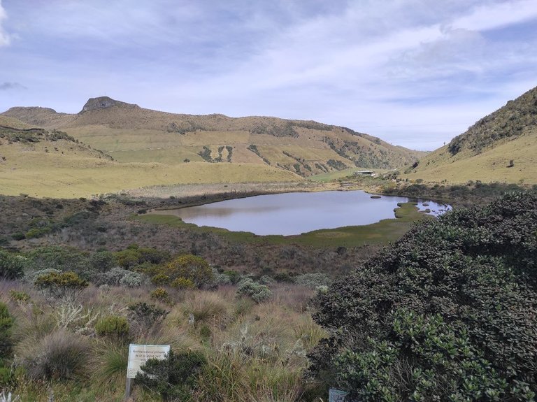
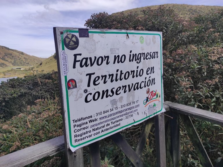
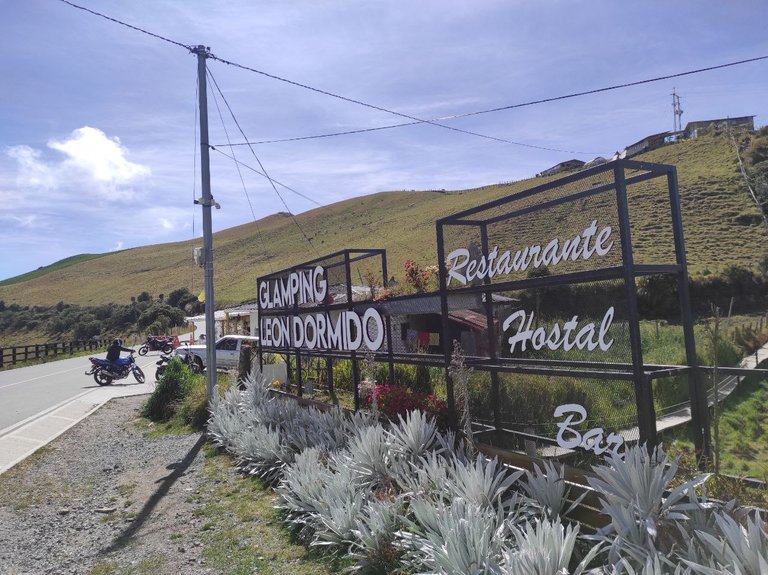
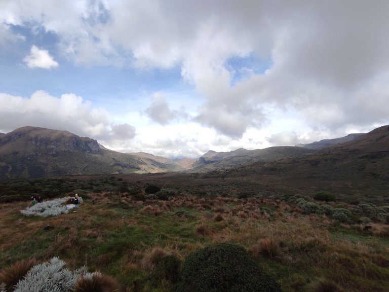
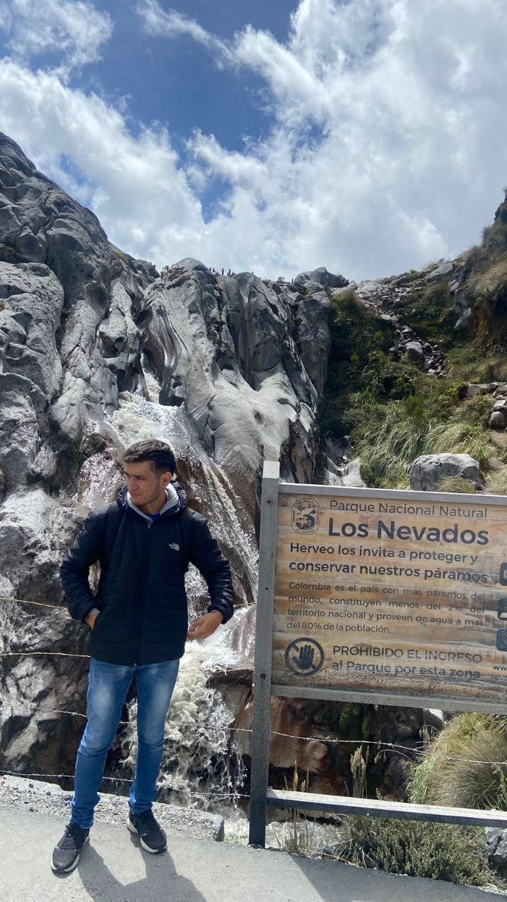
La siguiente parada a unos pocos minutos es la Laguna Negra, este ecosistema es protegido y esta prohibido el ingreso aunque antes era permitido con la compañía de guardabosques, se ingresaba al entorno y se podían tomar fotografías mas no se podía tocar el agua y menos dejar basura en el lugar. La entrada era por pocos minutos, pero ahora solo se puede observar desde el mirador, en este mismo lugar hay un restaurante, pero al ser el primer parador turístico hay muchas personas, así que nosotros paramos por 10min y continuamos al siguiente destino para desayunar.
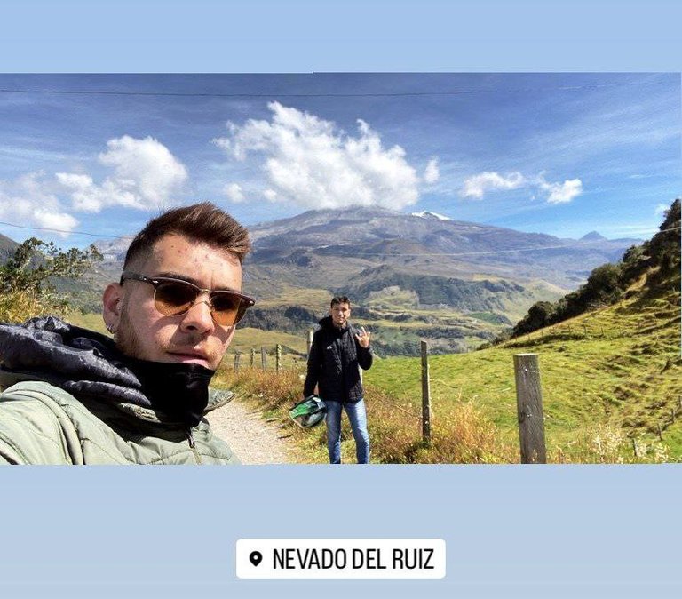
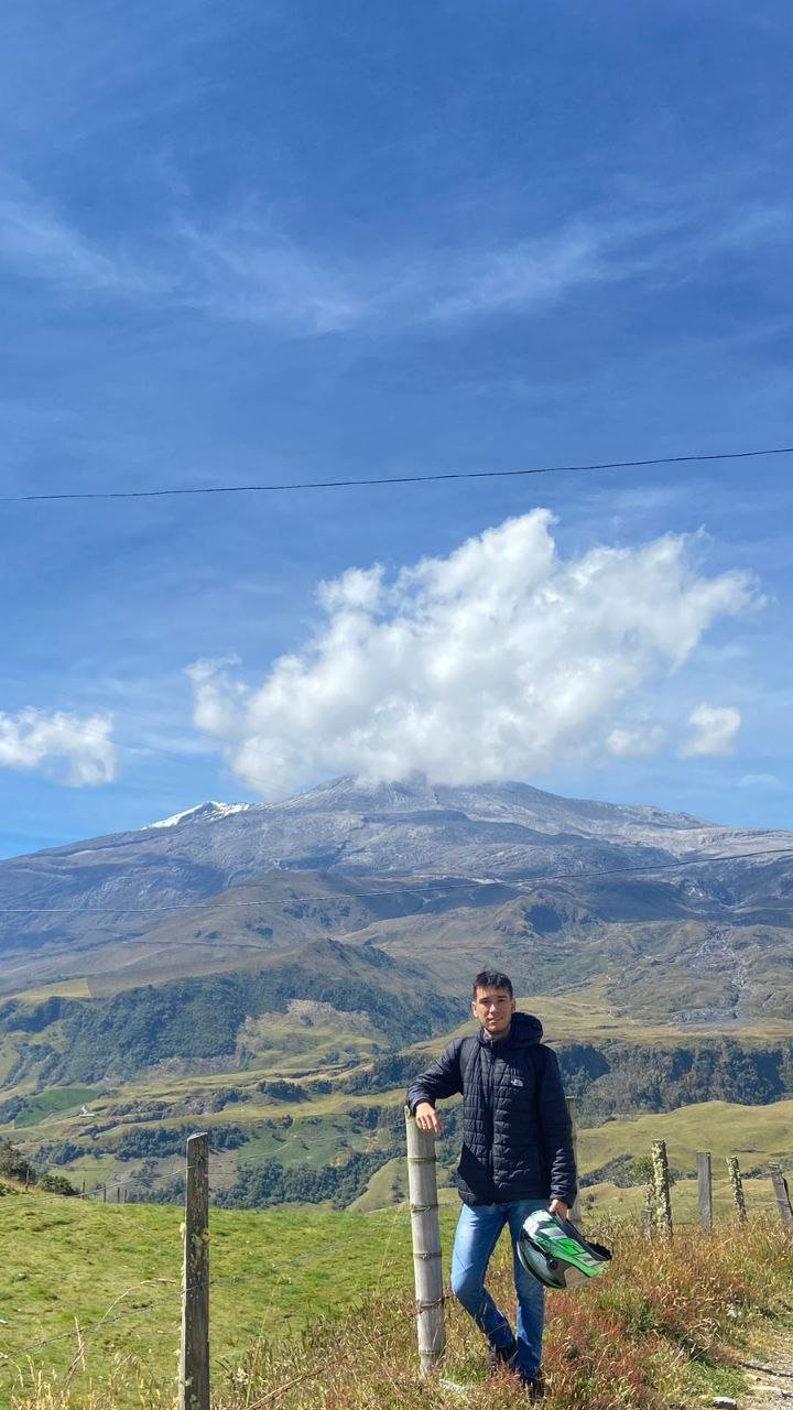
Por cierto cuando estamos por llegar al mirador de Laguna negra, por pequeños tramos se puede observar la nieve del Volcán Nevado del Ruiz.
The next stop a few minutes away is the Laguna Negra, this ecosystem is protected and it is forbidden to enter although before it was allowed with the company of park rangers, you could enter the environment and take pictures but you could not touch the water and less leave garbage in the place. The entrance was for a few minutes, but now you can only observe from the viewpoint, in this same place there is a restaurant, but being the first tourist stop there are many people, so we stopped for 10min and continue to the next destination for breakfast.
By the way when we are about to reach the viewpoint of Laguna negra, for small stretches you can see the snow of the Nevado del Ruiz Volcano.
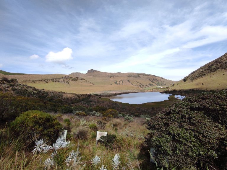
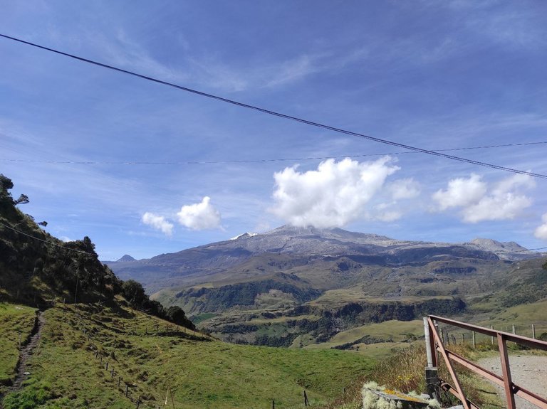
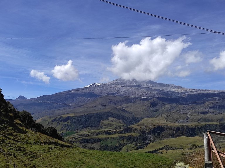
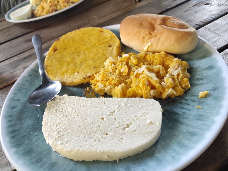
Un poco mas arriba de Laguna Negra se encuentran varios restaurantes, desde aquí se observa el Nevado del Ruiz en su máximo esplendor, eran aproximadamente las 10am, así que estaba un poco despejado y se la nieve y la forma del volcán, aunque no esta para nada cerca desde este punto, aprovechamos y tomamos las fotografías antes que se tapara por la neblina. En esta parada desayunamos un poco, un desayuno tradicional Colombiano y muy delicioso la verdad que costo 10.000 pesos colombianos (equivalente a 2.5$), arepa colombiana, queso, huevos revueltos, pan y chocolate.
A little above Laguna Negra are several restaurants, from here you can see the Nevado del Ruiz in its maximum splendor, it was about 10am, so it was a little clear and the snow and the shape of the volcano, although it is not at all close from this point, we took advantage and took pictures before it was covered by the fog. At this stop we had some breakfast, a traditional Colombian breakfast and very delicious the truth that cost 10,000 Colombian pesos (equivalent to $ 2.5), Colombian arepa, cheese, scrambled eggs, bread and chocolate.
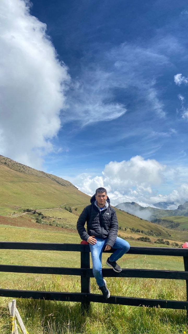
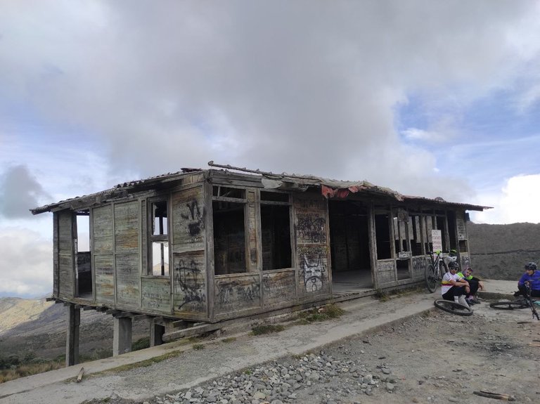
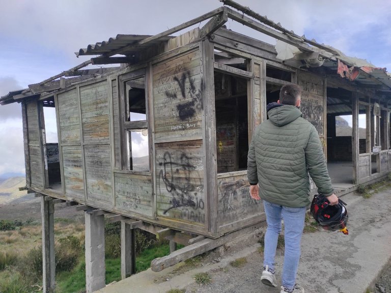
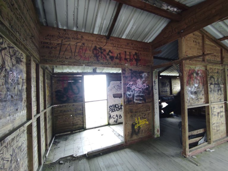
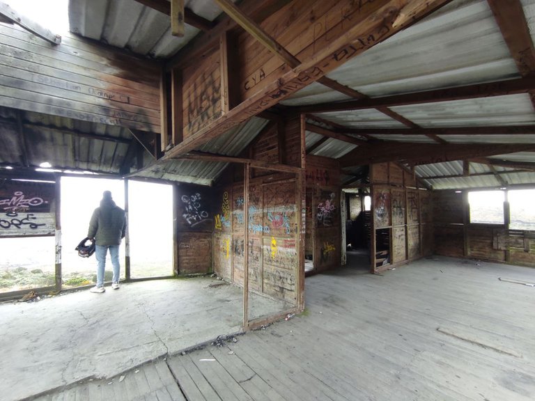
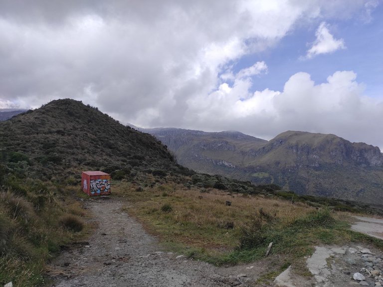
Nuevamente en marcha a la siguiente parada es una cabaña desolada, que al parecer antes era un restaurante pequeño, ahora quedo como mirador turístico y literalmente es un parada emblemática del lugar, todas las personas bajan aquí a tomar fotos y observar la vista desde las ventanas.
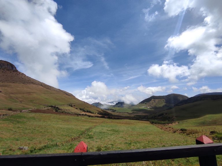
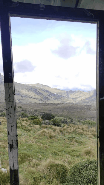
Todas las paredes y el piso estaban hechos de madera, y hay nombres que los turísticas marcan cuando pasan por aquí. Ya en este punto se observa el paisaje de paramo, vegetación de paramo, algunos cactus, frailejones, montañas y laderas desde lejos, el microclima cambiante de neblina también predomina y por supuesto el frio mucho mas, estábamos a 10°C.
Again on the road to the next stop is a desolate cabin, which apparently used to be a small restaurant, now it is a tourist lookout and literally an emblematic stop of the place, all the people come down here to take pictures and observe the view from the windows.
All the walls and the floor were made of wood, and there are names that tourists mark when they pass by. Already at this point you can see the paramo landscape, paramo vegetation, some cactus, frailejones, mountains and hillsides from far away, the changing microclimate of fog also predominates and of course the cold much more, we were at 10°C.
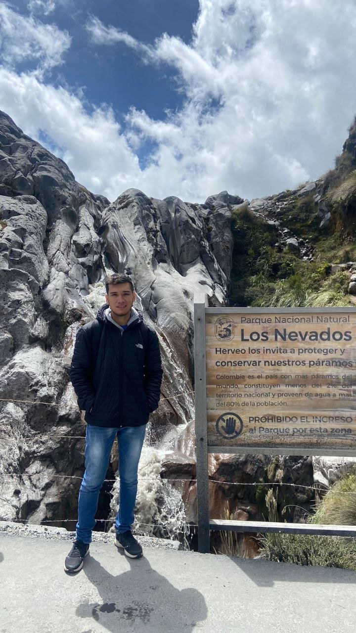
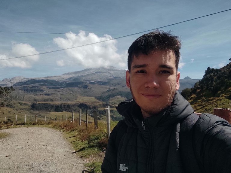
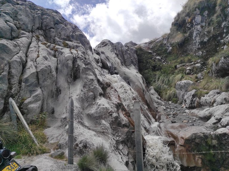
Ahora nuevamente en marcha hacia uno de los destinos finales, nos adentramos un poco mas al centro del PNN Los Nevados, donde comienzan a verse nacientes de agua que corren por las rocas, donde los frailejones abundan mucho mas, y donde el frio es de quizás 5°C, esto nos tomo aproximadamente 10min, donde ya estamos en paramo total, el ambiente se nota frio y es completamente distinto a lo que venimos viendo. La vía esta en excelente condiciones hacia las primeras nacientes después de esto, la carretera esta en construcción, sin embargo el acceso no es difícil.
Now again on the way to one of the final destinations, we go a little further into the center of the PNN Los Nevados, where we begin to see water springs that run through the rocks, where the frailejones are much more abundant, and where the cold is perhaps 5 ° C, this took us about 10min, where we are already in total paramo, the atmosphere is cold and is completely different from what we have been seeing. The road is in excellent condition towards the first springs after this, the road is under construction, however access is not difficult.
Ya aquí como mencione antes, se siente mucho el olor a azufre en el ambiente, ya es mucho mas peligroso estar a esta altura para los que no están acostumbrados, yo llevaba dulces, Gatorade y otras cosas por si alguno de los 2 se mareaba o algo por estilo, en este caso le sucedió a mi hermano, incluso le dieron nauseas intensas, y yo tuve que manejar gran parte de ese trayecto.
Habían demasiadas personas aquí, inclusos buses que traían turistas de otros departamentos de Colombia, muchos mochileros que querían llegar hasta el pie del volcán y se iban por veredas y caminos clandestinos tratando de burlar a los guarda parques.
Como aun quedan demasiadas fotos del viaje y mucha mas historia por contar, dejare una parte para este post luego, que llega lo mas interesante intentar subir al volcán.
Nos vemos en la siguiente parte, gracias.
Already here as I mentioned before, you can feel the smell of sulfur in the air, it is much more dangerous to be at this altitude for those who are not used to it, I was carrying candy, Gatorade and other things in case one of us got dizzy or something like that, in this case it happened to my brother, he even got intense nausea, and I had to drive much of that journey.
There were too many people here, even buses that brought tourists from other departments of Colombia, many backpackers who wanted to get to the foot of the volcano and went through clandestine paths and roads trying to circumvent the park rangers.
As there are still too many photos of the trip and much more history to tell, I will leave a part for this post later, that comes the most interesting thing to try to climb the volcano.
See you in the next part, thanks.
Congratulations, your post has been added to Pinmapple! 🎉🥳🍍
Did you know you have your own profile map?
And every post has their own map too!
Want to have your post on the map too?
Congratulations, your post has been upvoted by @dsc-r2cornell, which is the curating account for @R2cornell's Discord Community.
Enhorabuena, su "post" ha sido "up-voted" por @dsc-r2cornell, que es la "cuenta curating" de la Comunidad de la Discordia de @R2cornell.
Muchaaas gracias, de verdad agradezco siempre el apoyo que me dan
Hiya, @livinguktaiwan here, just swinging by to let you know that this post made it into our Top 3 in Travel Digest #2014.
Your post has been manually curated by the @pinmapple team. If you like what we're doing, please drop by to check out all the rest of today's great posts and consider supporting other authors like yourself and us so we can keep the project going!
Become part of our travel community:
Wooooooooooooooooow,I still can't believe it, thank you very much, I am very excited.
https://leofinance.io/threads/luzscarllet18/re-leothreads-canxhj7f
The rewards earned on this comment will go directly to the people ( luzscarllet18 ) sharing the post on LeoThreads,LikeTu,dBuzz.
Que hermoso lugar, se nota que está aventura fue una ruta de alto impacto 🤭 muy buenos micro videos le da un genial toque a tu post
Hey muchas gracias, se suponía que fueran de mejor calidad pero no entiendo por qué se subieron así 😂😂, aunque no es lo mejor pues se hace lo que se puede.
It's wonderful to hear about your adventures and the effort you put into reaching this destination.
Thank you, the effort for each trip here was the same😂, it is the good thing about being a tourist to travel as far as the destination takes us.