Kim's Quest #10: Day Trek to Osmeña Peak | Discover Cebu
[I was supposed to post this on travelfeed.io as my first post in the site, but there's something going on that I can't seamlessly post it there.]
Hello steemians and travellers!
It's been a while since my last travel blog and I kind of missed the feeling of writing and editing. If you have continued doing what you love especially here on Steem, good for you. I, on the other hand, had been very eager to go back, but there are factors that kept me from doing the things I love. Anyway, let's put that aside and I am just happy that I'm here again.
Most of my travel photos before were from @legendarryll, but since he's already in Singapore, current photos are from me. As expected, they're not as good as his, but I tried to at least have them as half decent as his photos. I bought a camera last February and I tried Lightroom just last June. Please don't be too harsh on your judgments. I know that I still have a lot of things to learn and photography has a very steep learning curve. I am just learning one lesson at a time, so it will probably take years for me to at least be half as good as Darryll.
Alright, let's start the journey to the jagged terrain of Mantalongon.
I've been in Cebu for 12 years already, but I was able to visit Osmeña Peak just recently. I was reluctant at first because I know a lot of people will flock there regardless of the time of day or if it's on weekdays or weekends. Although it's one of the highest points, it's very accessible and the trek to the peak would usually just take about 20 minutes.
I just kept my expectations low as I thought I would just be disappointed when I get there. I don't usually go to tourist spots that are easily accessible to the general public, but I don't discriminate lately. I don't know; maybe I'm just getting old or I'm just thirsty to travel when I started with my work.
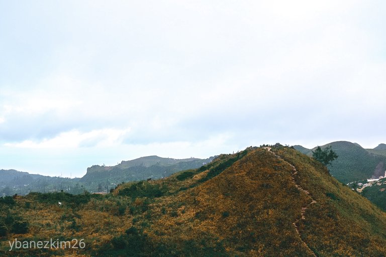
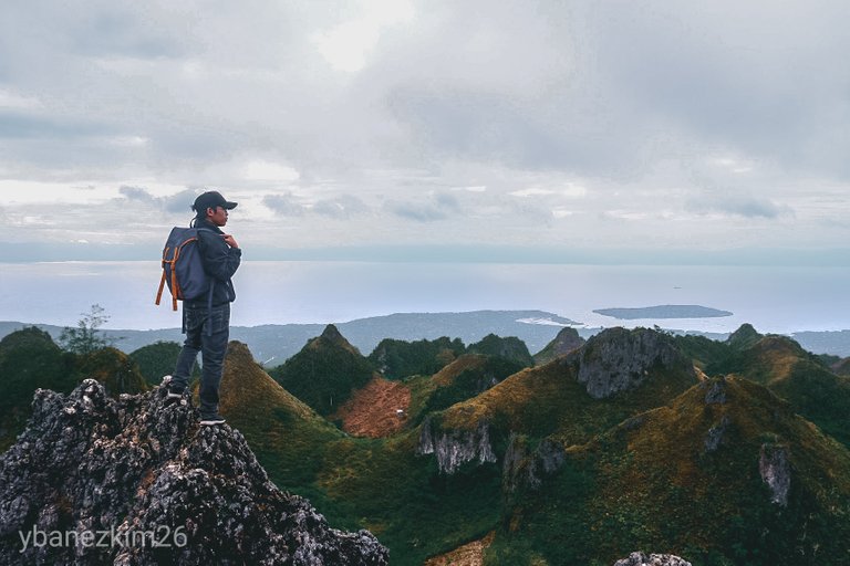
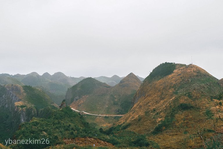
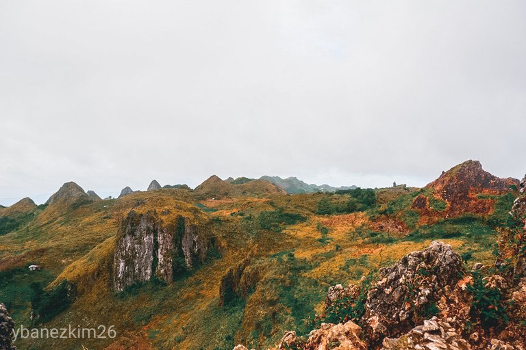
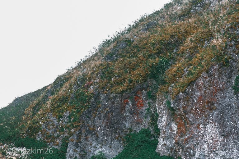
Osmeña Peak is the highest point of a cluster of jagged hills located in the southern towns of Cebu. Osmeña Peak is specifically located in Mantalongon in the town of Dalaguete, but it is part of Patung, Badian Mountain Range.
Osmena Peak, also called as Mt. Labalasan, is one of the many peaks in the area, including Mercado Peak, Casino Peak, and Kandungaw Peak (the one featured in Kim's Quest #2).
How to Get There
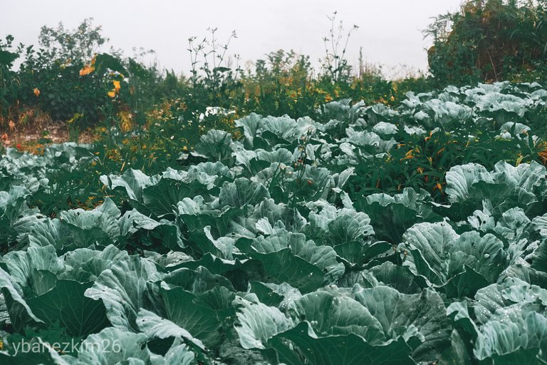
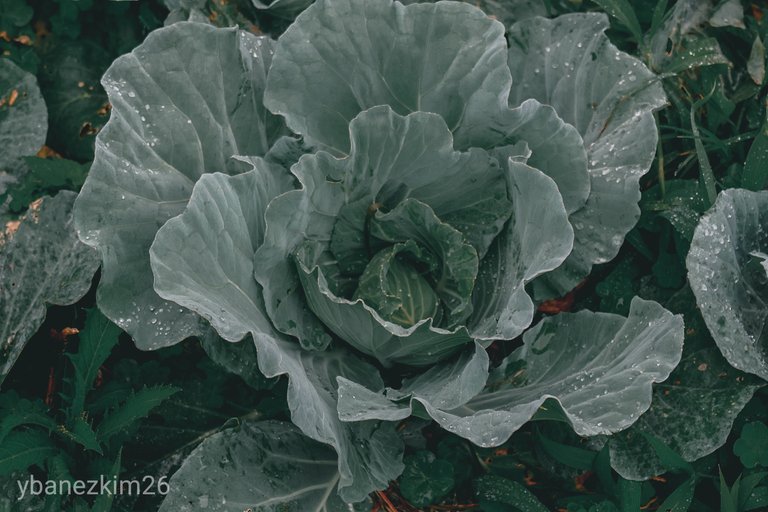
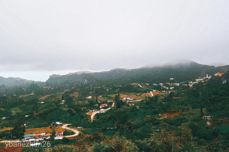
There are a few ways to get to the peak, but the most common and probably the easiest is through Mantalongon Public Market. Mantalongon is one of the 33 barangays of Dalaguete and it's dubbed as the vegetable basket of Cebu. Along the way, it's very evident that the main source of income of the locals in the area is through farming. Since it's elevated, vegetable farming is ideal due to its cool climate all year.
Starting from the Cebu South Bus Terminal, buses are available 24 hours going to the south. I would prefer to travel at night because it tends to get crowded during the day specially on holidays and weekends. From the terminal, you can reach Dalaguete in 3 hours via Bato-Oslob route. Just tell the driver to drop you off to the junction going to Mantalongon. Motorcycles or locally known as habal-habal are available at a fixed rate. Travel time would usually take about 1 hour from the junction to the drop off point.
You can request to pass by Mantalongon Public Market to buy some supplies and food. From the public market, uphill traverse via habal-habal will continue until the entrance to the peak. You don't have to worry because almost all of the barangay roads in the area are paved.
Uphill Trek to the Peak
You need to sign in at the Tourism Center and pay an entrance fee. Local guides will usually approach you, but you can choose not to have a guide since the trail is already established and a lot of tourists frequent the peak. If you opt to have a guide, there's no regulated or fixed rate as guide fee so it's up to you on how much you will pay.
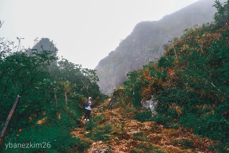
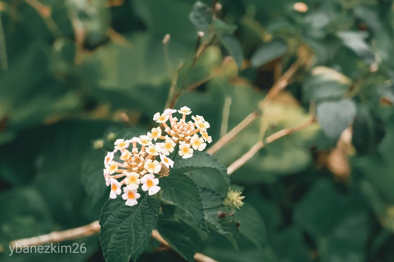
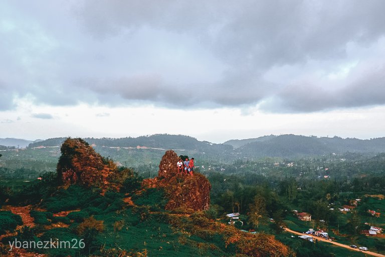
After all that formalities, the trek to the peak will commence. It looks intimidating at first especially if you're not into trekking, but it's just so easy. It usually takes 20 minutes trek from the entrance to the peak. Along the way, planted flowers and vegetables are a feast to the eyes.
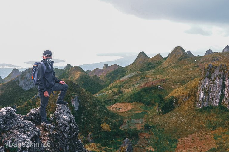
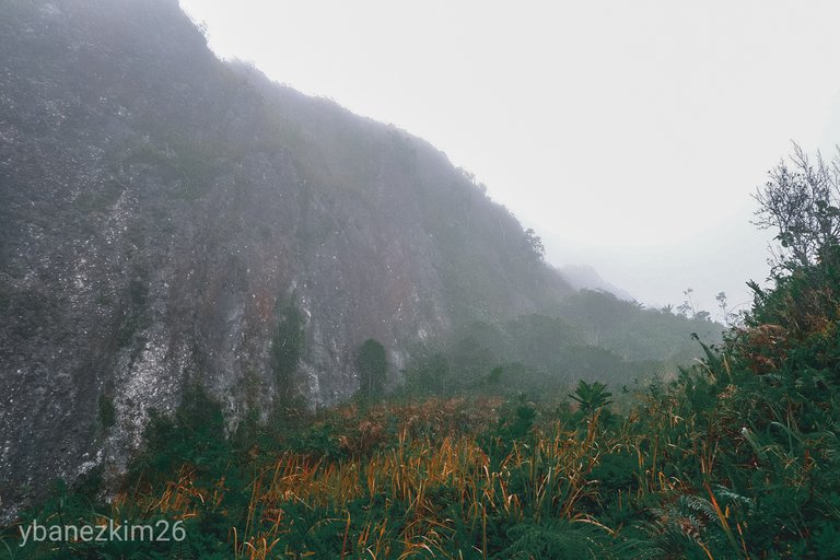
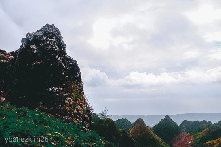
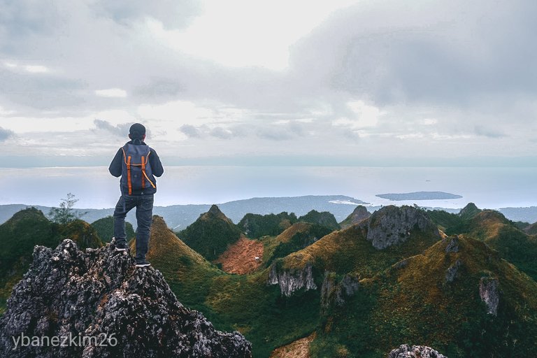
Depending on your time, you can choose to take a detour and go to the top of the many hills in the area. On the east side is the valley where vegetable farms are located. A trek further going to the peak will lead to the west side where Tanon Strait and Negros Island can be seen from the top.
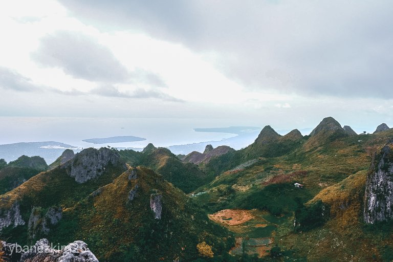
The View at the Top
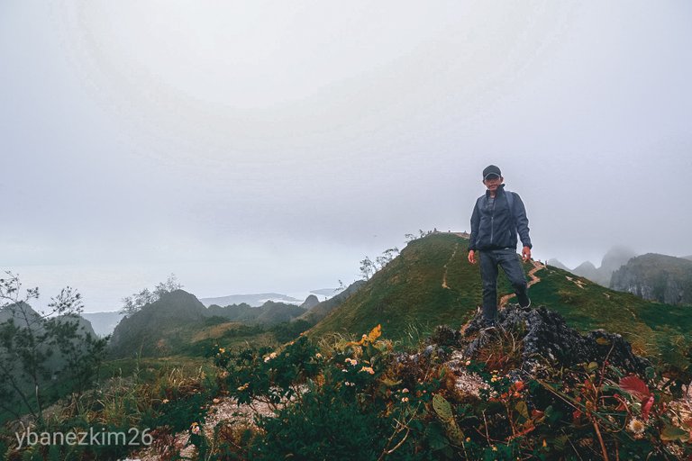
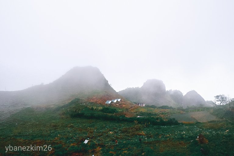
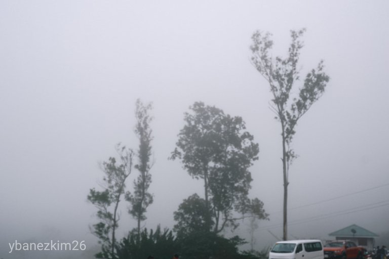
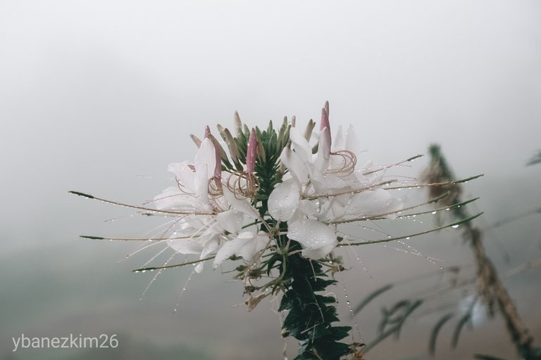
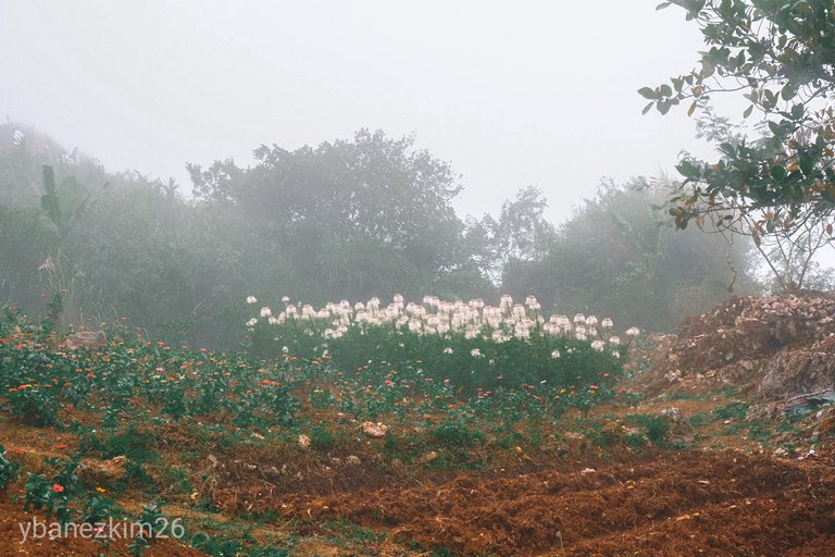
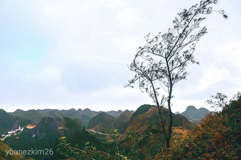
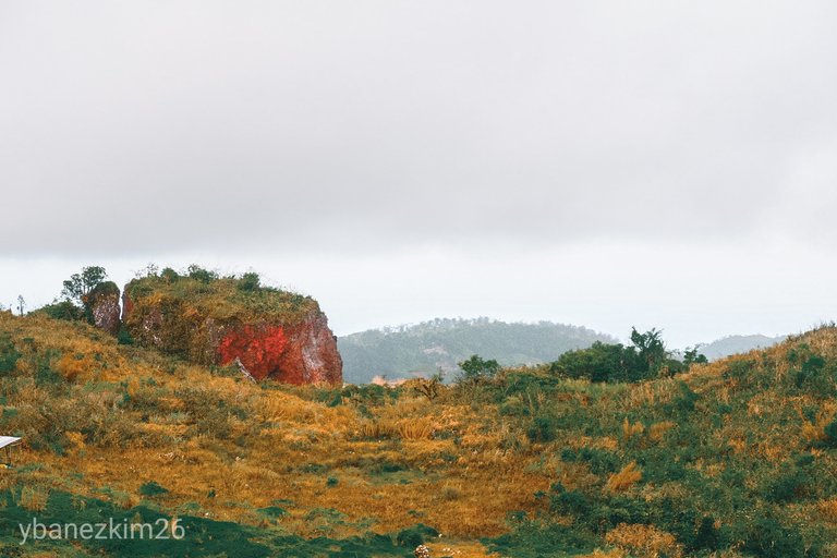
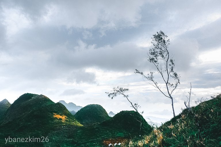
Tourists usually flock during summer because the sky is clear during that season so the shorelines of Badian can be marveled from the peak. During rainy season, the hills are vibrant and green, but the sky is usually gloomy and it tends to get foggy most of the time.
It is usually foggy in the morning, so some would choose to have their hike in the afternoon. The place is also a good for sunset watching. I'm sure thousands of photos are available online from those who watched the sunset at the peak.
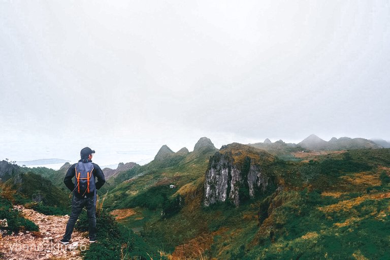
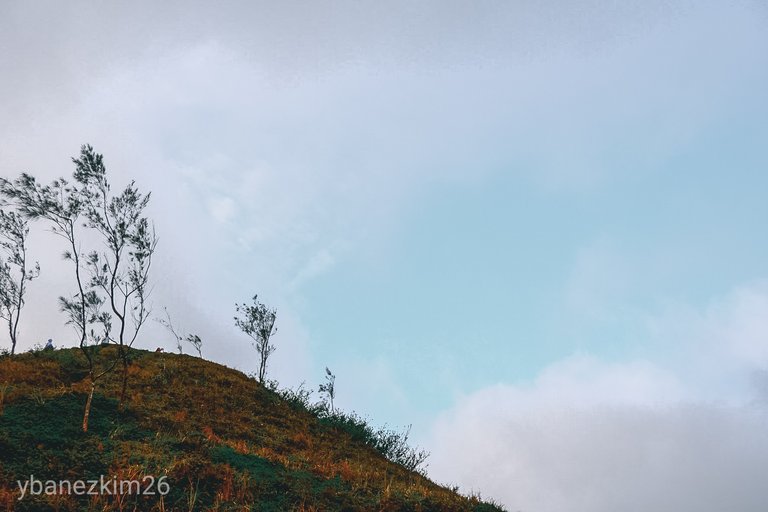
It is said that the place is reminiscent of Baguio or Benguet. Although I haven't been to Benguet, I can say that it's really cool and I mean both the climate and the view. The hills looked like deformed counterparts of the Chocolate Hills in Bohol.
Instead of perfect mounds, the hills are sharp and cliffs can be seen everywhere. They're not perfect in shape, but it doesn't make them less spectacular. It's remote so it's a good way to reconnect with nature.
If you plan to stay overnight, there are available camping grounds to pitch your tent. In that case, you'll have to bring your own tent because I don't there are available tents for rent and you have to pay the camping fee. Otherwise, it's just a day trek and probably a good way to spend your weekend just like we did.
You can opt to go to other tourist spots in the south if you still have time. Kawasan Falls is one of the best choices. Osmena Peak is just one of the many options that you can try while in the south.
Final Words
I don't think Osmeña Peak as the ultimate destination, but it is a vantage point. As with many mountains and peaks, being on top changes your view of the world and makes you realize that we're just a miniscule part of the grand scheme of things. It puts you into perspective and helps you to let go of the things that are out of your control. Now, we're becoming philosophical here, but it has always been my case.
The same with what happened in many tourist spots in the Philippines, Osmeña Peak is in danger. Since it's very accessible, human activities are very evident. Garbage from irresponsible tourists can be seen in some parts of the trail. I just hope that the local tourism office will do something about this.
See you in the next quest!
-Kim
Congratulations, Your Post Has Been Added To The Steemit Worldmap!
Author link: http://steemitworldmap.com?author=ybanezkim26
Post link: http://steemitworldmap.com?post=kim-s-quest-10-day-trek-to-osmena-peak-or-discover-cebu
Want to have your post on the map too?
Congratulations! Your high-quality travel content was selected by @travelfeed curator @worldcapture and earned you a reward, in form of an upvote and a resteem. Your work really stands out! Your article now has a chance to get featured under the appropriate daily topic on our TravelFeed blog.
Thank you for being part of the TravelFeed community!
Did you know that you get larger upvotes when posting through TravelFeed.io? That is not all, we are also giving away a ticket to Steemfest to one lucky TravelFeed user. Make sure to read the announcement and opt in! Also, thanks to the travel writing contest by @invisusmundi you can now earn up to 100 STEEM on top of the post rewards when posting through our new platform TravelFeed.io! Read the contest announcement for more information on how to participate.
We are continuously working on improving TravelFeed, recently we introduced EasySignUp and EasyLogin, our first step to make TravelFeed ready for mass adoption.
Learn more about TravelFeed by clicking on the banner above and join our community on Discord.
Yay! Thank you so much!
Hiya, @lizanomadsoul here, just swinging by to let you know that this post made into our Top 3 in Daily Travel Digest #624.

Your post has been manually curated by the @steemitworldmap team. If you like what we're doing, please drop by to check out all the rest of today's great posts and consider upvoting and supporting us.
Hi! Thank you!