A Trip to Windy Point/Dee Wright Observatory and the Long Lasting Rainbow
Last week I took another trip up to Dee Wright Observatory for my birthday. It is about 15 miles up the road from where I live in the heart of the Central Oregon Cascade Mountain Range. I've been up here several times since I moved to Central Oregon but it had been about a year since my last visit. There is always something different to see up here and with an approaching storm this trip was no different. :)
WINDY POINT
Click images for larger view
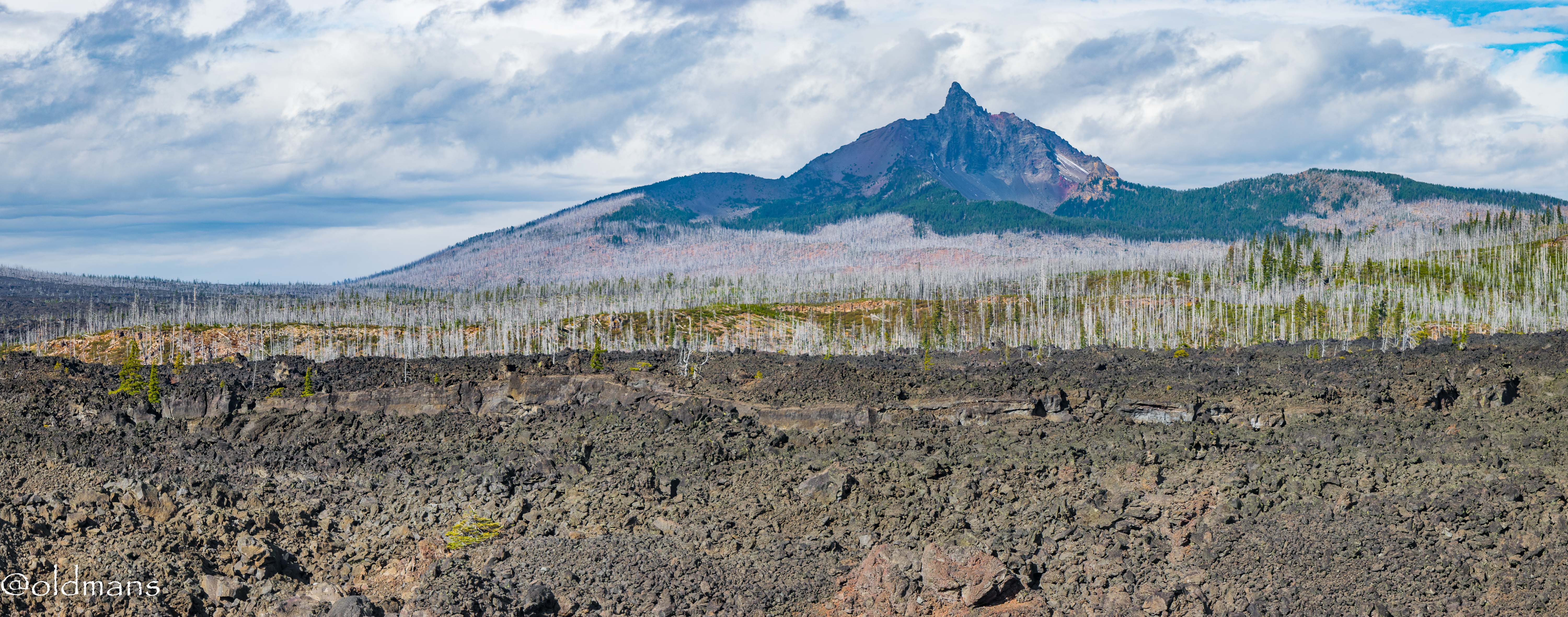
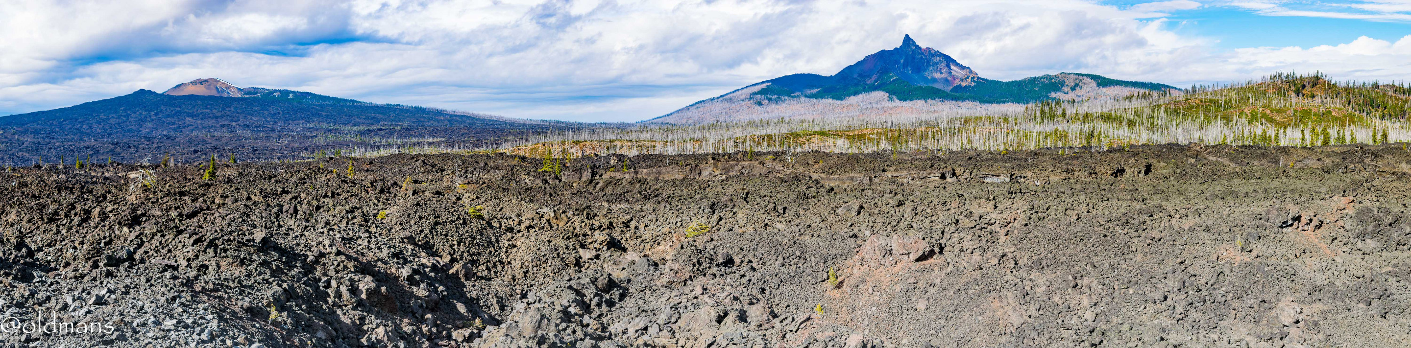
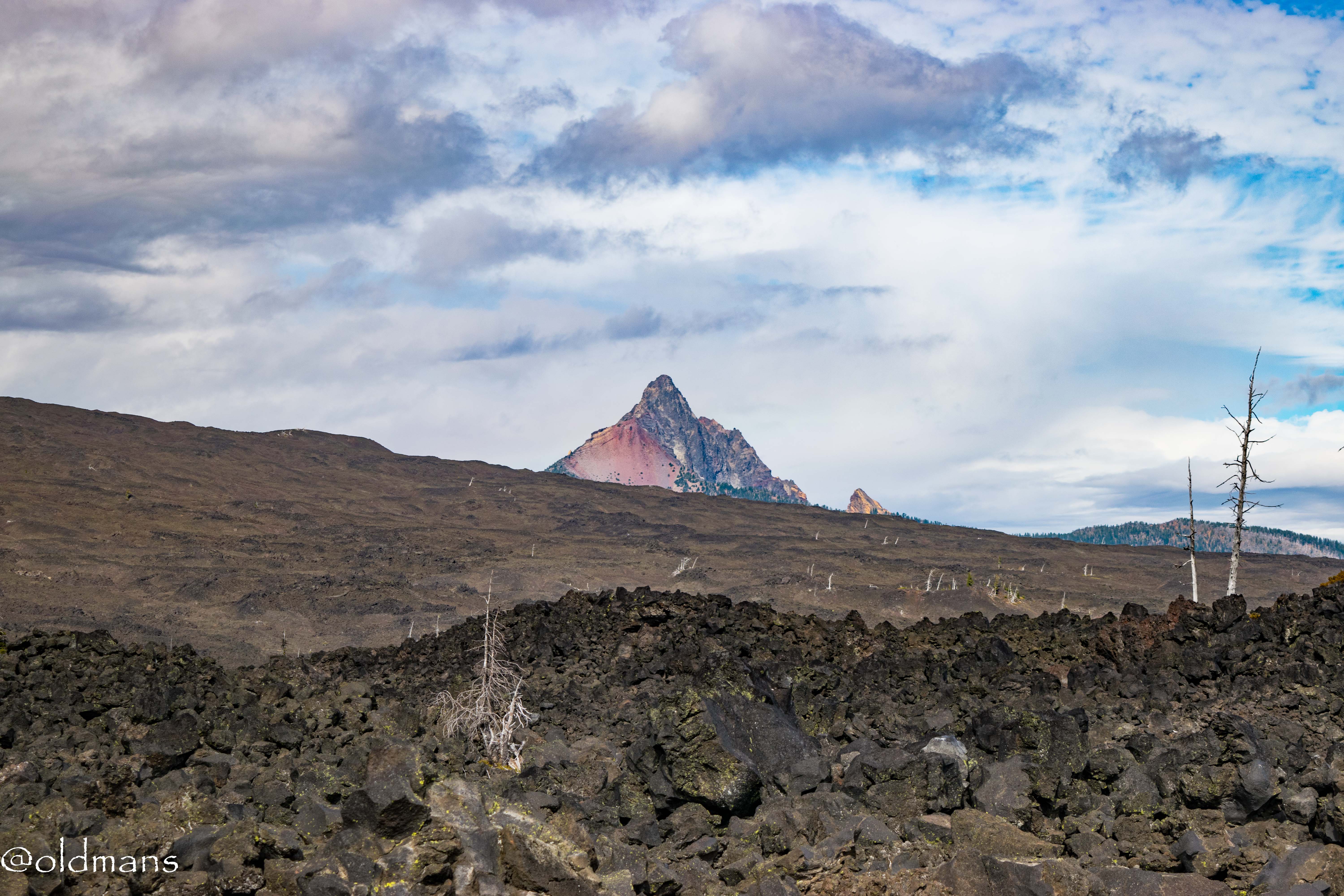
The first stop is a little pullover on HWY 242 called Windy Point. Here are a couple shots across the sea of cooled lava looking at Mt Washington. This is just a small portion of the lava field that covers approximately 65 square miles.
This is a double row panorama I took and stitched together using Lightroom. With a storm approaching Windy Point was living up to its name this day. I was having a hard time keeping my balance as I took the 4 or 5 pictures for each row of the pano. :)
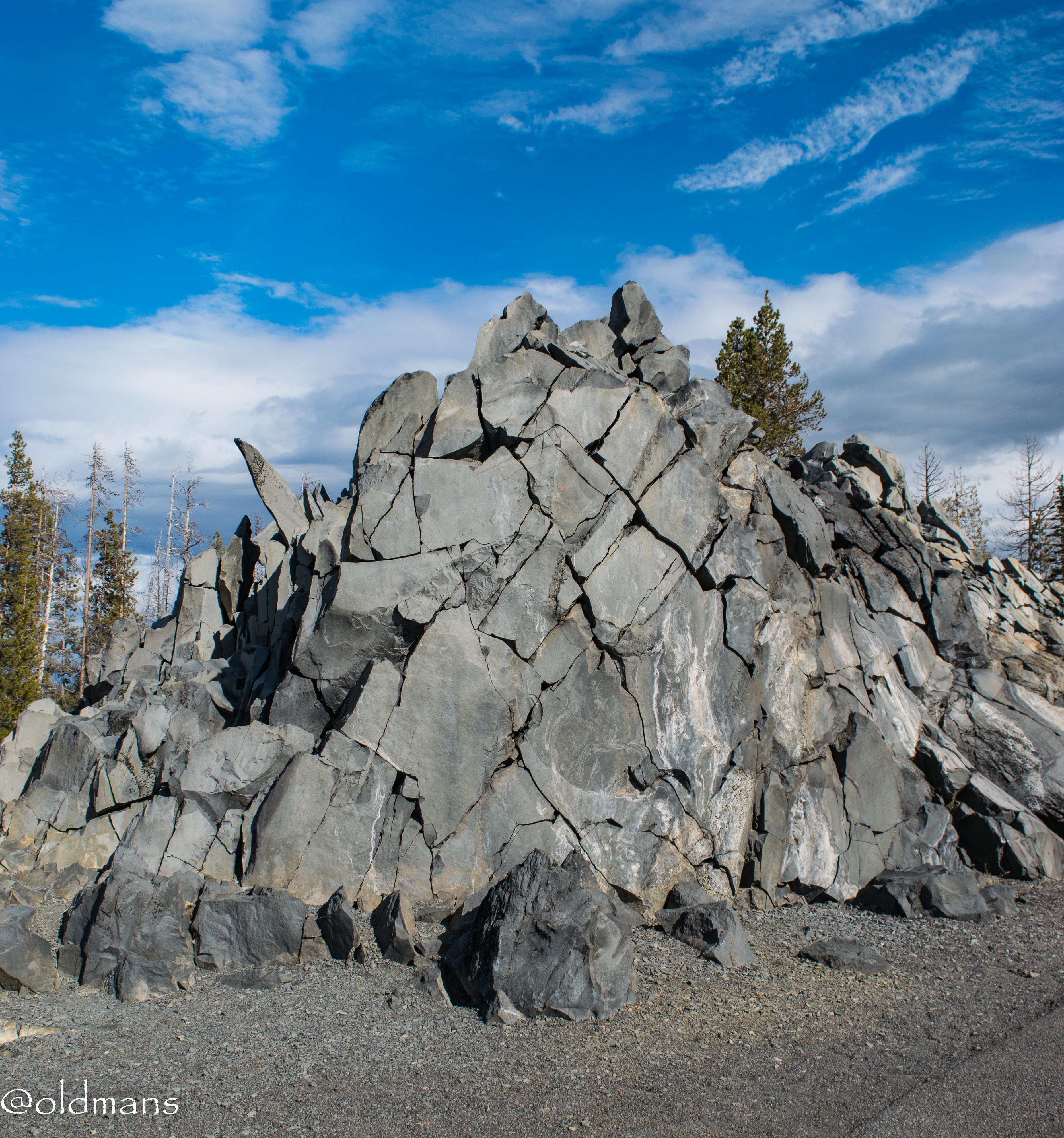
Another interesting rock feature at Windy Point.
DEE WRIGHT
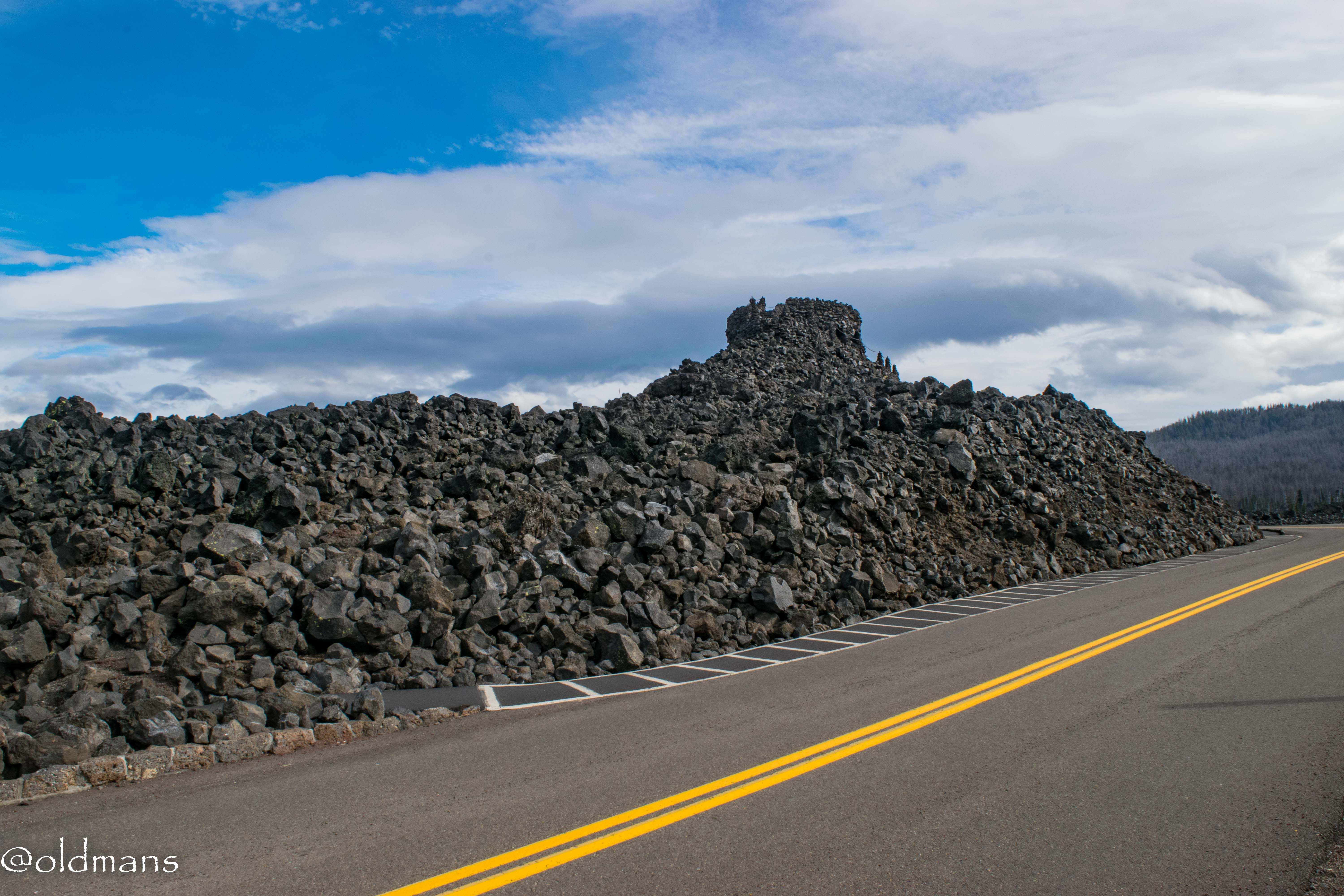
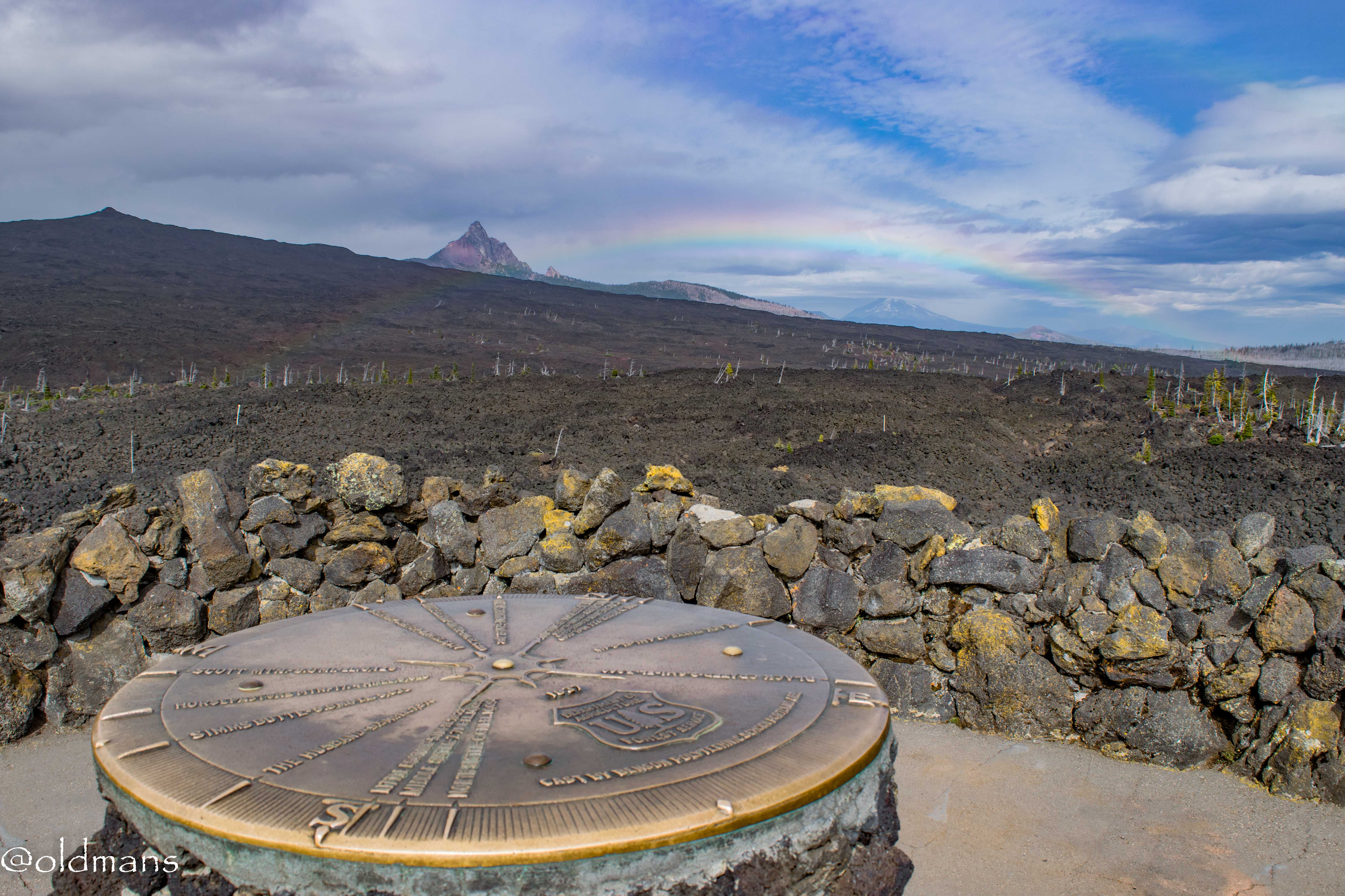
Here is a shot of the Observatory from the parking lot at the summit of McKenzie Pass (5,325 feet). Obviously this is an older/primative structure built with lava rock from the surrounding area.
It was constructed by the Civilian Conservation Corps Company in the 1920's.
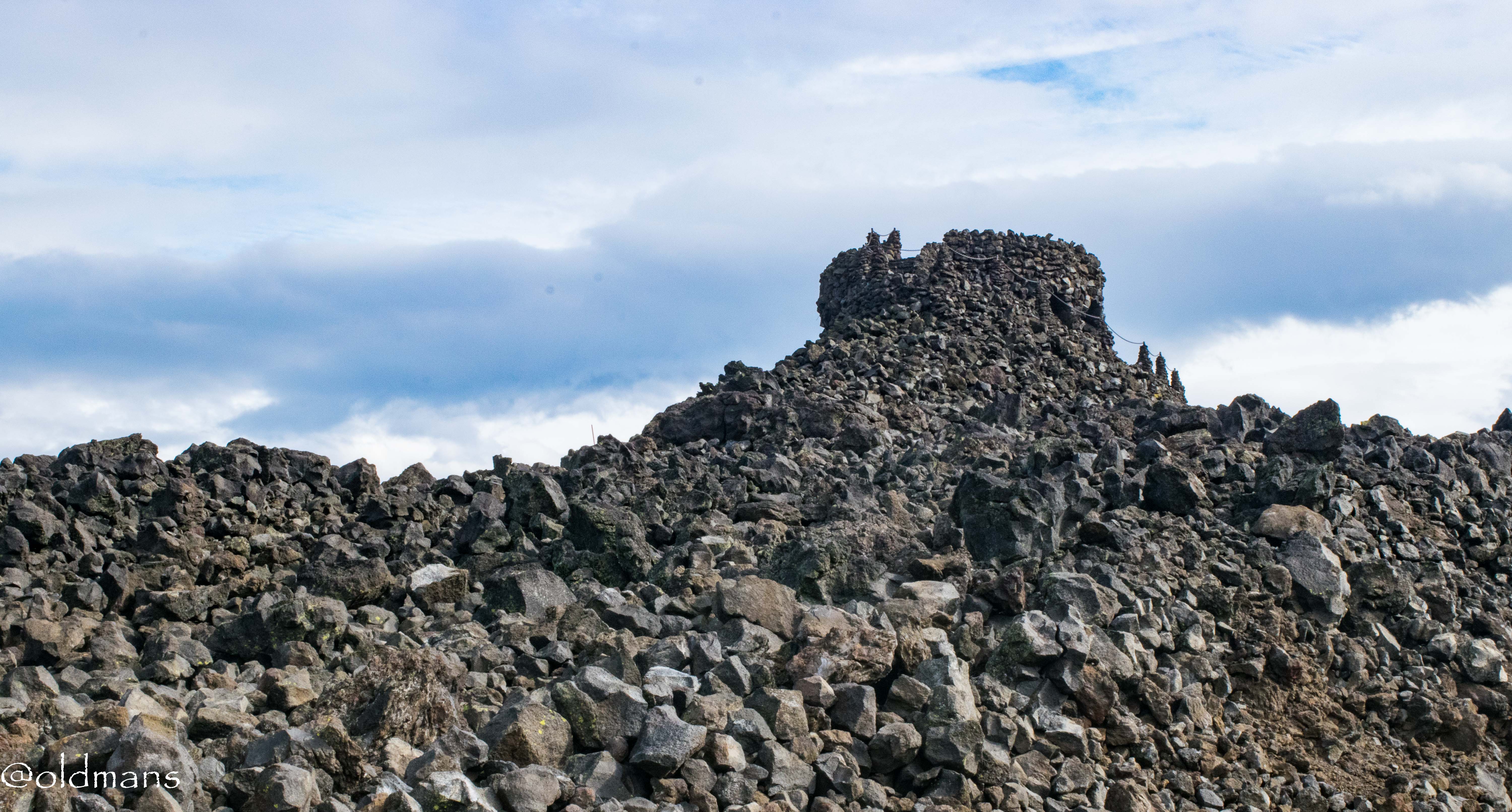
You definitely get a castle like feel to this structure as you walk around it.

This is about as far as I got out the little paved trail before the rain started in.
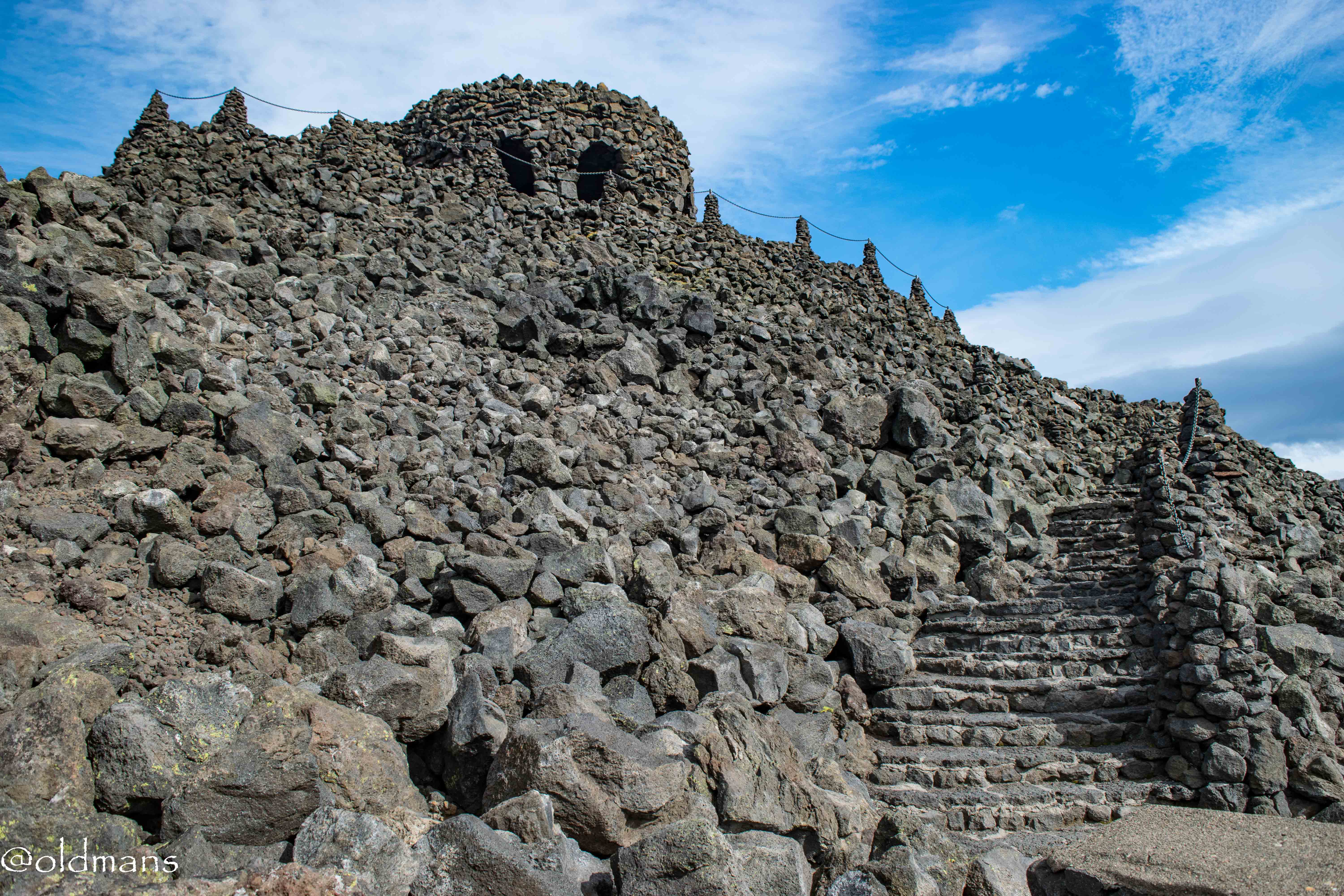
Took a last shot of the observatory and decided to head inside the castle. :)
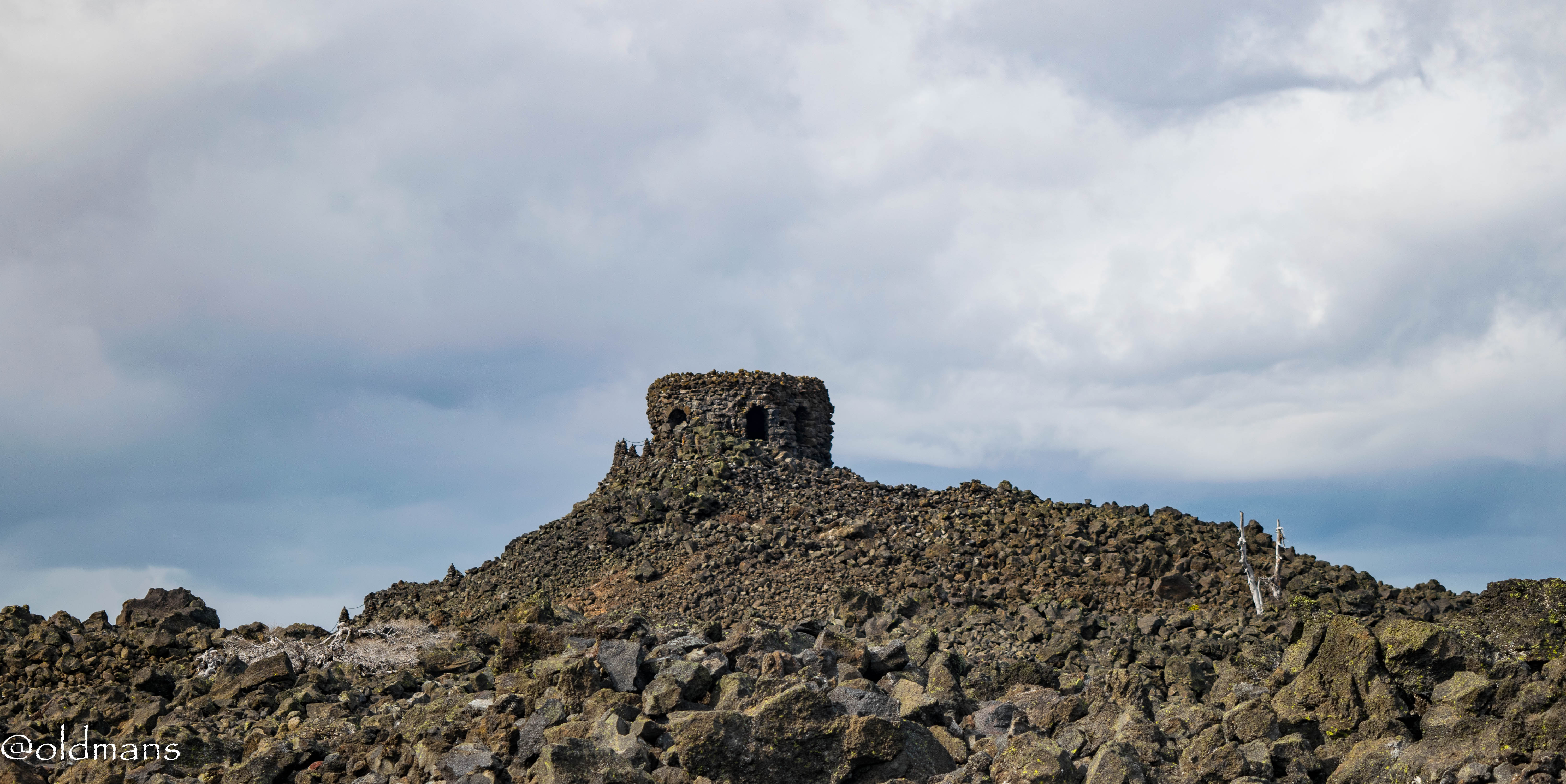
A shot of Mt Washington on the trail back.
INSIDE THE OBSERVATORY
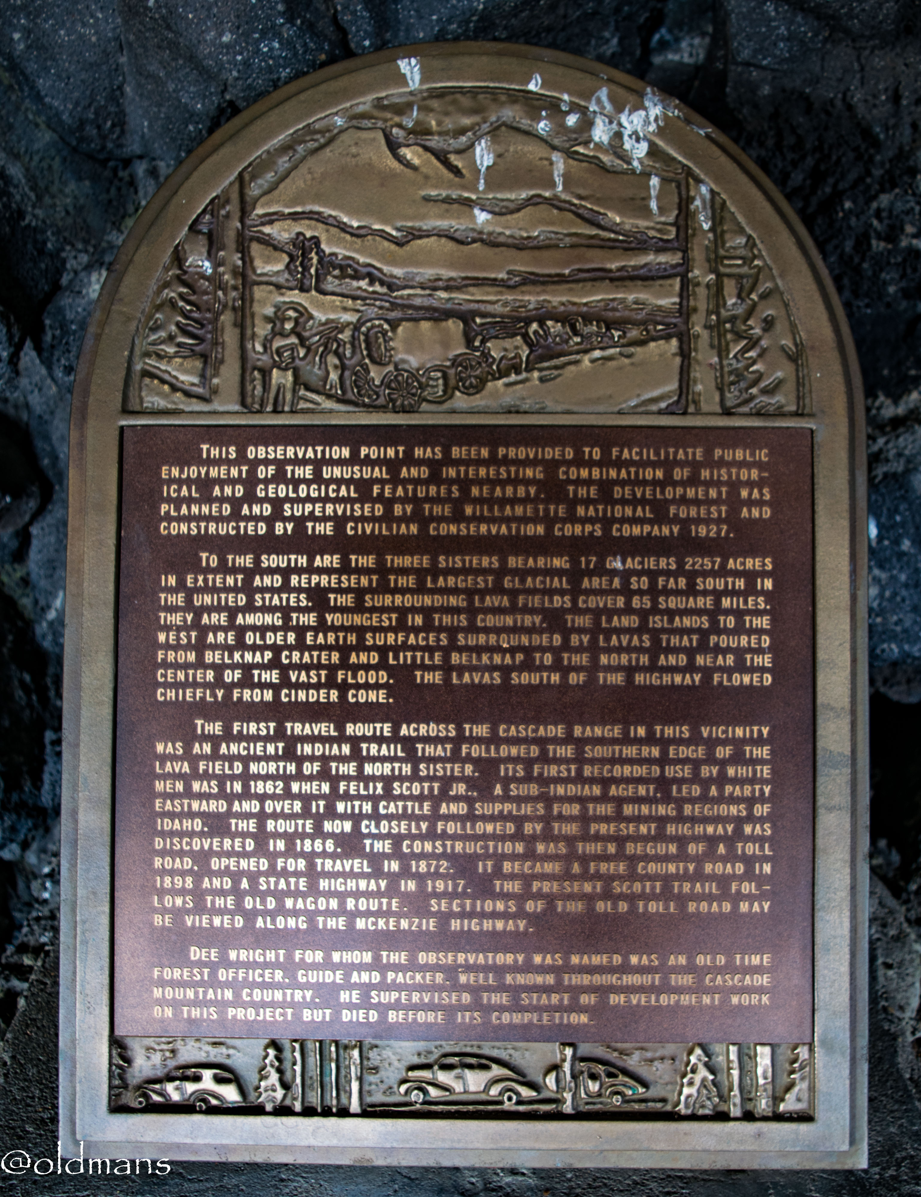
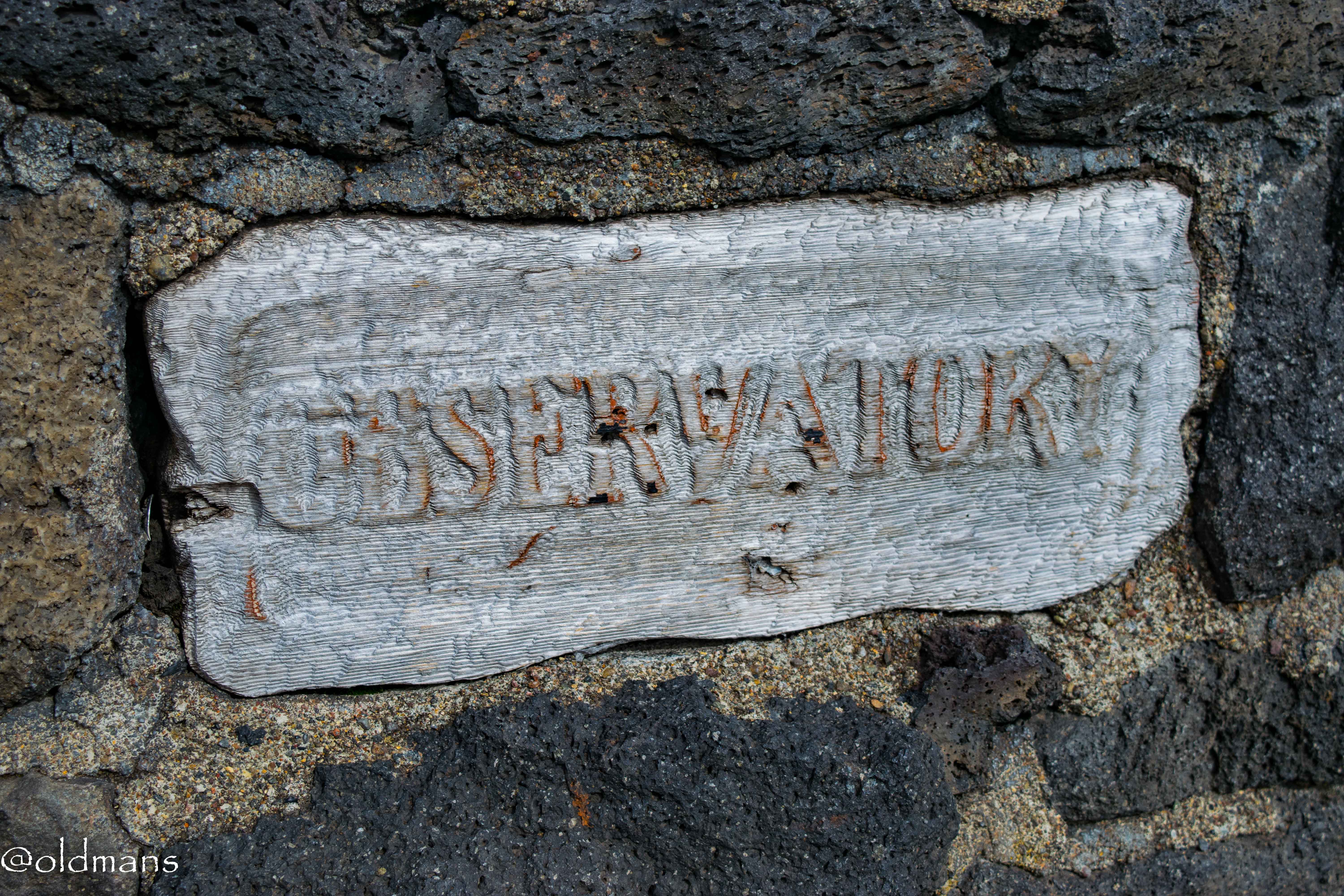
A plaque with information about the area and the observatory.
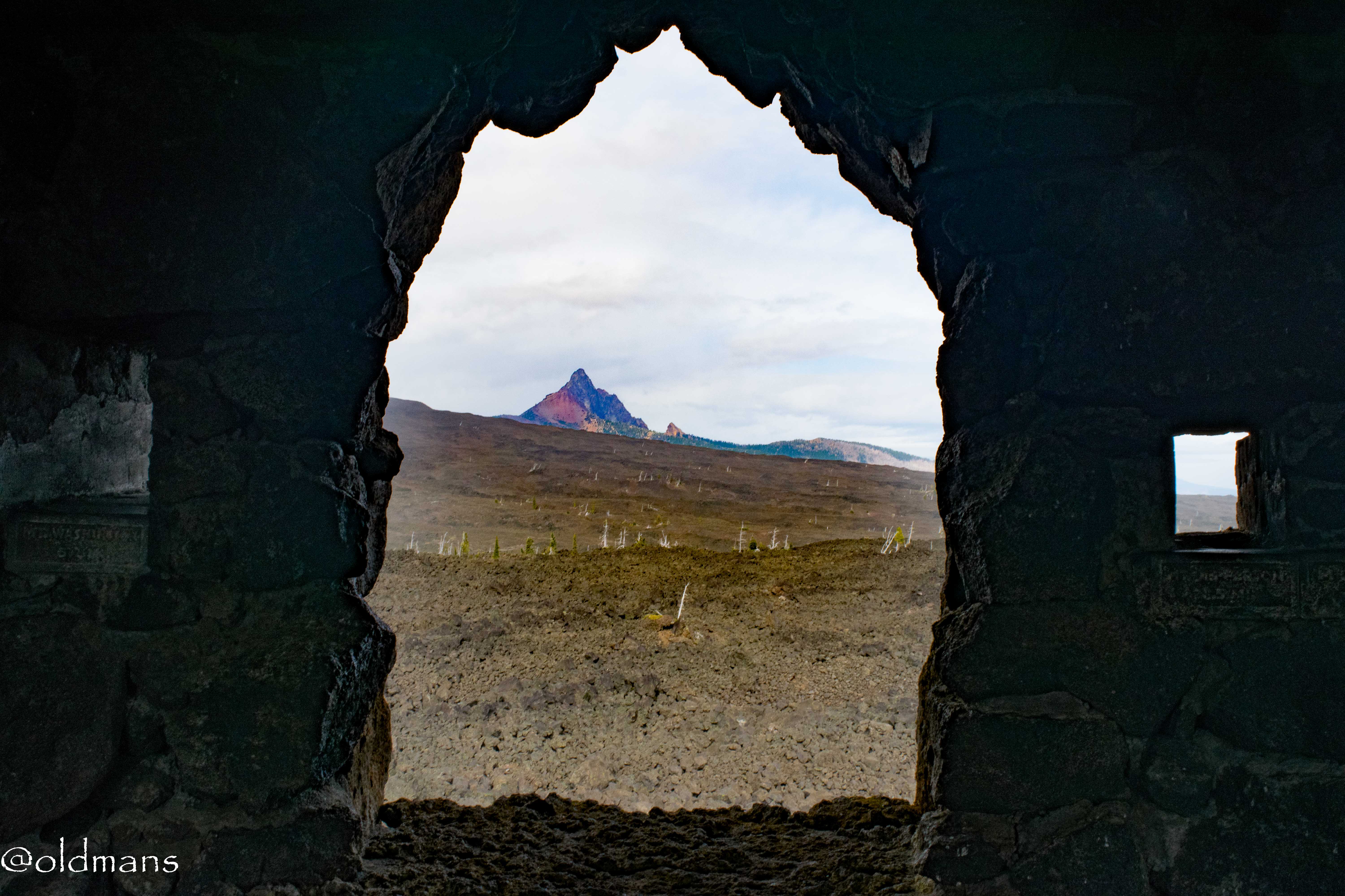
So last time I was here I failed miserably at getting shots of the inside that also showed the outside.
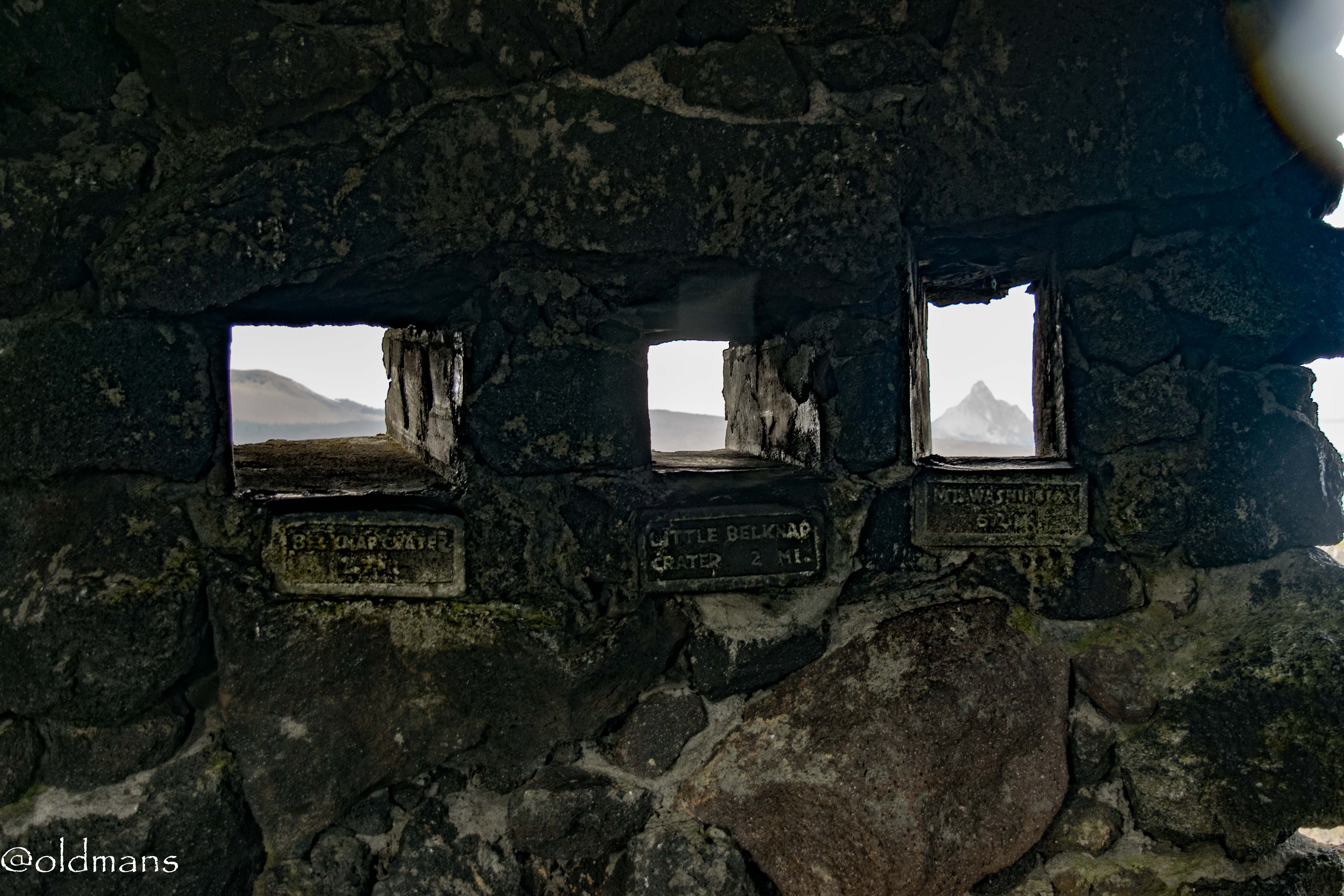
These are a little better, but I still need some practice with my camera and Lightroom. :)
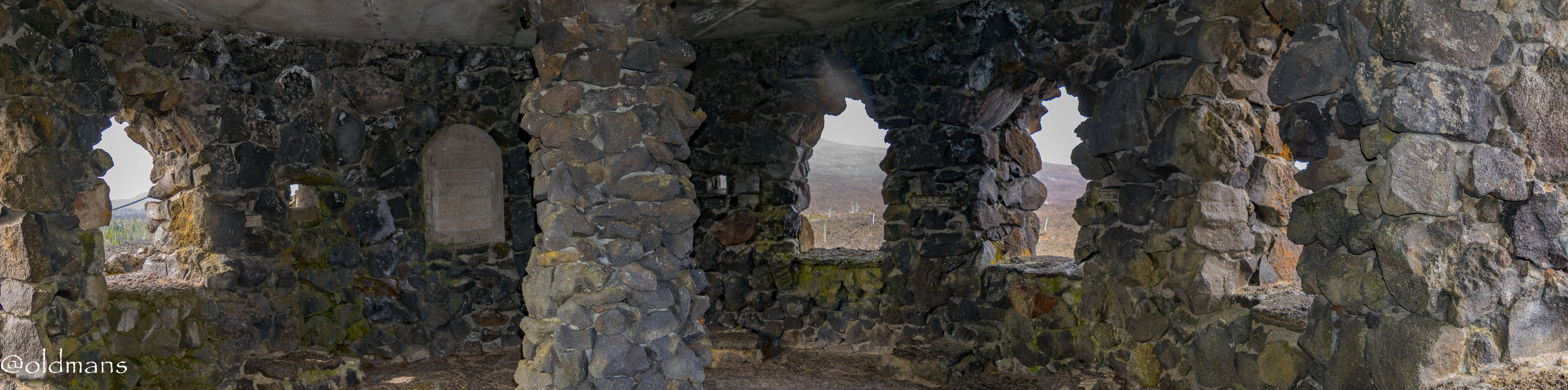
A three shot pano of the inside.
THE RAINBOW APPEARS
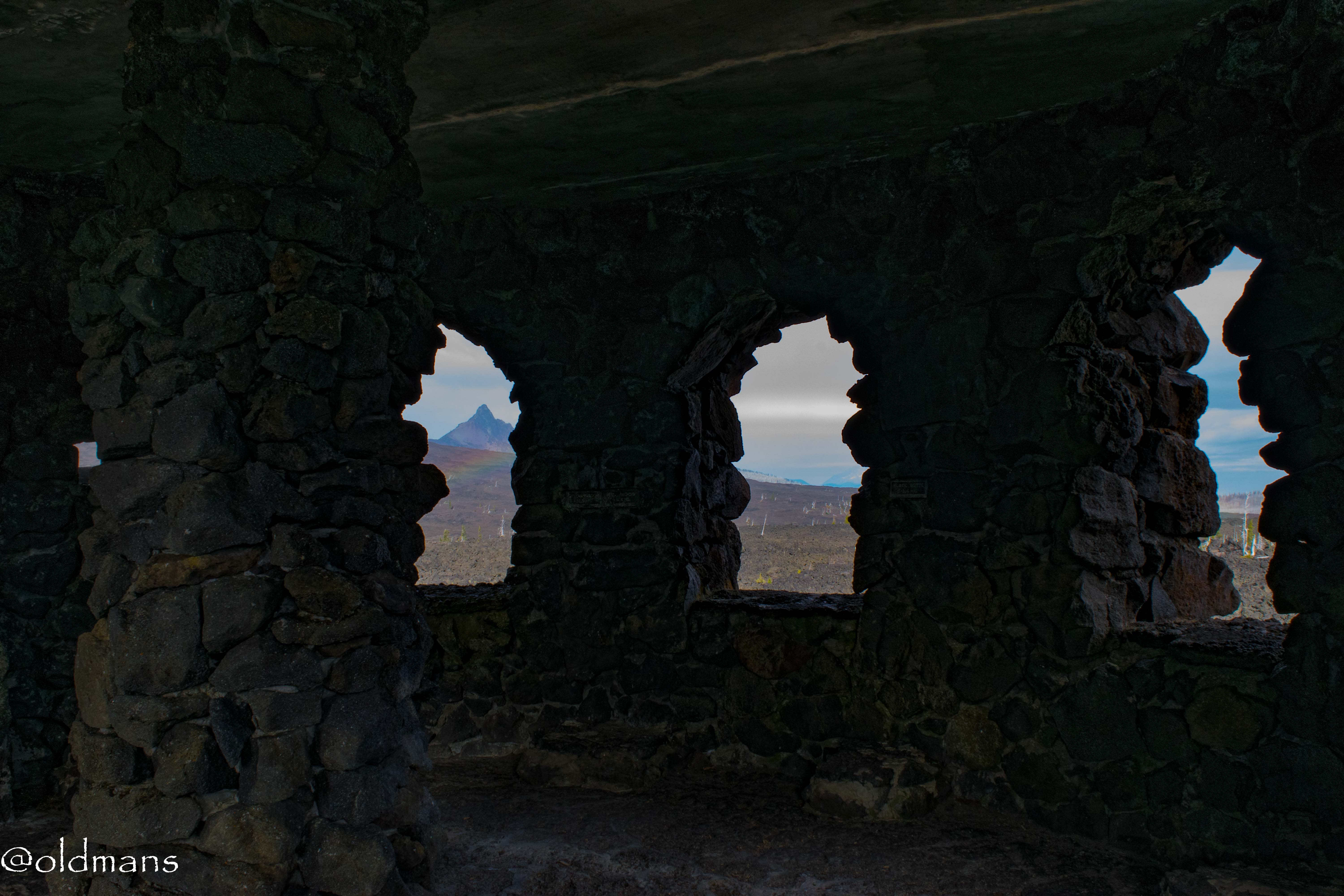
The last couple shots from the inside captured the rainbow that had formed. It was time for me to head to the top of the observatory.
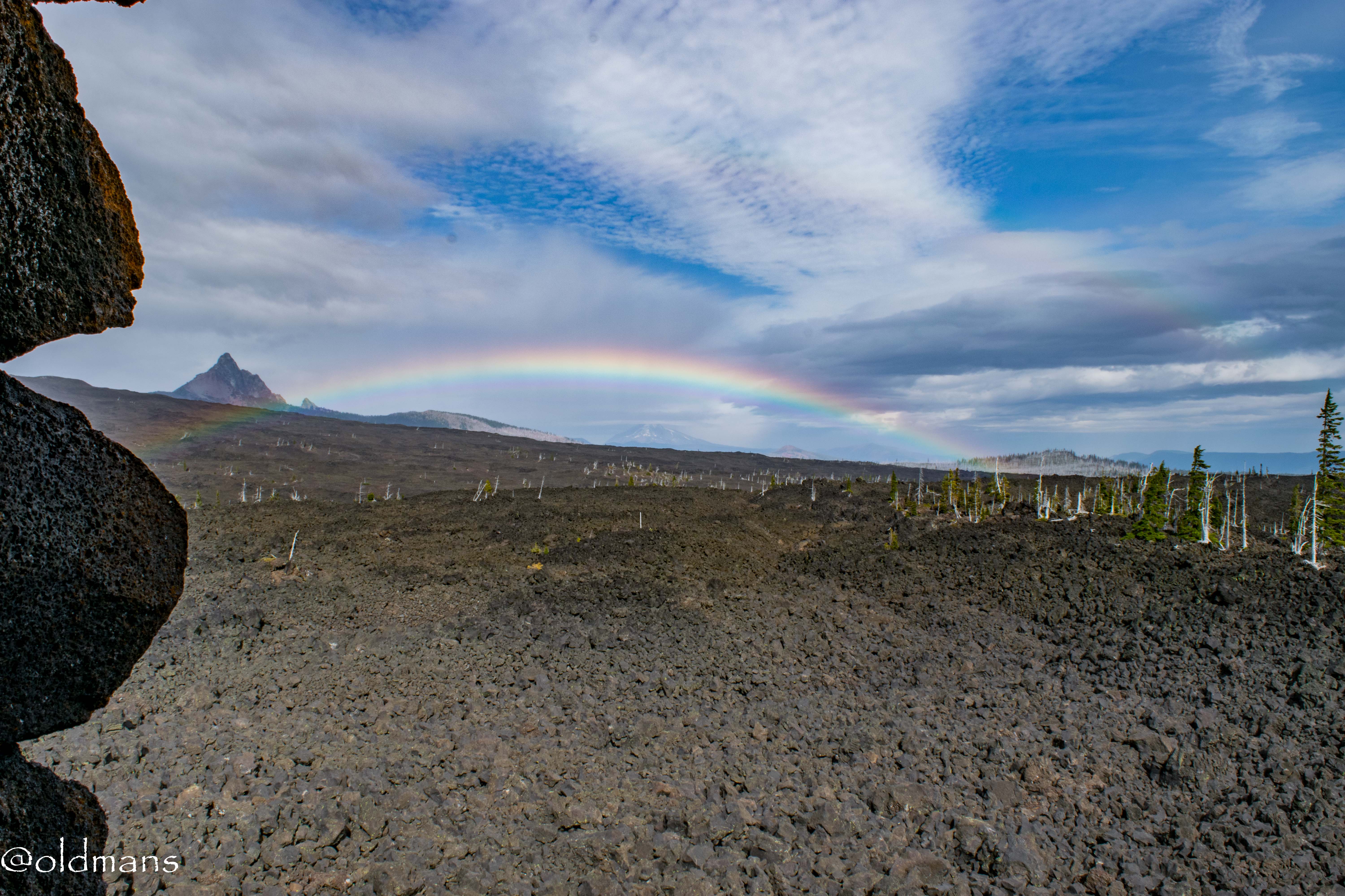
I over processed this shot from the top trying to bring up the double rainbow. When I was there real time I never noticed it. It wasn't until I got home and started to review the images that I saw the second rainbow.

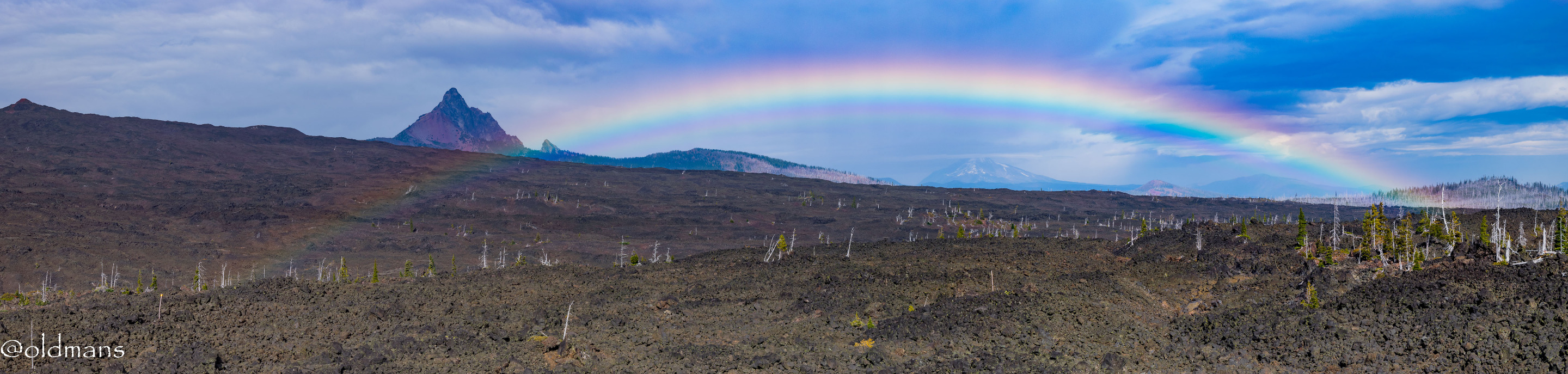
A panorama with Mt Jefferson in the far distance under the rainbow.

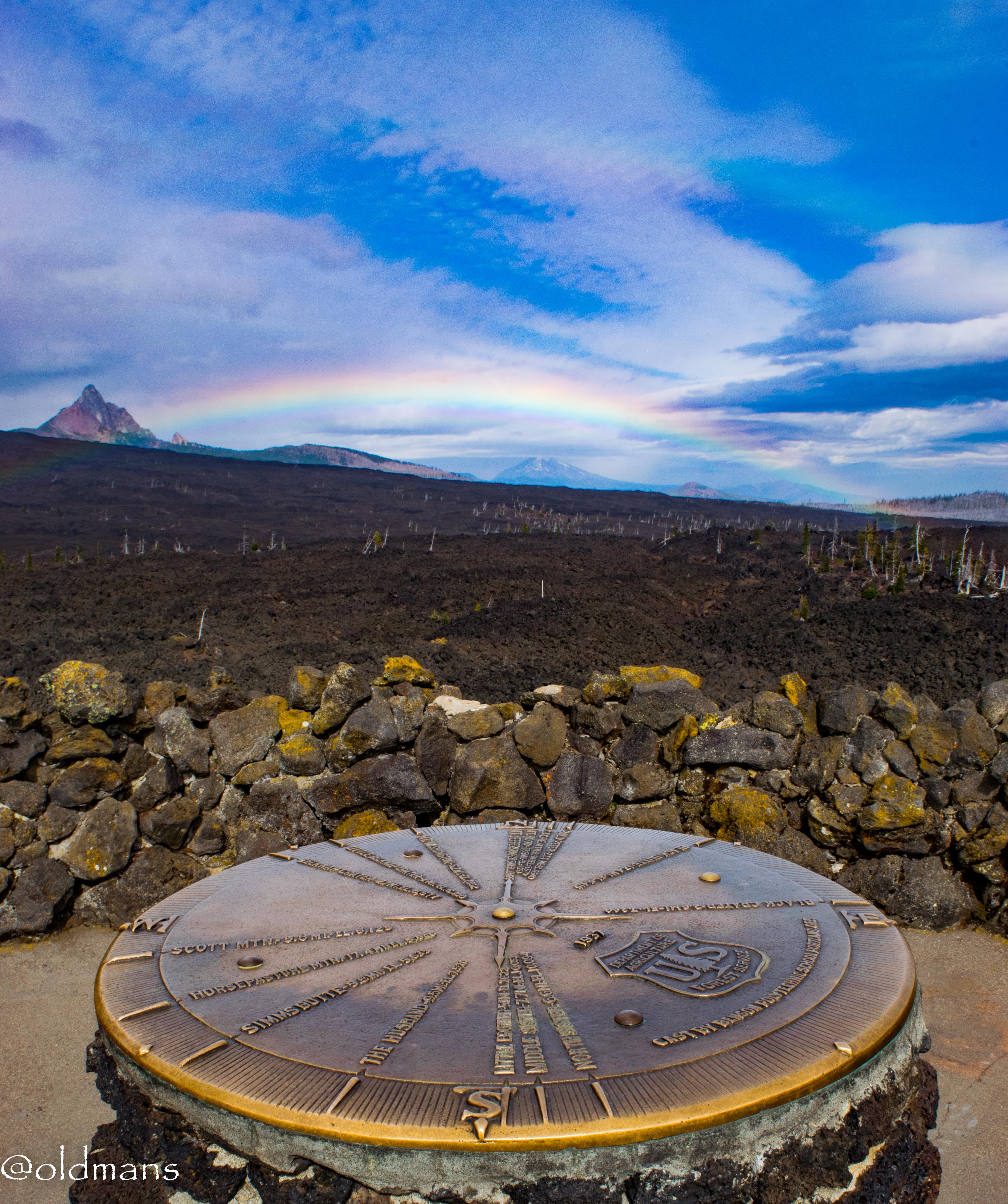
A shot on the way down from the top of the observatory.
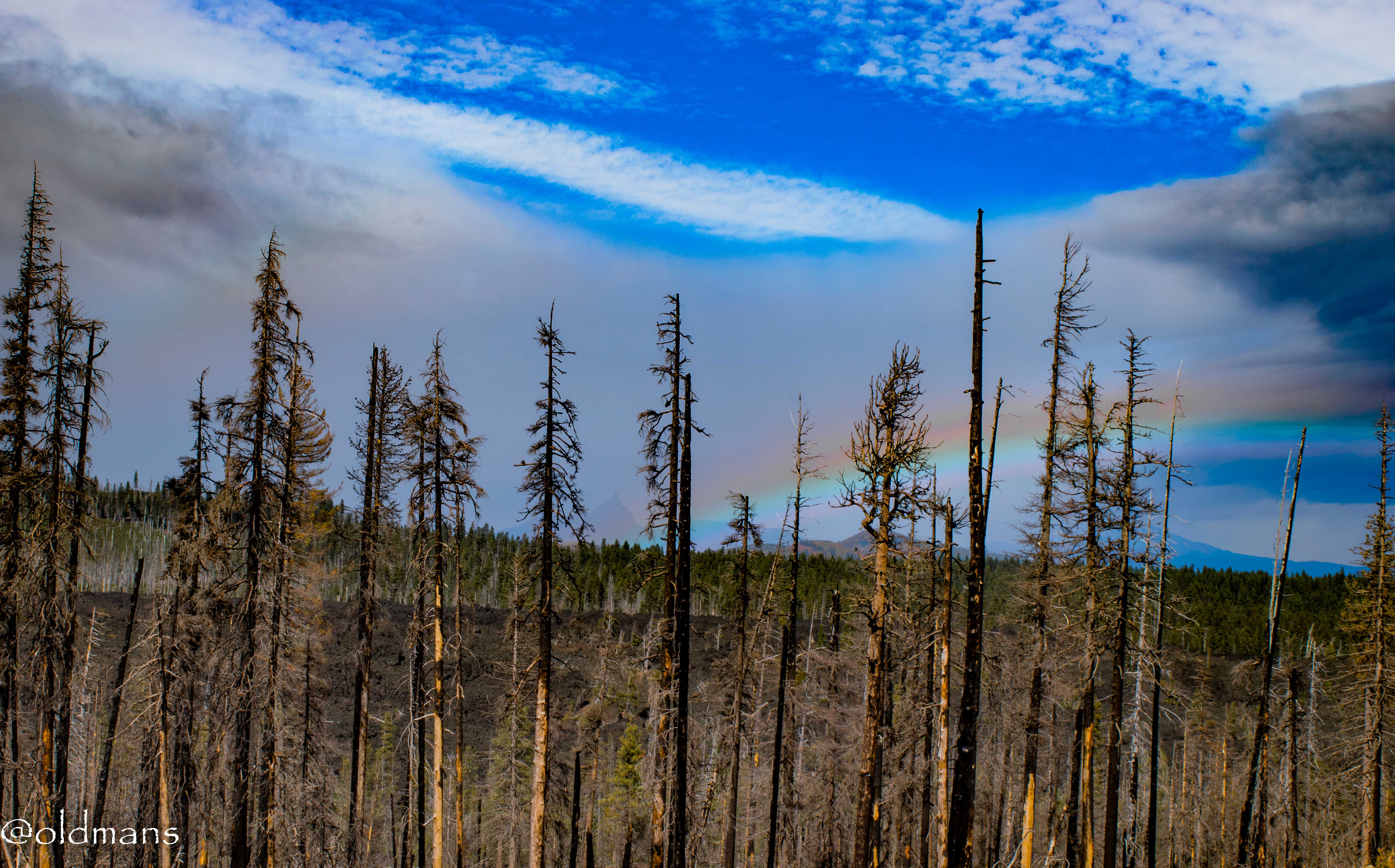
Another over processed shot showing the colors of the rainbow on my way back down the raod. Another rock formation known as Three Finger Jack can be seen in the rain haze at the end of the rainbow. This had to be at least a half hour after initially seeing the rainbow and it was still going strong.
Click images for larger view
Hope you enjoyed coming along with me as I took another trip up to Dee Wright. It always leaves me feeling more calm and centered and the time spent admiring the rainbow made it even more so. :)
Photos taken by me with a Nikon D3300 and CPL filter with some Lightroom post processing.
Thanks for looking and enjoy your day!
This post has been manually curated by PhotoStreem: The Photography Tribe!
Thank you!
@tipu curate
Posted using Partiko Android
Upvoted 👌 (Mana: 15/20)
Thank you!
Thank you very much @tonyz!
This place has everything, rocks, boulders, mountains,
astronomy and so much more! I'd love to visit this area someday!
Beautiful photos of the wonderful views @oldmans! :-)
!BEER
It is an amazing place, especially for a rock hound. :) Central Oregon has a lot of geological wonders.
Thanks for the beer. :)